Estimated payment $160/month
About This Lot
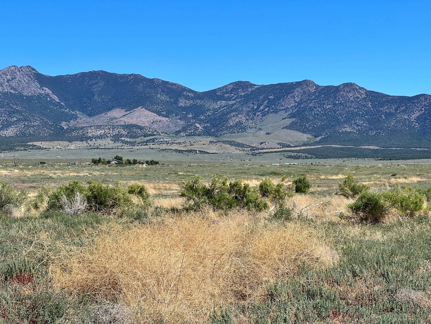
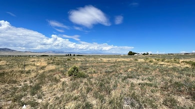
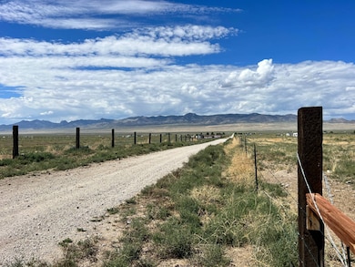
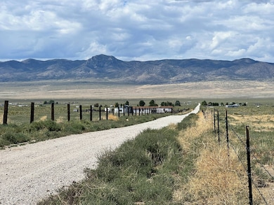
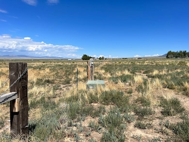
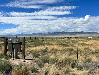
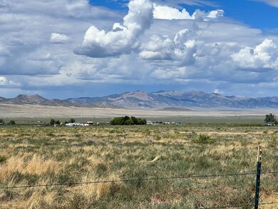
Come Find Your Freedom on this 9.61 Ac parcel, SE of Montello, NV and North of I-80 and West Wendover, NV. The Utah state line is just 3 mi due East. This would be a perfect site for a personal base camp for all of your Northern Nevada Outback Adventures or come build your dream home or cabin. Here is your opportunity to get away from it all and own a piece of the West. This parcel is less than 1/2 mile to thousands of acres of BLM lands and it is at the base of Pilot Peak. No Address, parcel is best identified by APN: 011-11J-014. Electricity in on the parcel. GPS Coordinates: NW Corner: 41.1046, -114.1045; NE Corner: 41.1046, -114.1024; SE Corner: 41.1028, -114.1045; SW Corner: 41.1028, -114.1025; PROPERTY INFORMATION: County: Elko County, Nevada; Acres: 9.61; APN: 011-11J-014; Elevation: 5,000 Ft; Zoning: AR - Agriculture/Residential; Land Use Code: 120 Single Family Residential (Livestock Allowed) Electricity: At the Road; Water: A private well will be needed; Water Rights - Well Needed - 1800 Gallons Per Day from a Domestic Well; Waste Disposal: A private septic system will be needed; Roads: Dirt; Time Limit to Build: None; NV Big Game Management Area: 091; Tax Year: 2023/2024; Yearly Taxes: $141.09 - Ad Valorem Tax Rate= 2.5733% Type of Terrain: Level,Combination/Varied; Elko County Nevada History: This area was long occupied by Native American tribes of the Plateau, particularly the Western Shoshone, Northern Paiute, and Bannock peoples. Their traditional ways were disrupted after European-American settlement, as the two cultures competed for resources and had differing conceptions of land use and property. Elko County was established in 1869 fromLander County; the name was taken from the name of the county seat, Elko. In 1877 what became known as the Duck Valley Indian Reservation was established by presidential executive order for the Western Shoshone in this area, after they signed treaties with the United States. Later the Paiute became involved in the Bannock War, but after they were allowed to return from exile in Washington State, in 1886 another executive order was used to expand the reservation to accommodate them. The federally recognized tribe of the two peoples together conducts farming and ranching in this high desert territory. The population of the county increased markedly in the late 20th century as the economy improved. On March 14, 2014, the Bureau of Land Management sold 29 oil and gas leases for $1.27 million to a collection of six companies that included Noble Energy. The transaction was the first such in Nevada.[4]~ Wikipedia Situated in the Northeastern part of the state, Montello, Nevada, is approximately 58 miles northwest of Wendover and about 176 miles northwest of Salt Lake City,Utah. The tiny town has a little more than 500 residents, so there isn't much to do in Montello. However, you can find an assortment of attractions within driving distance of the city. Crittenden Reservoir (ndow) sits on 260 acres of state-owned land. You've got to travel about 19 miles north of Montello on a gravel road to get there. The reservoir is an ideal destination for fishermen because the facility stocks a variety of fish, including several types of trout and largemouth bass. Legacy Ranches, LLC is pleased to have been selected as the Exclusive Agent for the seller of this offering. All information has been obtained from sources deemed reliable by Legacy Ranches, LLC, however the accuracy of this information is not guaranteed or warranted by either Legacy Ranches, LLC, or the sellers, and prospective buyers are charged with making and are expected to conduct their own independent investigation of the information contained herein. This offering is subject to prior sale, price change, correction or withdrawal without notice and any offer presented does not have to be accepted.
Property Details
Property Type
- Land
Est. Annual Taxes
- $141
Lot Details
- 9.61 Acre Lot
Property Views
- Scenic Vista
- Mountain
Map
Home Values in the Area
Average Home Value in this Area
Tax History
| Year | Tax Paid | Tax Assessment Tax Assessment Total Assessment is a certain percentage of the fair market value that is determined by local assessors to be the total taxable value of land and additions on the property. | Land | Improvement |
|---|---|---|---|---|
| 2025 | $141 | $4,900 | $4,900 | -- |
| 2024 | $141 | $4,900 | $4,900 | $0 |
| 2023 | $141 | $4,900 | $4,900 | $0 |
| 2022 | $141 | $4,900 | $4,900 | $0 |
| 2021 | $152 | $4,900 | $4,900 | $0 |
| 2020 | $136 | $4,900 | $4,900 | $0 |
| 2019 | $136 | $4,900 | $4,900 | $0 |
| 2018 | $133 | $4,900 | $4,900 | $0 |
| 2017 | $114 | $4,900 | $4,900 | $0 |
| 2016 | $108 | $4,290 | $4,290 | $0 |
| 2015 | $108 | $4,290 | $4,290 | $0 |
| 2014 | $108 | $4,290 | $4,290 | $0 |
Property History
| Date | Event | Price | List to Sale | Price per Sq Ft |
|---|---|---|---|---|
| 09/10/2025 09/10/25 | For Sale | $28,000 | 0.0% | -- |
| 08/31/2025 08/31/25 | Price Changed | $28,000 | -4.8% | -- |
| 08/31/2025 08/31/25 | Pending | -- | -- | -- |
| 09/09/2024 09/09/24 | Price Changed | $29,400 | -1.7% | -- |
| 07/16/2024 07/16/24 | For Sale | $29,900 | 0.0% | -- |
| 07/15/2024 07/15/24 | Off Market | $29,900 | -- | -- |
| 02/14/2024 02/14/24 | Price Changed | $29,900 | -25.1% | -- |
| 07/14/2023 07/14/23 | For Sale | $39,900 | -- | -- |
Purchase History
| Date | Type | Sale Price | Title Company |
|---|---|---|---|
| Bargain Sale Deed | $8,000 | Stewart Title | |
| Bargain Sale Deed | -- | Stewart Title | |
| Interfamily Deed Transfer | -- | None Available |
Source: My State MLS
MLS Number: 11191711
APN: 011-11J-014
- 0 Unit 3626583
- 2150 Pilot Rd
- 0 E St 10th St Unit 3626642
- 0 010-56b-029 T37n R69e S3 Unit 3626935
- 0 010-57r-028 Unit 3626109
- 0 14th St C St Unit 3626932
- 0 B St 11th St
- 0 01079h014 T38n R70e S33 Unit 3626025
- 000 Pilot Rd
- 0 Pilot Valley Rd Unit 3626278
- 0 Sec 29 Twp 38n Rge 69e Mdb&m Unit 3626739
- 0 Pine Cone Dr Unit 220015980
- 010-57P-00 Sec Lot31twn38n Rng69e Unit 1057P
- 010-57P-00 Sec Lot31twn38n Unit Rng69E unit: 01057P
- 0 Sec 25 Twp 37n Rge 68e Unit 3626399
- 0 Montello Unit 3626032
- 0 010-58s-051 Unit 3626412
- SEC 27 Twp 38n Rge 68e Ne4sw4se4
- Unnamed Dirt Rd
- 0 Sec 33 Twp 38n Rge 68e Mdb&m Nv Unit 3626214
