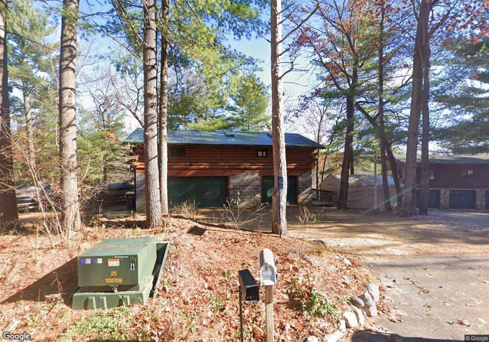
E11426 Hillside Dr Wisconsin Dells, WI 53965
Estimated Value: $395,000 - $693,000
--
Bed
--
Bath
--
Sq Ft
0.42
Acres
About This Home
This home is located at E11426 Hillside Dr, Wisconsin Dells, WI 53965 and is currently estimated at $485,654. E11426 Hillside Dr is a home located in Sauk County with nearby schools including Wisconsin Dells High School and Trinity Lutheran School.
Ownership History
Date
Name
Owned For
Owner Type
Purchase Details
Closed on
Nov 21, 2007
Sold by
Schwab David L and Schwab Roxanne
Bought by
Strande Jay T
Current Estimated Value
Home Financials for this Owner
Home Financials are based on the most recent Mortgage that was taken out on this home.
Original Mortgage
$100,000
Outstanding Balance
$63,107
Interest Rate
6.33%
Mortgage Type
New Conventional
Estimated Equity
$422,547
Create a Home Valuation Report for This Property
The Home Valuation Report is an in-depth analysis detailing your home's value as well as a comparison with similar homes in the area
Home Values in the Area
Average Home Value in this Area
Purchase History
| Date | Buyer | Sale Price | Title Company |
|---|---|---|---|
| Strande Jay T | $160,000 | None Available |
Source: Public Records
Mortgage History
| Date | Status | Borrower | Loan Amount |
|---|---|---|---|
| Open | Strande Jay T | $100,000 |
Source: Public Records
Tax History Compared to Growth
Tax History
| Year | Tax Paid | Tax Assessment Tax Assessment Total Assessment is a certain percentage of the fair market value that is determined by local assessors to be the total taxable value of land and additions on the property. | Land | Improvement |
|---|---|---|---|---|
| 2024 | $3,774 | $402,400 | $240,000 | $162,400 |
| 2023 | $3,010 | $182,600 | $105,000 | $77,600 |
| 2022 | $2,876 | $182,600 | $105,000 | $77,600 |
| 2021 | $2,798 | $182,600 | $105,000 | $77,600 |
| 2020 | $2,713 | $182,600 | $105,000 | $77,600 |
| 2019 | $2,748 | $182,600 | $105,000 | $77,600 |
| 2018 | $2,872 | $182,600 | $105,000 | $77,600 |
| 2017 | $2,682 | $182,600 | $105,000 | $77,600 |
| 2016 | $2,750 | $182,600 | $105,000 | $77,600 |
| 2015 | $2,592 | $182,600 | $105,000 | $77,600 |
| 2014 | $2,619 | $182,600 | $105,000 | $77,600 |
Source: Public Records
Map
Nearby Homes
- L23 Hillside Dr
- Lot 1 Hillside Dr
- 66 Wild Turkey Rd
- 68 Wild Turkey Rd
- 61 Dakota Ridge Rd
- 73 Morningside Rd
- L27-29 Hillside
- 56 Redhawk Trail
- 58 Redhawk Trail
- 77 Morningside Rd
- 31 Eagles Nest
- L22 Hillside
- 12 Dakota Ridge Rd
- 9/10 Dakota Ridge Rd
- L11 Orrin Anderson Pass
- 1093 Canyon Rd Unit 508
- 1093 Canyon Rd Unit 303
- 1093 Canyon Rd Unit 406
- 1093 Canyon Rd Unit 202
- 1093 Canyon Rd Unit 207
- E11424 Hillside Dr
- E11428 Hillside Dr
- E11434 Hillside Dr
- E11420 Hillside Dr
- E11433 Hillside Dr
- E11437 Hillside Dr Unit E114
- E11411 Hillside Dr
- E11444 Hillside Dr
- E11444 Hillside Dr
- E11405 Hillside Dr
- E11450 Hillside Dr
- E11449 Hillside Dr
- E11404 Hillside Dr
- E11389 Hillside Dr
- E11383 Hillside Dr
- E11456 Hillside Dr
- E11398A Hillside Dr
- L25 Hillside Dr
- L24 Hillside Dr
- 1.54 Ac Hillside Dr