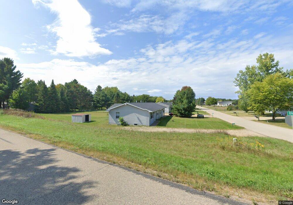
E1597 Raymond Dr Waupaca, WI 54981
Estimated Value: $271,000 - $725,000
4
Beds
2
Baths
1,976
Sq Ft
$202/Sq Ft
Est. Value
About This Home
This home is located at E1597 Raymond Dr, Waupaca, WI 54981 and is currently estimated at $399,122, approximately $201 per square foot. E1597 Raymond Dr is a home located in Waupaca County with nearby schools including Waupaca Learning Center Elementary School, Waupaca Middle School, and Waupaca High School.
Ownership History
Date
Name
Owned For
Owner Type
Purchase Details
Closed on
May 29, 2009
Sold by
Wachsmuth Raymond G
Bought by
Kaminske Brian J
Current Estimated Value
Purchase Details
Closed on
Jan 9, 2008
Sold by
Wachsmuth Raymond G and Wachsmuth Cheryl J
Bought by
Kaminske Brian R and Kaminske Janah J
Home Financials for this Owner
Home Financials are based on the most recent Mortgage that was taken out on this home.
Original Mortgage
$89,000
Interest Rate
5.74%
Mortgage Type
Adjustable Rate Mortgage/ARM
Create a Home Valuation Report for This Property
The Home Valuation Report is an in-depth analysis detailing your home's value as well as a comparison with similar homes in the area
Home Values in the Area
Average Home Value in this Area
Purchase History
| Date | Buyer | Sale Price | Title Company |
|---|---|---|---|
| Kaminske Brian J | $115,000 | -- | |
| Kaminske Brian R | -- | None Available |
Source: Public Records
Mortgage History
| Date | Status | Borrower | Loan Amount |
|---|---|---|---|
| Previous Owner | Kaminske Brian R | $89,000 |
Source: Public Records
Tax History Compared to Growth
Tax History
| Year | Tax Paid | Tax Assessment Tax Assessment Total Assessment is a certain percentage of the fair market value that is determined by local assessors to be the total taxable value of land and additions on the property. | Land | Improvement |
|---|---|---|---|---|
| 2024 | $2,128 | $199,000 | $37,100 | $161,900 |
| 2023 | $2,128 | $199,000 | $37,100 | $161,900 |
| 2022 | $2,342 | $132,400 | $21,800 | $110,600 |
| 2021 | $2,264 | $132,400 | $21,800 | $110,600 |
| 2020 | $2,128 | $132,400 | $21,800 | $110,600 |
| 2019 | $2,172 | $132,400 | $21,800 | $110,600 |
| 2018 | $2,567 | $132,400 | $21,800 | $110,600 |
| 2017 | $2,523 | $132,400 | $21,800 | $110,600 |
| 2016 | $2,523 | $132,400 | $21,800 | $110,600 |
| 2015 | $2,411 | $132,400 | $21,800 | $110,600 |
| 2014 | $2,493 | $133,300 | $21,800 | $111,500 |
| 2013 | $2,469 | $133,300 | $21,800 | $111,500 |
Source: Public Records
Map
Nearby Homes
- E1396 Grandview Rd
- N2475 E Miner Dr
- E1457 Rural Rd
- E1761 Amy St
- E1280 County Road Q Unit 3
- E1852 King Rd
- E2041 Meadowlark Ln
- 0 State Road 22 Unit 50271805
- 0 State Road 22 Unit 50271804
- N2645 Pleasant Park Ln
- E1747 Pine Ridge Ln
- N2371 Long Cove Dr
- N2577 Ottman Dr
- E2086 King Rd
- N3012 Hicks Ln
- E2319 Parfreyville Rd
- N3032 Hicks Ln
- N1983 Evergreen Ln
- 1579 Foxfire Ct
- 1500 Foxfire Ct
- E1593 Raymond Dr
- 0 Old Highway 22
- N2360 Old Highway 22
- E1596 Raymond Dr
- E1598 Raymond Dr
- E1589 Raymond Dr
- E1592 Raymond Dr
- E1594 McCrossen Rd
- E1585 Raymond Dr
- E1590 McCrossen Rd
- E1580 McCrossen Rd
- N2330 Old Highway 22
- E1570 McCrossen Rd
- E1581 Raymond Dr
- N2326 S McCrossen Rd
- E1584 Raymond Dr
- N2395 Smith Rd
- N2324 Old Highway 22
- N2320 S McCrossen Rd
- E1580 Raymond Dr