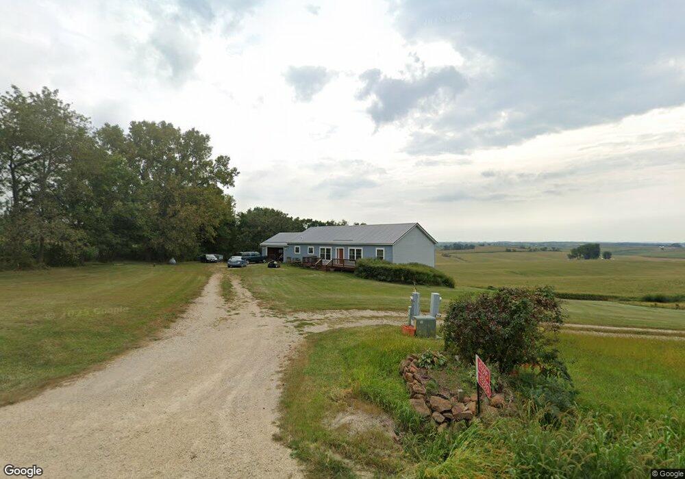
E5595 State Highway 82 Viroqua, WI 54665
Estimated Value: $348,000 - $536,000
--
Bed
--
Bath
--
Sq Ft
2.1
Acres
About This Home
This home is located at E5595 State Highway 82, Viroqua, WI 54665 and is currently estimated at $420,126. E5595 State Highway 82 is a home located in Vernon County with nearby schools including Viroqua Elementary School, Viroqua Middle School, and Viroqua High School.
Ownership History
Date
Name
Owned For
Owner Type
Purchase Details
Closed on
Jun 30, 2022
Sold by
J. Zietlow Jason
Bought by
Ridge Top Bnb Llc A Wisconsin Limited
Current Estimated Value
Purchase Details
Closed on
Jun 7, 2021
Sold by
Zietlow Laura L
Bought by
Zietlow Jason L
Purchase Details
Closed on
Dec 19, 2013
Sold by
Fannie Mae
Bought by
Zietlow Jason J and Zietlow Laura L
Purchase Details
Closed on
Apr 29, 2013
Sold by
Senn Andrew B and Senn Cecila
Bought by
Federal National Mortgage Association
Purchase Details
Closed on
Oct 7, 2009
Sold by
Senn Andrew B and Senn Cecelia
Bought by
Buchanan Robert Durrant
Create a Home Valuation Report for This Property
The Home Valuation Report is an in-depth analysis detailing your home's value as well as a comparison with similar homes in the area
Home Values in the Area
Average Home Value in this Area
Purchase History
| Date | Buyer | Sale Price | Title Company |
|---|---|---|---|
| Ridge Top Bnb Llc A Wisconsin Limited | $173,000 | Attorney Michael M. Fortney | |
| Zietlow Jason L | -- | None Available | |
| Zietlow Jason J | -- | None Available | |
| Federal National Mortgage Association | -- | None Available | |
| Buchanan Robert Durrant | -- | -- |
Source: Public Records
Tax History Compared to Growth
Tax History
| Year | Tax Paid | Tax Assessment Tax Assessment Total Assessment is a certain percentage of the fair market value that is determined by local assessors to be the total taxable value of land and additions on the property. | Land | Improvement |
|---|---|---|---|---|
| 2024 | $3,390 | $172,500 | $18,300 | $154,200 |
| 2023 | $3,008 | $172,500 | $18,300 | $154,200 |
| 2022 | $2,911 | $172,500 | $18,300 | $154,200 |
| 2021 | $2,791 | $172,500 | $18,300 | $154,200 |
| 2020 | $2,682 | $129,050 | $16,050 | $113,000 |
| 2019 | $2,558 | $129,050 | $16,050 | $113,000 |
| 2018 | $2,807 | $129,050 | $16,050 | $113,000 |
| 2017 | $2,745 | $129,050 | $16,050 | $113,000 |
| 2016 | $2,617 | $129,050 | $16,050 | $113,000 |
| 2015 | $3,054 | $129,050 | $16,050 | $113,000 |
| 2014 | $959 | $53,750 | $16,050 | $37,700 |
| 2013 | $2,206 | $100,750 | $16,050 | $84,700 |
Source: Public Records
Map
Nearby Homes
- 6966 Johnson Ave
- S6966 Johnson Ave
- Tbd Weber Rd
- TBD Weber Rd
- S6205 Sidie Hollow Rd
- S5695 Nottingham Rd
- Lot 9 Woodland Rd
- 169.88± Acres Stump Ridge Rd
- 0 Stump Ridge Rd
- LOT 15 16th Fairway Dr
- LOT 13 W Point Cir
- 1215 16th Fairway Dr
- 1213 16th Fairway Dr
- 13486 Gurnsey Dr
- LOT 42 Crossing Meadows Dr
- LOT 41 Crossing Meadows Dr
- LOT 28 16th Fairway Dr
- LOT 30 16th Fairway Dr
- 1129 16th Fairway Dr
- LOT 31 16th Fairway Dr