Estimated Value: $108,000 - $148,725
Studio
--
Bath
1,340
Sq Ft
$94/Sq Ft
Est. Value
About This Home
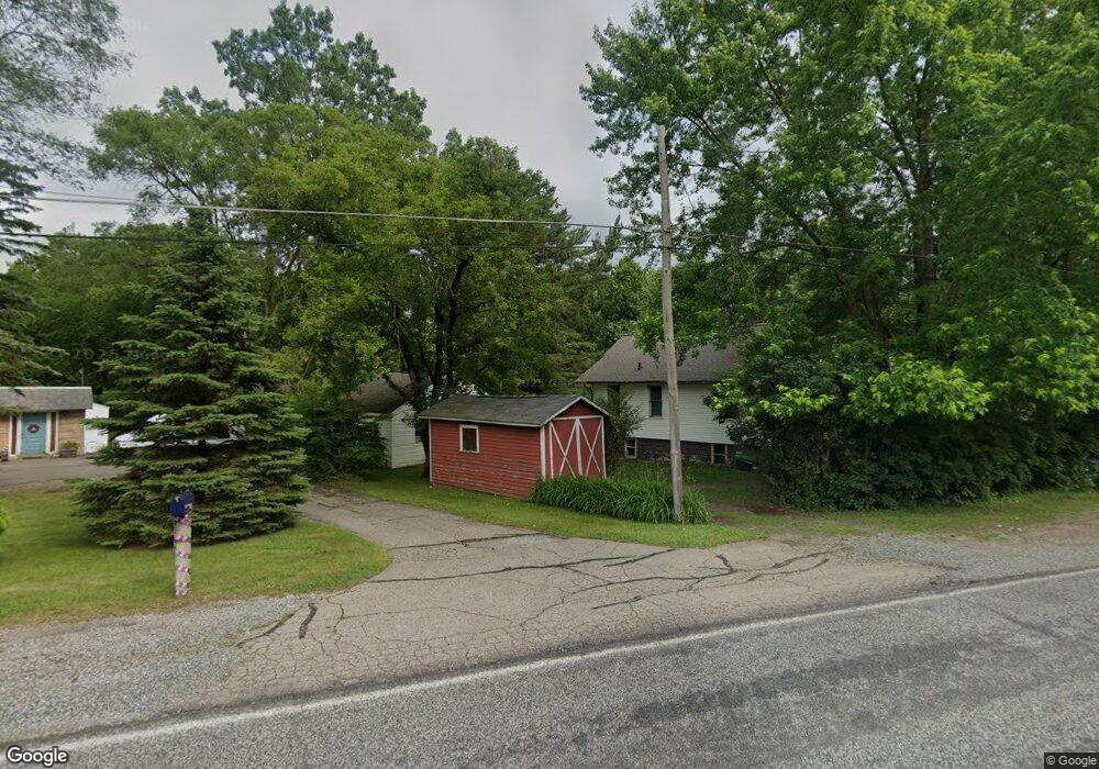
This home is located at G4342 Branch Rd, Flint, MI 48506 and is currently estimated at $125,931, approximately $93 per square foot. G4342 Branch Rd is a home located in Genesee County with nearby schools including Weston Elementary School, Kate Dowdall Elementary School, and Leota Fiedler Elementary School.
Ownership History
Date
Name
Owned For
Owner Type
Purchase Details
Closed on
Oct 30, 2006
Sold by
Fannie Mae
Bought by
Lemon Terri Lyn
Current Estimated Value
Purchase Details
Closed on
Dec 8, 2005
Sold by
Mortgage Electronic Registration Systems
Bought by
Federal National Mortgage Association
Purchase Details
Closed on
Nov 30, 2005
Sold by
Rogers Steven C and Rogers Denise A
Bought by
Mortgage Electronic Registration Systems
Purchase Details
Closed on
Jul 26, 2004
Sold by
Rogers Denise A
Bought by
Roger Steven C
Purchase Details
Closed on
Jun 25, 2003
Sold by
Yaldo Mazin and Yaldo Sada H
Bought by
Burton Corners Llc
Purchase Details
Closed on
May 22, 2003
Sold by
Pamaqua & Co
Bought by
Jabro Sarmad and Yaldo Mazin
Create a Home Valuation Report for This Property
The Home Valuation Report is an in-depth analysis detailing your home's value as well as a comparison with similar homes in the area
Home Values in the Area
Average Home Value in this Area
Purchase History
| Date | Buyer | Sale Price | Title Company |
|---|---|---|---|
| Lemon Terri Lyn | $80,000 | Guaranty Title Company | |
| Federal National Mortgage Association | -- | None Available | |
| Mortgage Electronic Registration Systems | $104,983 | None Available | |
| Roger Steven C | -- | -- | |
| Burton Corners Llc | -- | -- | |
| Burton Corners Llc | -- | -- | |
| Jabro Sarmad | -- | Grego Title |
Source: Public Records
Tax History
| Year | Tax Paid | Tax Assessment Tax Assessment Total Assessment is a certain percentage of the fair market value that is determined by local assessors to be the total taxable value of land and additions on the property. | Land | Improvement |
|---|---|---|---|---|
| 2025 | $2,145 | $71,000 | $0 | $0 |
| 2024 | $431 | $66,000 | $0 | $0 |
| 2023 | $411 | $59,500 | $0 | $0 |
| 2022 | $1,778 | $54,400 | $0 | $0 |
| 2021 | $1,767 | $50,100 | $0 | $0 |
| 2020 | $376 | $46,100 | $0 | $0 |
| 2019 | $370 | $41,500 | $0 | $0 |
| 2018 | $1,702 | $38,900 | $0 | $0 |
| 2017 | $1,640 | $38,100 | $0 | $0 |
| 2016 | $1,653 | $36,700 | $0 | $0 |
| 2015 | $1,022 | $35,100 | $0 | $0 |
| 2014 | $341 | $32,100 | $0 | $0 |
| 2012 | -- | $28,500 | $28,500 | $0 |
Source: Public Records
Map
Nearby Homes
- 2919 Hampstead Dr
- 5919 Western Rd
- 2825 Eaton Place
- 2909 E Pierson Rd
- 2727 Eaton Place
- 4907 Delta Dr
- 3364 E Pierson Rd
- 4298 N Center Rd
- 3456 E Pierson Rd
- 4072 Crosby Rd
- 1704 E Webster Rd
- 5190 Branch Rd
- 4141 Hidden View Dr
- 5910 N Dort Hwy
- 2935 Richfield Rd
- 00 Richfield Rd
- 0 Sugar Maple Farms Unit 50195365
- 1218 E Piper Ave
- 1206 E Home Ave
- 3010 Wyoming Ave
- G4326 Branch Rd
- G4358 Branch Rd
- G4314 Branch Rd
- 6211 Branch Rd
- 3019 Hampstead Dr
- 3013 Hampstead Dr
- 3222 Branch Rd
- 3007 Hampstead Dr
- 4214 Branch Rd
- 3001 Hampstead Dr
- 5825 Branch Rd
- 4264 Branch Rd
- 3010 Hampstead Dr
- 2913 Hampstead Dr
- 3002 Hampstead Dr
- 5821 Branch Rd
- 2909 Hampstead Dr
- 2914 Hampstead Dr
- 5817 Branch Rd
- 2905 Hampstead Dr
Your Personal Tour Guide
Ask me questions while you tour the home.