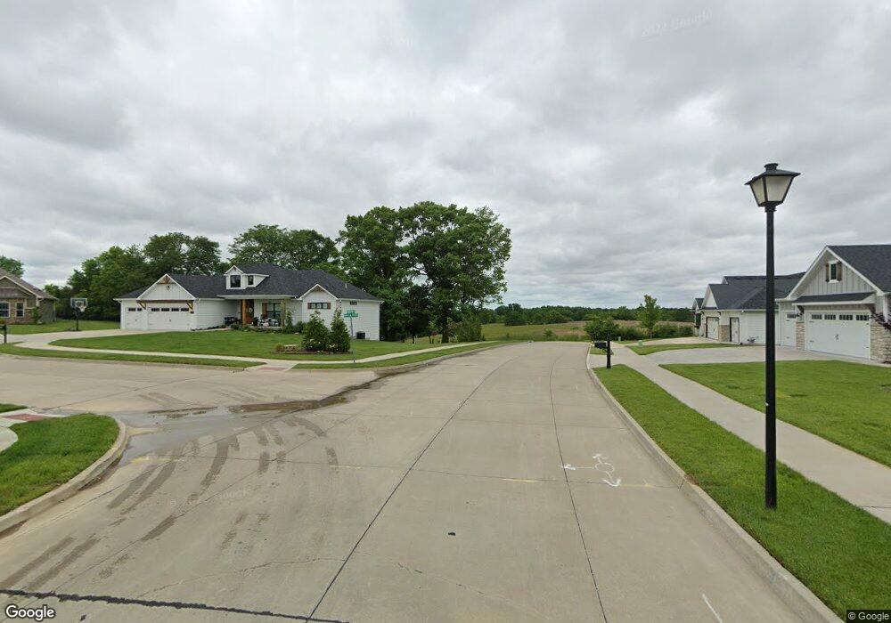
L 10 Deerfield Ridge Columbia, MO 65203
Estimated Value: $660,000 - $773,316
3
Beds
4
Baths
4,434
Sq Ft
$163/Sq Ft
Est. Value
About This Home
This home is located at L 10 Deerfield Ridge, Columbia, MO 65203 and is currently estimated at $722,329, approximately $162 per square foot. L 10 Deerfield Ridge is a home located in Boone County with nearby schools including Beulah Ralph Elementary School, Ann Hawkins Gentry Middle School, and Rock Bridge High School.
Ownership History
Date
Name
Owned For
Owner Type
Purchase Details
Closed on
Jun 18, 2021
Sold by
Gusky Raymond L and Gusky Patricia A
Bought by
Ingerslew Erik and Ingerslew Kaitlin
Current Estimated Value
Home Financials for this Owner
Home Financials are based on the most recent Mortgage that was taken out on this home.
Original Mortgage
$420,000
Outstanding Balance
$380,258
Interest Rate
2.9%
Mortgage Type
New Conventional
Estimated Equity
$342,071
Purchase Details
Closed on
Jul 23, 2015
Sold by
Bradley Ramona M and Bradley Philip P
Bought by
Gusky Raymond L and Gusky Patricia A
Home Financials for this Owner
Home Financials are based on the most recent Mortgage that was taken out on this home.
Original Mortgage
$310,000
Interest Rate
4.08%
Mortgage Type
New Conventional
Create a Home Valuation Report for This Property
The Home Valuation Report is an in-depth analysis detailing your home's value as well as a comparison with similar homes in the area
Home Values in the Area
Average Home Value in this Area
Purchase History
| Date | Buyer | Sale Price | Title Company |
|---|---|---|---|
| Ingerslew Erik | -- | Boone Central Title Company | |
| Gusky Raymond L | -- | None Available |
Source: Public Records
Mortgage History
| Date | Status | Borrower | Loan Amount |
|---|---|---|---|
| Open | Ingerslew Erik | $420,000 | |
| Previous Owner | Gusky Raymond L | $310,000 |
Source: Public Records
Tax History Compared to Growth
Tax History
| Year | Tax Paid | Tax Assessment Tax Assessment Total Assessment is a certain percentage of the fair market value that is determined by local assessors to be the total taxable value of land and additions on the property. | Land | Improvement |
|---|---|---|---|---|
| 2025 | $5,669 | $86,241 | $11,970 | $74,271 |
| 2024 | $5,669 | $78,394 | $11,970 | $66,424 |
| 2023 | $5,621 | $78,394 | $11,970 | $66,424 |
| 2022 | $5,400 | $75,373 | $11,970 | $63,403 |
| 2021 | $5,408 | $75,373 | $11,970 | $63,403 |
| 2020 | $5,730 | $75,373 | $11,970 | $63,403 |
| 2019 | $5,731 | $75,373 | $11,970 | $63,403 |
| 2018 | $5,766 | $0 | $0 | $0 |
| 2017 | $5,701 | $75,373 | $11,970 | $63,403 |
| 2016 | $5,691 | $75,373 | $11,970 | $63,403 |
| 2015 | $5,256 | $75,373 | $11,970 | $63,403 |
| 2014 | $5,268 | $75,373 | $11,970 | $63,403 |
Source: Public Records
Map
Nearby Homes
- 6801 Montauk Ct
- 3702 Timber Run Dr
- 6901 S Scott Blvd
- 3985 W Shrubbery Ct
- 3995 W Shrubbery Ct
- TRACT 2B Old Plank Rd S
- TR 2 W Route K
- Lot 3 Arrowhead Lake Dr
- 3108 Timber Run Dr
- 7259 Brackenhill Ct
- 0 Lot 1005 Needle Rush Dr Unit 420353
- 7405 Brackenhill Dr
- LOT 1 & 2 W Old Plank Road (Barcus Ridge) Rd
- 7590 S R A Nursery Rd
- 6245 S Arrowhead Lake Dr
- 7100 Madison Creek Dr
- 7200 Rudchester Ct
- 3001 Rivington Dr
- 7333 Sella Ct
- 7510 Kirby Knowle Ct
- 6950 Seminole Ct
- 6900 Seminole Ct
- 6925 Seminole Ct
- 7000 Seminole Ct
- 6957 Seminole Ct
- 6951 White Fawn Ct
- 7001 Seminole Ct
- 7003 White Fawn Ct
- 6950 White Fawn Ct
- 7051 White Fawn Ct
- 7110 Seminole Ct
- 7050 Seminole Ct
- 7051 Seminole Ct
- 7000 White Fawn Ct
- 6800 Montauk Ct
- 6802 Montauk Ct
- 6804 Montauk Ct
- 6904 Montauk Ct
- 6900 Montauk Ct
- 6902 Montauk Ct