
L12B3 Parsons Rd Driggs, ID 83422
Estimated Value: $235,000 - $275,000
2.55
Acres
$100,000
Price per Acre
111,078
Sq Ft Lot
About This Lot
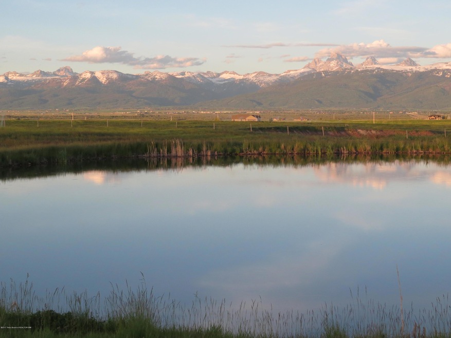
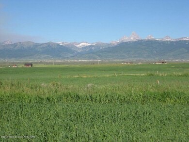
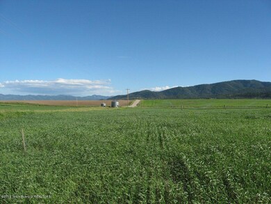
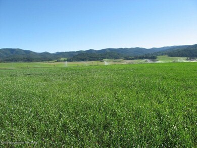
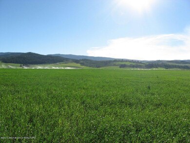
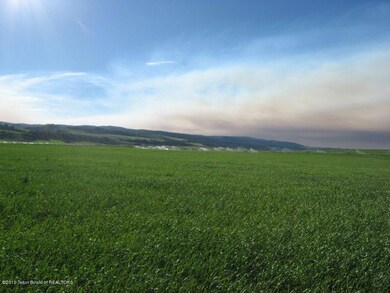
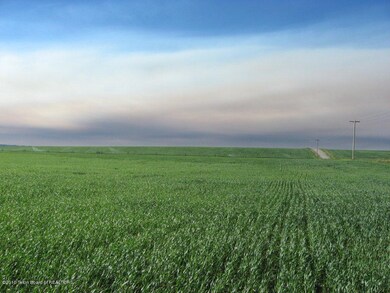
As of February 2021See Master Plan in Docs section for additional lot availability. 2.55-acre lot with rock-free topsoil and water rights in the foothills of the Big Hole Range, 5.5 miles west of Driggs on Bates(Ski Hill) Road. Entire subdivision is currently farmed, which manages noxious weeds and supplements HOA. Horses allowed on 2+ adjoining lots.
Property Details
Property Type
- Land
Est. Annual Taxes
- $509
Lot Details
- 2.55 Acre Lot
- Cul-De-Sac
Property Views
- Valley Views
Utilities
- Electricity To Lot Line
- Phone Available
Community Details
- Property has a Home Owners Association
- Blue Indian Subdivision
Listing and Financial Details
- Tax Lot L12B3
- Assessor Parcel Number RP008950030120
Ownership History
Date
Name
Owned For
Owner Type
Purchase Details
Listed on
Dec 8, 2020
Closed on
Feb 16, 2021
Sold by
Buxton West Llc
Bought by
Trenkle Kathryn M
Seller's Agent
Matt Hail
eXp Realty, LLC
Buyer's Agent
Ann Goodell
Coldwell Banker Mountain Properties
List Price
$80,000
Sold Price
$90,000
Premium/Discount to List
$10,000
12.5%
Total Days on Market
49
Current Estimated Value
Home Financials for this Owner
Home Financials are based on the most recent Mortgage that was taken out on this home.
Estimated Appreciation
$165,000
Avg. Annual Appreciation
27.33%
Original Mortgage
$193,325
Interest Rate
3.14%
Mortgage Type
Construction
Similar Properties in Driggs, ID
Create a Home Valuation Report for This Property
The Home Valuation Report is an in-depth analysis detailing your home's value as well as a comparison with similar homes in the area
Home Values in the Area
Average Home Value in this Area
Purchase History
| Date | Buyer | Sale Price | Title Company |
|---|---|---|---|
| Trenkle Kathryn M | -- | Alliance Title | |
| Trenkle Kathryn M | -- | Alliance Title Driggs Office |
Source: Public Records
Mortgage History
| Date | Status | Borrower | Loan Amount |
|---|---|---|---|
| Open | Trenkle Kathryn M | $315,500 | |
| Closed | Trenkle Kathryn M | $193,325 | |
| Previous Owner | Trenkle Kathryn M | $193,325 |
Source: Public Records
Property History
| Date | Event | Price | Change | Sq Ft Price |
|---|---|---|---|---|
| 02/19/2021 02/19/21 | Sold | -- | -- | -- |
| 01/27/2021 01/27/21 | Pending | -- | -- | -- |
| 12/08/2020 12/08/20 | For Sale | $80,000 | -- | -- |
Source: Teton Board of REALTORS®
Tax History Compared to Growth
Tax History
| Year | Tax Paid | Tax Assessment Tax Assessment Total Assessment is a certain percentage of the fair market value that is determined by local assessors to be the total taxable value of land and additions on the property. | Land | Improvement |
|---|---|---|---|---|
| 2024 | $509 | $153,000 | $153,000 | $0 |
| 2023 | $509 | $153,000 | $153,000 | $0 |
| 2022 | $609 | $127,500 | $127,500 | $0 |
| 2021 | $367 | $56,100 | $56,100 | $0 |
| 2020 | $12 | $1,492 | $1,492 | $0 |
| 2019 | $12 | $1,492 | $1,492 | $0 |
| 2018 | $12 | $1,433 | $1,433 | $0 |
| 2017 | $11 | $1,392 | $1,392 | $0 |
| 2016 | $25 | $1,352 | $1,352 | $0 |
| 2015 | $70 | $1,290 | $1,290 | $0 |
Source: Public Records
Agents Affiliated with this Home
-
Matt Hail
M
Seller's Agent in 2021
Matt Hail
eXp Realty, LLC
(208) 399-8080
114 Total Sales
-
Ann Goodell
Buyer's Agent in 2021
Ann Goodell
Coldwell Banker Mountain Properties
(208) 317-8505
88 Total Sales
Map
Source: Teton Board of REALTORS®
MLS Number: 20-3598
APN: RP008950030120
Nearby Homes
- L13B3 Parsons Rd
- 6188 Hatfield Way
- 6118 Hatfield Way
- 118 Olivia Ct
- 284 Parsons Rd
- 1315 S Sorensen Way
- 6352 W 1170 N
- 7033 Bates Rd
- 51 Greene Dr
- 0 6053 W 1400 N Unit 24-2228
- 0 6135 W 1400 N Unit 24-2229
- TBD W 500 S
- 1070 Horseshoe Ln
- 1347 Horseshoe Ln
- 4915 Royal Scot Rd
- TBD W 1000 S
- 0 Old Horseshoe Rd Unit 22046029
- 0
- 2500 S 5000 W
- 1845 S 5000 W
- L12B3 Parsons Rd
- L2B4 Parsons Rd
- L3B4 Hatfield Way Ct
- L11B3 Parsons Rd
- L14B3 Parsons Rd
- L4B4 Parsons Rd
- L5B3 Parsons Rd
- L1B4 Parsons Rd
- 6232 Hatfield Way
- L10B3 Parsons Rd
- L11B2 Hatfield Rd
- L7B3 Hatfield Way
- 101 N 6100 W
- 102 N 6100 W
- 100 N 6100 W
- L8B3 Parsons Rd
- 489 Parsons Rd
- L5 B4 Parsons Rd
- 179 Olivia Ct
- 104 N 6100 W