
L13B2 Hatfield Way Driggs, ID 83422
Estimated Value: $1,184,000 - $1,379,681
3.04
Acres
$411,368
Price per Acre
132,422
Sq Ft Lot
Highlights
- Horses Allowed On Property
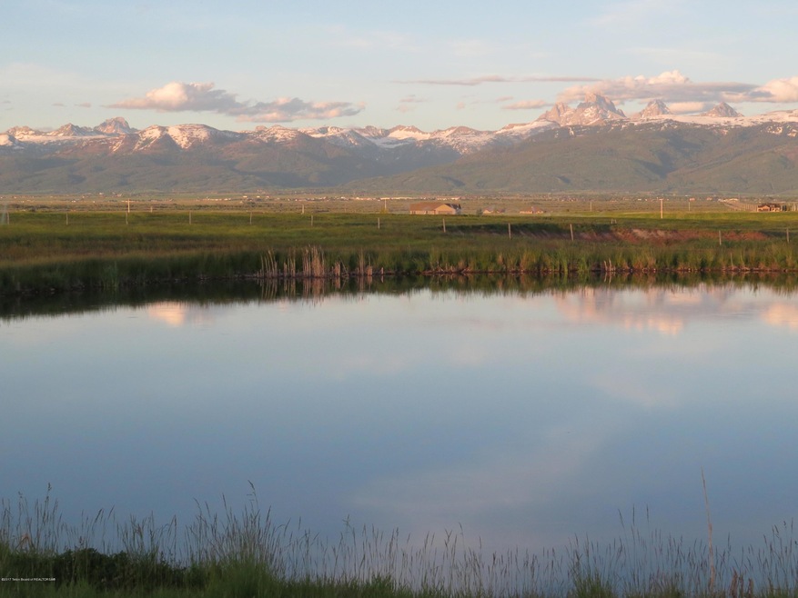
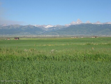
- Valley View
- Cul-De-Sac
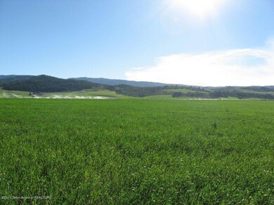
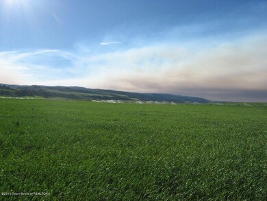
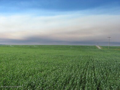
About This Lot
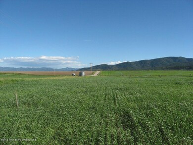
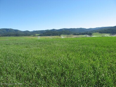
As of November 2020See Master Plan in Docs section for additional lot availability. 3.02-acre lot with rock-free topsoil and water rights in the foothills of the Big Hole Range, 5.5 miles west of Driggs on Bates(Ski Hill) Road. Entire subdivision is currently farmed, which manages noxious weeds and supplements HOA. Horses allowed on 2+ adjoining lots.
Last Buyer's Agent
Matt Hail
Coldwell Banker Mountain Properties License #SP37399
Property Details
Property Type
- Land
Est. Annual Taxes
- $2,878
Year Built
- 2023
Lot Details
- 3.04 Acre Lot
- Cul-De-Sac
Utilities
- Electricity To Lot Line
- Phone Available
Additional Features
- Valley Views
- Horses Allowed On Property
Community Details
- Property has a Home Owners Association
- Blue Indian Subdivision
Listing and Financial Details
- Tax Lot L13B2
- Assessor Parcel Number RP008950020130
Ownership History
Date
Name
Owned For
Owner Type
Purchase Details
Closed on
Dec 14, 2023
Sold by
Dixon John Paul
Bought by
Dixon John Paul and Babbitt Kelli
Total Days on Market
0
Current Estimated Value
Purchase Details
Closed on
Apr 27, 2022
Sold by
Paul Dixon
Bought by
Dixon John Paul
Home Financials for this Owner
Home Financials are based on the most recent Mortgage that was taken out on this home.
Original Mortgage
$534,000
Interest Rate
5.11%
Mortgage Type
Construction
Purchase Details
Listed on
Sep 28, 2020
Closed on
Oct 22, 2020
Sold by
Buxton West Llc
Bought by
Dixon Paul
Seller's Agent
Matt Hail
eXp Realty, LLC
Buyer's Agent
Matt Hail
Coldwell Banker Mountain Properties
List Price
$65,000
Sold Price
$65,000
Home Financials for this Owner
Home Financials are based on the most recent Mortgage that was taken out on this home.
Avg. Annual Appreciation
89.85%
Original Mortgage
$30,500
Interest Rate
2.9%
Mortgage Type
New Conventional
Similar Properties in Driggs, ID
Create a Home Valuation Report for This Property
The Home Valuation Report is an in-depth analysis detailing your home's value as well as a comparison with similar homes in the area
Home Values in the Area
Average Home Value in this Area
Purchase History
| Date | Buyer | Sale Price | Title Company |
|---|---|---|---|
| Dixon John Paul | -- | Flying S Title | |
| Dixon John Paul | -- | First American Title | |
| Dixon Paul | -- | First American Title Driggs |
Source: Public Records
Mortgage History
| Date | Status | Borrower | Loan Amount |
|---|---|---|---|
| Previous Owner | Dixon John Paul | $534,000 | |
| Previous Owner | Dixon Paul | $30,500 |
Source: Public Records
Property History
| Date | Event | Price | Change | Sq Ft Price |
|---|---|---|---|---|
| 11/04/2020 11/04/20 | Sold | -- | -- | -- |
| 09/28/2020 09/28/20 | Pending | -- | -- | -- |
| 09/28/2020 09/28/20 | For Sale | $65,000 | -- | -- |
Source: Teton Board of REALTORS®
Tax History Compared to Growth
Tax History
| Year | Tax Paid | Tax Assessment Tax Assessment Total Assessment is a certain percentage of the fair market value that is determined by local assessors to be the total taxable value of land and additions on the property. | Land | Improvement |
|---|---|---|---|---|
| 2024 | $2,878 | $1,026,164 | $145,920 | $880,244 |
| 2023 | $2,878 | $145,920 | $145,920 | $0 |
| 2022 | $683 | $145,920 | $145,920 | $0 |
| 2021 | $398 | $60,800 | $60,800 | $0 |
| 2020 | $14 | $1,778 | $1,778 | $0 |
| 2019 | $14 | $1,778 | $1,778 | $0 |
| 2018 | $14 | $1,708 | $1,708 | $0 |
| 2017 | $13 | $1,660 | $1,660 | $0 |
| 2016 | $27 | $1,611 | $1,611 | $0 |
| 2015 | $72 | $1,538 | $1,538 | $0 |
Source: Public Records
Agents Affiliated with this Home
-
Matt Hail
M
Seller's Agent in 2020
Matt Hail
eXp Realty, LLC
(208) 399-8080
113 Total Sales
Map
Source: Teton Board of REALTORS®
MLS Number: 20-2934
APN: RP008950020130
Nearby Homes
- 284 Parsons Rd
- 118 Olivia Ct
- 6188 Hatfield Way
- L13B3 Parsons Rd
- 6118 Hatfield Way
- 7033 Bates Rd
- 1315 S Sorensen Way
- 6352 W 1170 N
- TBD W 500 S
- 51 Greene Dr
- 1070 Horseshoe Ln
- 0 6135 W 1400 N Unit 24-2229
- 0 6053 W 1400 N Unit 24-2228
- 1347 Horseshoe Ln
- TBD W 1000 S
- 4915 Royal Scot Rd
- 0 Old Horseshoe Rd Unit 22046029
- 0
- 2500 S 5000 W
- TBD S 5000 W
- L13B2 Hatfield Way
- L3B1 Parsons Rd
- L4B1 Parsons Rd
- L14B2 Parsons Rd
- L2B1 Parsons Rd
- L11B2 Hatfield Rd
- 102 N 6100 W
- L7B3 Hatfield Way
- L5B1 Parsons Rd
- L8B3 Parsons Rd
- L1B1 Parsons Rd
- 140 Olivia Ct
- 100 N 6100 W
- L5B3 Parsons Rd
- L8B2 Hatfield Way
- 6232 Hatfield Way
- L7B1 Parsons Rd
- APX 450 Parsons Rd
- L16B2 Parsons Rd
- 179 Olivia Ct