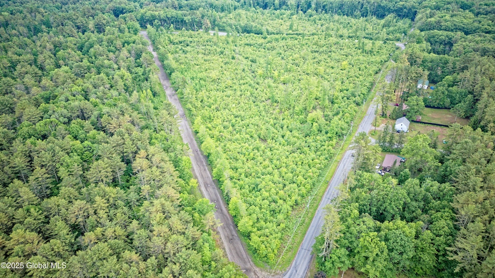

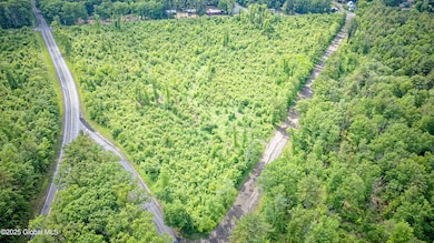
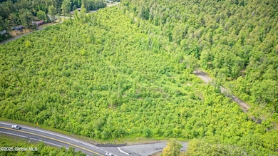
L2 9 Mile Tree Rd Mayfield, NY 12078
Estimated payment $1,624/month
Highlights
- 14.4 Acre Lot
- Wooded Lot
- No HOA
About This Lot
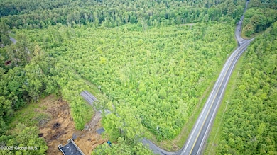
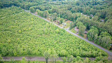
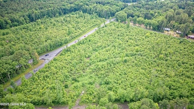
Triangular 14.40 acre lot bordered by Route 29A, Nine Mile Tree Road, Sand Hill Road (portion) and Frank Road. Located in a well traveled area with direct visibilty from Route 29A. Multiple points of access from the bordering roads. Your vision awaits!
Property Details
Property Type
- Land
Est. Annual Taxes
- $614
Lot Details
- 14.4 Acre Lot
- Property fronts a private road
- Wooded Lot
Community Details
- No Home Owners Association
Listing and Financial Details
- Legal Lot and Block 2 / 6
- Assessor Parcel Number 173089 136.-6-2
Map
Home Values in the Area
Average Home Value in this Area
Property History
| Date | Event | Price | List to Sale | Price per Sq Ft |
|---|---|---|---|---|
| 12/04/2025 12/04/25 | For Sale | $300,000 | 0.0% | -- |
| 11/30/2025 11/30/25 | Off Market | $300,000 | -- | -- |
| 06/12/2025 06/12/25 | For Sale | $300,000 | -- | -- |
Source: Global MLS
MLS Number: 202519398
Disclaimer: Certain information contained herein is derived from information provided by parties other than Homes.com. All information provided is deemed reliable, but is not guaranteed to be accurate and should be independently verified.
![]() IDX information is provided exclusively for personal, non-commercial use, and may not be used for any purpose other than to identify prospective properties consumers may be interested in purchasing.
IDX information is provided exclusively for personal, non-commercial use, and may not be used for any purpose other than to identify prospective properties consumers may be interested in purchasing.
Information is deemed reliable but not guaranteed.
Local REALTOR® - Todd Siegel, Broker - (888)-952-6393
- 236 State Highway 29a
- 327 New York 29a
- 52 Oak Ln
- 13 Bluebird Ln
- 493 Warren Rd
- 3380 State Highway 30
- 1808 State Highway 29
- 179 Vandenburgh Point Rd
- 211 Woods Hollow Rd
- 376 Bemis Rd
- 365 Bemis Rd
- L8 New York 349
- 824 County Highway 106
- 109 Bertrand Rd
- 199 Blanchard Rd
- 136 Longview Dr
- 148 Bellen Rd
- L39 Sunrise Dr
- 120 County Highway 155
- 194 Bellen Rd
- 12 N Main St
- 12 N Main St
- 49 Woodward Ave Unit 1
- 42 North Blvd
- 174 Perthshire Dr Unit Studio
- 60 E 8th Ave Unit 2
- 461 N Main St Unit 2
- 44 N Main St Unit Apartment #3
- 79 Park St Unit 2
- 52 Church St
- 22 Lexington Ave
- 588 County Highway 142
- 20 Water St Unit 2
- 20 Water St Unit 2
- 147 Wallins Corners Rd
- 26 Stewart St Unit 2
- 16 Stewart St Unit second floor
- 16 Stewart St
- 269 W Main St Unit 1
- 265 W Main St Unit 1
