T
Seller's Agent in 2024
Tony Novotny, P.L.S.
M.A.P.S., P.L.L.C.
(406) 599-2359
23 Total Sales
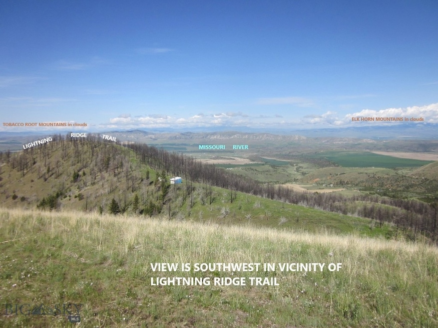
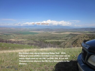
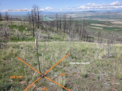
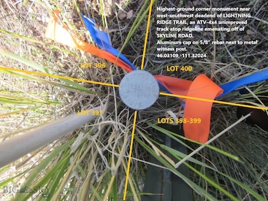
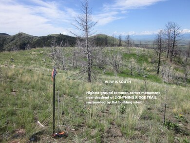
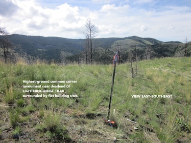
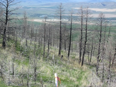
NOW SELLER FINANCING: 50% down, 7% interest, monthly payment around $500, lump sum payoff within 5 years, split all closing costs, & buyer pays for escrow account to track payments: 10-acre Lot 400 has breathtaking views from its SW corner & from a natural clearing adjacent to that with flat building sites providing incomparable seclusion, ideal for building that getaway cabin. Elevation of 5500’ means access would be seasonal via ATV-4x4-snowmobile using Lightning Ridge Trail. Cool summer breezes, bountiful wildlife (pictured) make this a most desirable property at about one hundredth of price per acre compared to nearby Gallatin Valley & Bozeman. Retired FWP biologist says 750 head of elk reside in the area, not counting migrants. Electricity is via solar, wind, propane, generator or a combo. Rainwater collection system off of a cabin roof would be a least expensive way to go. PUBLIC LANDS lie 1.5 mi NE and SW; PUBLIC RIVER LANDS are 8 mi drive where entire river can be fished legally, or where one may watch migratory waterfowl or upland game birds being chased by eagles. Montana has a little known regulation called “non-qualified Ag land” such that if connected acreages add up to 20+ acres with the same owner of record, property tax per 20 acres is about the same as for 10 acres; accordingly, as of June 2023 Lot 398-399 with a well is for sale searching Realtor.com with #378991 & Lot 396 is for sale searching with #379009; see last picture here for configuration. Suggested route is Pole Gulch Rd, to Spring Valley Rd, to Skyline Rd, to Lightning Ridge Trail. To generally navigate there, Buyer/Realtor may buy a 3’x4’ black & white map of Ponderosa Pines for about $8 at Selby’s Bozeman, UPS Store Belgrade, or Main St Office Three Forks if reminded that they were given a digital file of it by this listing Broker/Surveyor-Mapper. The latter recovered & flagged the SW & SE property corner monuments, & observed GPS coordinates on them, to be viewed amongst pictures. Conifer timber cover has been burnt by a wildfire covering this 10 acres, State forester estimates 10 years for regeneration Distance to I-90 is 40 min, to international airport is about 60 min away in good weather. Google Earth the SW corner – near best cabin build site - at 46.03111,-111.32027
Last Agent to Sell the Property
M.A.P.S., P.L.L.C. License #BRO-12806 Listed on: 07/23/2022
| Date | Event | Price | List to Sale | Price per Sq Ft |
|---|---|---|---|---|
| 12/11/2024 12/11/24 | Sold | -- | -- | -- |
| 10/14/2024 10/14/24 | Pending | -- | -- | -- |
| 07/23/2022 07/23/22 | For Sale | $79,900 | -- | -- |
T
Seller's Agent in 2024
Tony Novotny, P.L.S.
M.A.P.S., P.L.L.C.
(406) 599-2359
23 Total Sales
Source: Big Sky Country MLS
MLS Number: 374664
Disclaimer: Certain information contained herein is derived from information provided by parties other than Homes.com. All information provided is deemed reliable, but is not guaranteed to be accurate and should be independently verified.
![]() IDX information is provided exclusively for consumers' personal, non-commercial use, that it may not be used for any purpose other than to identify prospective properties consumers may be interested in purchasing, and that the data is deemed reliable but is not guaranteed accurate by the MLS.
IDX information is provided exclusively for consumers' personal, non-commercial use, that it may not be used for any purpose other than to identify prospective properties consumers may be interested in purchasing, and that the data is deemed reliable but is not guaranteed accurate by the MLS.
