Lt99 N 18th St Manitowoc, WI 54220
Estimated payment $1,803/month
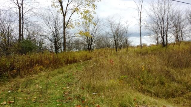
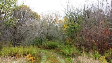
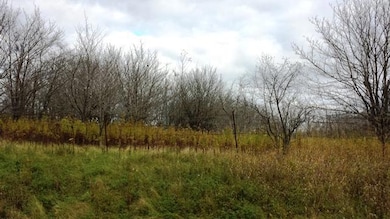
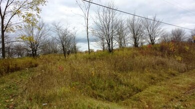
About This Lot
17.4 acres North of the Little Manitowoc River, including frontage. Located between the end of Albert Drive and N.18th street(Hwy Q). You could use in its entirety or split into 6 large 2 to 5 acre lots which are already surveyed for development. Land is wooded and in city limits and could be hooked up to sewer and municipal water.
Property Details
Property Type
- Land
Est. Annual Taxes
- $1,750
Lot Details
- 17.4 Acre Lot
Schools
- Lincoln High School
Listing and Financial Details
- Assessor Parcel Number 818102050
Map
Home Values in the Area
Average Home Value in this Area
Property History
| Date | Event | Price | List to Sale | Price per Sq Ft |
|---|---|---|---|---|
| 01/04/2022 01/04/22 | For Sale | $320,000 | -- | -- |
Source: Metro MLS
MLS Number: 1775667
Disclaimer: Certain information contained herein is derived from information provided by parties other than Homes.com. All information provided is deemed reliable, but is not guaranteed to be accurate and should be independently verified.
![]() IDX information is provided exclusively for personal, non-commercial use, and may not be used for any purpose other than to identify prospective properties consumers may be interested in purchasing.
IDX information is provided exclusively for personal, non-commercial use, and may not be used for any purpose other than to identify prospective properties consumers may be interested in purchasing.
IDX listing data provided by Multiple Listing Service, Inc. Information is supplied by seller and other third parties and has not been verified.
Copyright 2025 – Multiple Listing Service, Inc. – All Rights Reserved.
- 2423 County Highway Q -
- 1920 Ravenswood Ln
- 1922 Ravenswood Ln
- 1926 Ravenswood Ln
- 1928 Ravenswood Ln
- 1934 Ravenswood Ln
- 1936 Ravenswood Ln
- 2510 Stoney Brook Ct
- 436 Maple Leaf Ct
- 2101 Hunters Ridge Ct
- 1925 Creekwood Ct
- 2903 County Highway B -
- 2003 Richmond Ave
- LT0 Mosie Ct
- 1437 Arden Ln
- 1432 Gunnell Ln
- 1101 Nagle Ave
- 3503 Joseph Rd
- 1339 Wolf Run
- 2209 Virginia Dr
- 310 Albert Dr
- 1485 N 7th St
- 917 N 18th St
- 1703 Cedar Grove Dr
- 2130 Zimmer Dr
- 1410 Johnston Dr
- 2003 Zimmer Dr Unit D
- 1708 Meadowbrook Dr
- 1100-1160 Bayshore Dr
- 2324-2410 Mirro Dr
- 4910 Benley Ct
- 1000 River Point Dr
- 914 S 8th St
- 1025 S 17th St
- 929 S 31st St
- 1201 Marshall St Unit 1201a Marshall St
- 1311 Madison St
- 3713 Mangin St
- 3404 Memorial Dr
- 3131 Southbrook Ct
