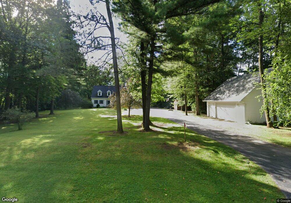
n 7030 Shady Lane Cir Porterfield, WI 54159
Estimated Value: $473,000 - $513,000
--
Bed
3
Baths
--
Sq Ft
2
Acres
About This Home
This home is located at n 7030 Shady Lane Cir, Porterfield, WI 54159 and is currently estimated at $492,341. n 7030 Shady Lane Cir is a home located in Marinette County with nearby schools including Marinette Middle School and Marinette High School.
Ownership History
Date
Name
Owned For
Owner Type
Purchase Details
Closed on
Oct 14, 2020
Sold by
Kent James and Kent Lisa
Bought by
Hass Brian and Hass Katharine
Current Estimated Value
Purchase Details
Closed on
Aug 2, 2019
Sold by
Caelwaerts William J
Bought by
Kent James
Purchase Details
Closed on
Nov 3, 2016
Sold by
Caelwaerts Robert A and Caelwaerts Lynn M
Bought by
Caelwaerts William Joseph and Caelwaerts Marie Alice
Purchase Details
Closed on
Dec 6, 2013
Sold by
Gerhartz Scott E and Gerhartz Rhonda D
Bought by
Caelwaerts Robert A and Caelwaerts Lynn M
Create a Home Valuation Report for This Property
The Home Valuation Report is an in-depth analysis detailing your home's value as well as a comparison with similar homes in the area
Home Values in the Area
Average Home Value in this Area
Purchase History
| Date | Buyer | Sale Price | Title Company |
|---|---|---|---|
| Hass Brian | $324,900 | -- | |
| Kent James | $270,400 | -- | |
| Caelwaerts William Joseph | $220,000 | -- | |
| Caelwaerts Robert A | $177,250 | -- |
Source: Public Records
Tax History Compared to Growth
Tax History
| Year | Tax Paid | Tax Assessment Tax Assessment Total Assessment is a certain percentage of the fair market value that is determined by local assessors to be the total taxable value of land and additions on the property. | Land | Improvement |
|---|---|---|---|---|
| 2024 | $3,429 | $218,400 | $74,800 | $143,600 |
| 2023 | $3,296 | $218,400 | $74,800 | $143,600 |
| 2022 | $3,219 | $218,400 | $74,800 | $143,600 |
| 2021 | $3,143 | $218,400 | $74,800 | $143,600 |
| 2020 | $3,290 | $218,400 | $74,800 | $143,600 |
| 2019 | $2,975 | $209,400 | $74,800 | $134,600 |
| 2018 | $3,069 | $209,400 | $74,800 | $134,600 |
| 2017 | $3,111 | $209,400 | $74,800 | $134,600 |
| 2016 | $2,975 | $209,400 | $74,800 | $134,600 |
| 2015 | $3,131 | $209,400 | $74,800 | $134,600 |
Source: Public Records
Map
Nearby Homes
- N7330 Shady Lane Dr
- N6568 State Highway 180
- 0 State Hwy 180 Unit 50254736
- 0 State Hwy 180 Unit 50254740
- 0 State Hwy 180 Unit 50254737
- N6307 Old Highway C
- N7775 Rastall Rd
- 0 Hwy 180 Unit 50254733
- 5 O4 Ln
- N1476 River Dr
- N1337 River Dr
- 0 Sobieski 8 Rd
- W6496 Number 7 Ln
- W6939 3 5 Rd
- W4254 County Road G
- 0 Nettleton Rd Unit 50301985
- 0 Nettleton Rd Unit 50310614
- N5149 State Highway 180
- W2291 Nettleton Rd
- W4485 County Road G
- N7030 Shady Lane Cir
- N7032 Shady Lane Cir
- N7030 Shady Lane Cr
- N7028 Shady Lane Cir
- N7027 Shady Lane Cir
- N7024 Shady Lane Cir
- N7081 Shady Lane Cir
- N7076 Shady Lane Cir
- N7076 Shady Lane Crl
- N7255 Shady Lane Cir
- W2777 Ivy Ln
- N7015 Shady Lane Cir
- N7089 Shady Lane Cir
- N5933 6 25 Ln
- N7088 Shady Lane Cir
- Lt3 Shady Lane Cir
- w 2781 Ivy Ln
- N2619 River Dr
- N7026 Shady Lane Dr
- N2631 River Rd