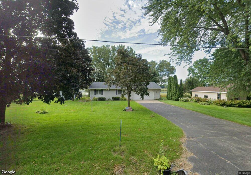
N10478 Chief Kuno Trail Fox Lake, WI 53933
Estimated Value: $440,000 - $610,000
--
Bed
--
Bath
--
Sq Ft
0.77
Acres
About This Home
This home is located at N10478 Chief Kuno Trail, Fox Lake, WI 53933 and is currently estimated at $558,349. N10478 Chief Kuno Trail is a home located in Dodge County with nearby schools including Meadow View Primary School, Rock River Intermediate School, and Waupun Area Junior High School.
Ownership History
Date
Name
Owned For
Owner Type
Purchase Details
Closed on
Jan 8, 2016
Sold by
Thurmer Arthur J and Thurmer Deann M
Bought by
Mcbridge Corey P and Mcbridge Carolyn S
Current Estimated Value
Home Financials for this Owner
Home Financials are based on the most recent Mortgage that was taken out on this home.
Original Mortgage
$200,000
Outstanding Balance
$158,908
Interest Rate
3.93%
Mortgage Type
New Conventional
Estimated Equity
$399,441
Purchase Details
Closed on
Dec 20, 2005
Sold by
Schober Rosalie
Bought by
Thurmer Arthur J and Thurmer Deann M
Home Financials for this Owner
Home Financials are based on the most recent Mortgage that was taken out on this home.
Original Mortgage
$250,000
Interest Rate
6.4%
Mortgage Type
New Conventional
Create a Home Valuation Report for This Property
The Home Valuation Report is an in-depth analysis detailing your home's value as well as a comparison with similar homes in the area
Home Values in the Area
Average Home Value in this Area
Purchase History
| Date | Buyer | Sale Price | Title Company |
|---|---|---|---|
| Mcbridge Corey P | $260,000 | None Available | |
| Thurmer Arthur J | $233,900 | -- |
Source: Public Records
Mortgage History
| Date | Status | Borrower | Loan Amount |
|---|---|---|---|
| Open | Mcbridge Corey P | $200,000 | |
| Previous Owner | Thurmer Arthur J | $250,000 |
Source: Public Records
Tax History Compared to Growth
Tax History
| Year | Tax Paid | Tax Assessment Tax Assessment Total Assessment is a certain percentage of the fair market value that is determined by local assessors to be the total taxable value of land and additions on the property. | Land | Improvement |
|---|---|---|---|---|
| 2024 | $6,000 | $399,500 | $132,200 | $267,300 |
| 2023 | $6,273 | $399,500 | $132,200 | $267,300 |
| 2022 | $5,584 | $399,500 | $132,200 | $267,300 |
| 2021 | $5,176 | $308,200 | $94,400 | $213,800 |
| 2020 | $5,415 | $308,200 | $94,400 | $213,800 |
| 2019 | $5,373 | $308,200 | $94,400 | $213,800 |
| 2018 | $5,500 | $308,200 | $94,400 | $213,800 |
| 2017 | $5,331 | $308,200 | $94,400 | $213,800 |
| 2016 | $5,372 | $308,200 | $94,400 | $213,800 |
| 2015 | $5,604 | $308,200 | $94,400 | $213,800 |
| 2014 | $5,860 | $310,800 | $94,400 | $216,400 |
Source: Public Records
Map
Nearby Homes
- 119 Linden Ln
- 123 Linden Ln
- 121 Linden Ln
- 117 Linden Ln
- N10638 Howard Dr
- N10801 Elmwood Island
- W10919 Blackhawk Trail
- W10935 Blackhawk Trail
- 320 Mill St
- 315 Second St
- W10723 Blackhawk Trail
- W10723 Blackhawk 1 2 3 7 8 9 10 Trail
- 202 W Green St
- W10802 Blackhawk Trail
- 406 S College Ave
- 305 E Crocker St
- N9384 Idle Hour Dr
- W10559 Hickory Point Rd
- W10904 Glen Dr
- W346 County Road P
- n 10478 Chief Kuno Trail
- N10472 Chief Kuno Trail
- N10480 Chief Kuno Trail
- n 10480 Chief Kuno Trail
- N10468 Chief Kuno Trail
- N10482 Chief Kuno Trail
- N10475 Chief Kuno Trail
- N10477 Chief Kuno Trail
- n 10477 Chief Kuno Trail
- N10464 Chief Kuno Trail
- N10490 Chief Kuno Trail
- N10471 Chief Kuno Trail
- N10481 Chief Kuno Trail
- N10467 Chief Kuno Trail
- N10458 Chief Kuno Trail
- N10483 Chief Kuno Trail
- N10463 Chief Kuno Trail
- N10461 Chief Kuno Trail
- N10491 Chief Kuno Trail
- n 10459 Chief Kuno Trail