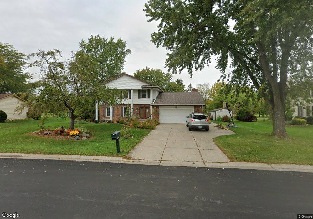
N106W16638 Old Farm Rd Germantown, WI 53022
Estimated Value: $487,083 - $518,000
4
Beds
3
Baths
2,528
Sq Ft
$199/Sq Ft
Est. Value
About This Home
This home is located at N106W16638 Old Farm Rd, Germantown, WI 53022 and is currently estimated at $502,771, approximately $198 per square foot. N106W16638 Old Farm Rd is a home located in Washington County with nearby schools including County Line Elementary School, Kennedy Middle School, and Germantown High School.
Ownership History
Date
Name
Owned For
Owner Type
Purchase Details
Closed on
Apr 11, 2017
Sold by
Williams Tony R and Williams Sarah J
Bought by
Clausing David and Clausing Erica
Current Estimated Value
Home Financials for this Owner
Home Financials are based on the most recent Mortgage that was taken out on this home.
Original Mortgage
$294,566
Outstanding Balance
$247,043
Interest Rate
4.5%
Mortgage Type
FHA
Estimated Equity
$255,728
Purchase Details
Closed on
Jul 19, 2013
Sold by
Spencer John R and Spencer Eileen B
Bought by
Williams Tony R and Williams Sarah J
Home Financials for this Owner
Home Financials are based on the most recent Mortgage that was taken out on this home.
Original Mortgage
$251,700
Interest Rate
3.91%
Mortgage Type
New Conventional
Create a Home Valuation Report for This Property
The Home Valuation Report is an in-depth analysis detailing your home's value as well as a comparison with similar homes in the area
Home Values in the Area
Average Home Value in this Area
Purchase History
| Date | Buyer | Sale Price | Title Company |
|---|---|---|---|
| Clausing David | $300,000 | Prism Title Services Llc Wis | |
| Williams Tony R | $265,000 | None Available |
Source: Public Records
Mortgage History
| Date | Status | Borrower | Loan Amount |
|---|---|---|---|
| Open | Clausing David | $294,566 | |
| Previous Owner | Williams Tony R | $251,700 |
Source: Public Records
Tax History Compared to Growth
Tax History
| Year | Tax Paid | Tax Assessment Tax Assessment Total Assessment is a certain percentage of the fair market value that is determined by local assessors to be the total taxable value of land and additions on the property. | Land | Improvement |
|---|---|---|---|---|
| 2024 | $5,411 | $425,000 | $83,500 | $341,500 |
| 2023 | $5,062 | $312,600 | $67,900 | $244,700 |
| 2022 | $5,043 | $312,600 | $67,900 | $244,700 |
| 2021 | $4,839 | $312,600 | $67,900 | $244,700 |
| 2020 | $5,035 | $312,600 | $67,900 | $244,700 |
| 2019 | $4,826 | $312,600 | $67,900 | $244,700 |
| 2018 | $4,616 | $278,100 | $61,700 | $216,400 |
| 2017 | $4,389 | $278,100 | $61,700 | $216,400 |
| 2016 | $4,357 | $278,100 | $61,700 | $216,400 |
| 2015 | $4,331 | $267,900 | $61,700 | $206,200 |
| 2014 | $4,423 | $265,000 | $61,700 | $203,300 |
| 2013 | $5,066 | $307,700 | $77,700 | $230,000 |
Source: Public Records
Map
Nearby Homes
- N106W16321 Old Farm Rd
- W165N10401 Wagon Trail
- N108W17282 Lilac Ln
- N110W16867 Ashbury Cir Unit 3
- W168N10125 Bittersweet Trail
- The Aspen Plan at
- The Breckenridge Plan at
- N119W14982 Ivy Ln
- W163N10968 Briarcliff Ct
- N101W16795 Gunflint Trail
- The Rosebud Plan at
- The Charlotte Plan at
- The Madison Plan at
- The Julia Plan at
- The Aubrey Plan at
- The Isabella Plan at
- The Elsa Plan at
- The Prescott Plan at
- The Celina Plan at
- The Geneva Plan at
- N106W16712 Old Farm Rd
- N106W16620 Old Farm Rd
- N106W16608 Old Farm Rd
- W166N10610 Surrey Dr
- N106W16603 Old Farm Rd
- N106W16726 Old Farm Rd
- W166N10577 Surrey Dr
- N106W16744 Old Farm Rd
- N106W16546 Old Farm Rd
- W166N10560 Surrey Dr Unit 6
- W165N10611 Wagon Trail
- W165N10643 Wagon Trail
- W166N10563 Surrey Dr
- W165N10603 Wagon Trail
- W165N10657 Wagon Trail
- N106W16741 Old Farm Rd
- W165N10565 Wagon Trail
- W165N10669 Wagon Trail
- W166N10552 Surrey Dr
- W166N10555 Surrey Dr