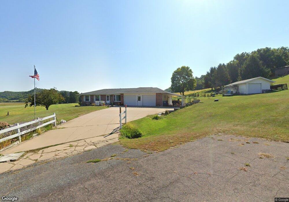
N1090 Pineview Dr La Crosse, WI 54601
Estimated Value: $361,000 - $570,000
--
Bed
--
Bath
--
Sq Ft
1.2
Acres
About This Home
This home is located at N1090 Pineview Dr, La Crosse, WI 54601 and is currently estimated at $454,845. N1090 Pineview Dr is a home located in La Crosse County with nearby schools including Southern Bluffs Elementary School, Longfellow Middle School, and Central High School.
Ownership History
Date
Name
Owned For
Owner Type
Purchase Details
Closed on
Jan 4, 2021
Sold by
Wisco Property Group Llc
Bought by
Mat Rentals Llc
Current Estimated Value
Home Financials for this Owner
Home Financials are based on the most recent Mortgage that was taken out on this home.
Original Mortgage
$76,000
Outstanding Balance
$67,818
Interest Rate
2.7%
Mortgage Type
Credit Line Revolving
Estimated Equity
$387,027
Purchase Details
Closed on
Nov 4, 2020
Sold by
Kindt Susan
Bought by
Wisco Property Group Llc
Home Financials for this Owner
Home Financials are based on the most recent Mortgage that was taken out on this home.
Original Mortgage
$48,000
Interest Rate
2.9%
Mortgage Type
New Conventional
Purchase Details
Closed on
Apr 20, 2016
Sold by
Vehrenkamp David W and Vehrenkamp Kathleen A
Bought by
Vehrenkamp Mark W and Stevens Amy L
Create a Home Valuation Report for This Property
The Home Valuation Report is an in-depth analysis detailing your home's value as well as a comparison with similar homes in the area
Home Values in the Area
Average Home Value in this Area
Purchase History
| Date | Buyer | Sale Price | Title Company |
|---|---|---|---|
| Mat Rentals Llc | $95,000 | New Castle Title | |
| Wisco Property Group Llc | $60,000 | New Castle Title | |
| Vehrenkamp Mark W | -- | -- |
Source: Public Records
Mortgage History
| Date | Status | Borrower | Loan Amount |
|---|---|---|---|
| Open | Mat Rentals Llc | $76,000 | |
| Previous Owner | Wisco Property Group Llc | $48,000 |
Source: Public Records
Tax History Compared to Growth
Tax History
| Year | Tax Paid | Tax Assessment Tax Assessment Total Assessment is a certain percentage of the fair market value that is determined by local assessors to be the total taxable value of land and additions on the property. | Land | Improvement |
|---|---|---|---|---|
| 2024 | $4,995 | $417,400 | $61,000 | $356,400 |
| 2023 | $4,495 | $232,700 | $33,200 | $199,500 |
| 2022 | $4,376 | $232,700 | $33,200 | $199,500 |
| 2021 | $4,471 | $232,700 | $33,200 | $199,500 |
| 2020 | $4,430 | $232,700 | $33,200 | $199,500 |
| 2019 | $4,415 | $232,700 | $33,200 | $199,500 |
| 2018 | $4,319 | $232,700 | $33,200 | $199,500 |
| 2017 | $4,291 | $232,700 | $33,200 | $199,500 |
| 2016 | $4,517 | $232,700 | $33,200 | $199,500 |
| 2015 | $4,414 | $232,700 | $33,200 | $199,500 |
| 2014 | $4,508 | $232,700 | $33,200 | $199,500 |
| 2013 | $4,188 | $200,000 | $30,000 | $170,000 |
Source: Public Records
Map
Nearby Homes
- W4934 Mill St
- W4945 Harvest Ln
- N1110 Bloomer Mill Rd
- 000 Us Highway 14 61 -
- N1583 Meadow Ridge Rd
- N1947 Forest Ridge Dr
- W4946 Battlestone Station Rd Unit 23
- W4952 Battlestone Station Rd Unit 25
- W4936 Battlestone Station Rd
- N2031 County Road F -
- 5615 Meir Ct
- W5419 Pine Bluff Rd
- W5453 Pine Bluff Rd
- 5221 33rd St S
- 5521 Mormon Coulee Rd
- 5917 River Run Rd
- 3532 Levy Ln
- W4844 State Road 33
- W5522 Eagle Point Dr
- W842 County Road K
- N1102 Pineview Dr
- N1097 Pineview Dr
- W4709 Cherrywood Dr
- N1114 Pineview Dr
- W4717 Cherrywood Dr
- W4717 Sprig St
- W4716 Sprig St
- W4727 Sprig St
- W4719 Green St
- W4726 Sprig St
- W4735 Cherrywood Dr
- W4749 Cherrywood Dr
- W4735 Sprig St
- W4727 Green St
- W4736 Sprig St
- N1090 Brookside Dr
- 1115 Green St
- W4739 Green St
- W4751 Sprig St
- W4752 Sprig St