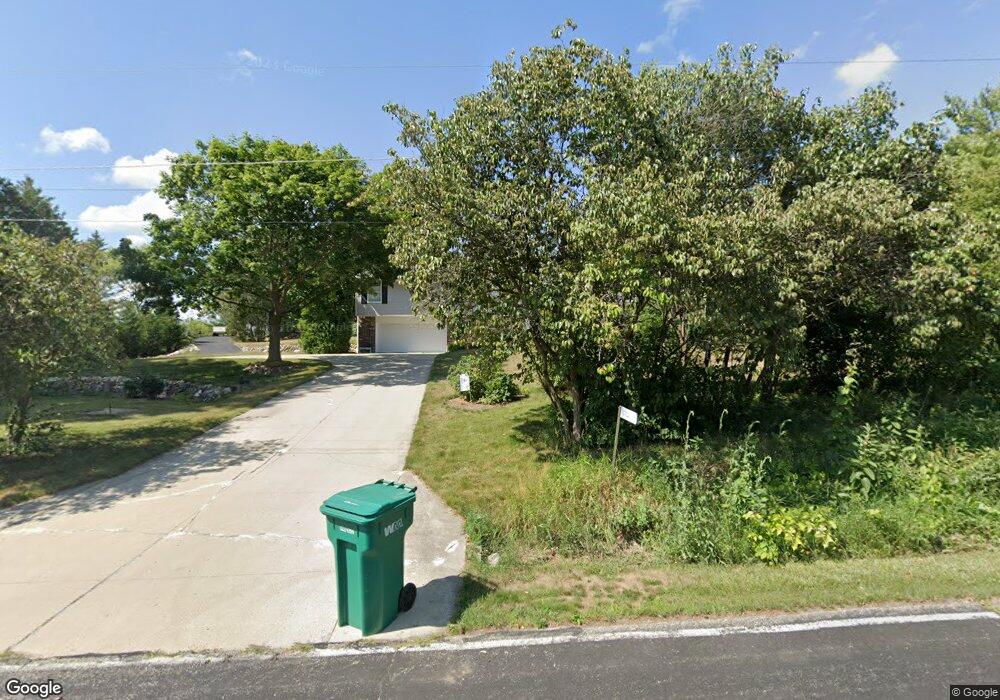
N112W21682 Mequon Rd Germantown, WI 53022
Estimated Value: $474,865 - $516,000
--
Bed
--
Bath
2,160
Sq Ft
$230/Sq Ft
Est. Value
About This Home
This home is located at N112W21682 Mequon Rd, Germantown, WI 53022 and is currently estimated at $496,716, approximately $229 per square foot. N112W21682 Mequon Rd is a home located in Washington County with nearby schools including Amy Belle Elementary School, Kennedy Middle School, and Germantown High School.
Ownership History
Date
Name
Owned For
Owner Type
Purchase Details
Closed on
Jun 14, 2024
Sold by
Berenschot Jay L and Berenschot Jean M
Bought by
Sunstrom Eric G and Sunstrom Janna L
Current Estimated Value
Home Financials for this Owner
Home Financials are based on the most recent Mortgage that was taken out on this home.
Original Mortgage
$115,000
Outstanding Balance
$108,972
Interest Rate
6.24%
Mortgage Type
Purchase Money Mortgage
Estimated Equity
$387,744
Purchase Details
Closed on
May 1, 2014
Sold by
Berenschot Jay L and Berenschot Jean M
Bought by
Berenschot Jay L and Berenschot Jean M
Create a Home Valuation Report for This Property
The Home Valuation Report is an in-depth analysis detailing your home's value as well as a comparison with similar homes in the area
Home Values in the Area
Average Home Value in this Area
Purchase History
| Date | Buyer | Sale Price | Title Company |
|---|---|---|---|
| Sunstrom Eric G | $446,000 | Attorneys Title And Closing Se | |
| Berenschot Jay L | -- | None Available |
Source: Public Records
Mortgage History
| Date | Status | Borrower | Loan Amount |
|---|---|---|---|
| Open | Sunstrom Eric G | $115,000 |
Source: Public Records
Tax History Compared to Growth
Tax History
| Year | Tax Paid | Tax Assessment Tax Assessment Total Assessment is a certain percentage of the fair market value that is determined by local assessors to be the total taxable value of land and additions on the property. | Land | Improvement |
|---|---|---|---|---|
| 2024 | $5,533 | $434,000 | $100,000 | $334,000 |
| 2023 | $2,581 | $302,600 | $80,000 | $222,600 |
| 2022 | $4,872 | $302,600 | $80,000 | $222,600 |
| 2021 | $4,674 | $302,600 | $80,000 | $222,600 |
| 2020 | $4,866 | $302,600 | $80,000 | $222,600 |
| 2019 | $4,664 | $302,600 | $80,000 | $222,600 |
| 2018 | $4,878 | $293,200 | $68,400 | $224,800 |
| 2017 | $4,571 | $289,200 | $68,400 | $220,800 |
| 2016 | $4,537 | $289,200 | $68,400 | $220,800 |
| 2015 | $4,418 | $273,100 | $68,400 | $204,700 |
| 2014 | $4,505 | $269,900 | $68,400 | $201,500 |
| 2013 | $4,825 | $293,200 | $78,800 | $214,400 |
Source: Public Records
Map
Nearby Homes
- W212N11206 Meeker Hill Ln
- N114W21077 Briarwood Ln
- W210N11120 Mountbrooke Dr
- W211N11454 Woodfield Ln
- N115W21122 Brookside Cir
- W208N11438 Brookside Dr Unit R30
- N115W20994 Brookside Dr
- W211N11683 Hilltop Cir
- Lt0 Lake Dr
- N116W21019 Brynwood Ln
- W211N11783 Hilltop Cir
- W211N11782 Hilltop Cir
- 571 S Ridge Ct
- 525 Woodland Dr
- W199N11293 Rosewood Ct
- Lt2 Oakview Ave
- W199N11276 Rosewood Ct
- Lt1 N Town Line Rd
- 3362 S Shore Dr
- 3358 S Shore Dr
- N112W21740 Mequon Rd
- W217N11262 Manor Ct
- N112W21614 Mequon Rd
- N112W21751 Mequon Rd
- W217N11261 S Manor Ct
- N112W21637 Mequon Rd
- N112W21830 Mequon Rd
- N112W21546 Mequon Rd
- N112W21705 Mequon Rd
- W217N11281 S Manor Ct
- N112W21541 Mequon Rd
- W217N11298 S Manor Ct
- W215N11271 Appleton Ave
- N112W21859 Bark Lake Rd
- W215N11251 Appleton Ave
- N113W21635 Bark Lake Rd
- N112W21880 Mequon Rd
- N112W21498 Mequon Rd
- N112W21901 Mequon Rd
- N112W21469 Mequon Rd