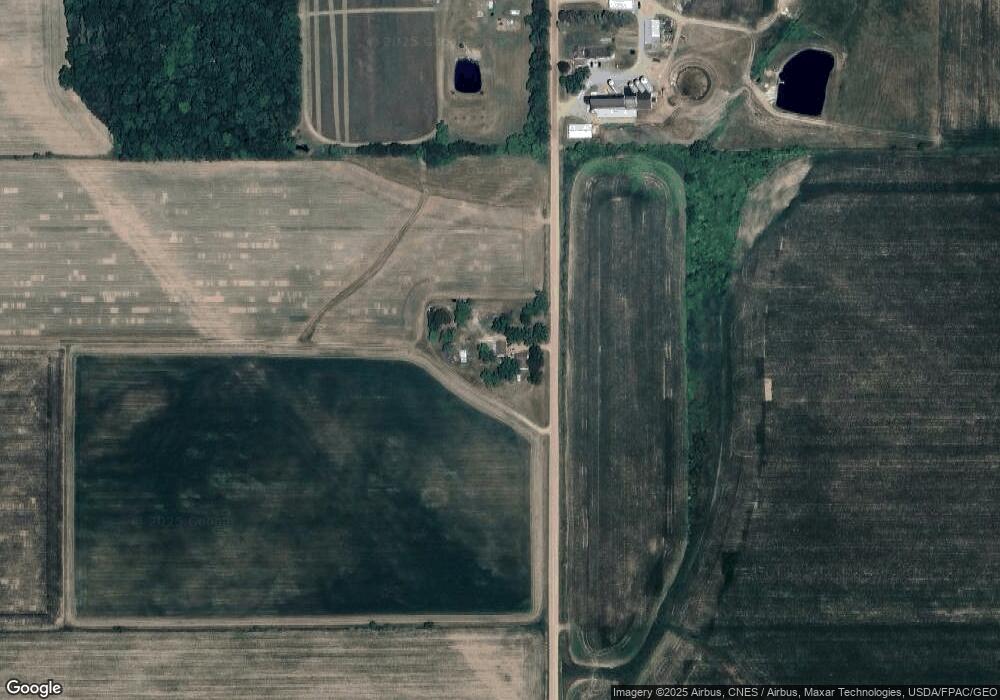
Estimated Value: $183,000 - $265,000
--
Bed
--
Bath
--
Sq Ft
5.14
Acres
About This Home
This home is located at N11859 Oak Grove Ave, Unity, WI 54488 and is currently estimated at $227,667. N11859 Oak Grove Ave is a home located in Clark County with nearby schools including Loyal Elementary School, Loyal Middle School, and Loyal High School.
Ownership History
Date
Name
Owned For
Owner Type
Purchase Details
Closed on
May 15, 2014
Sold by
Jpmorgan Chase Bank National Associatio
Bought by
Haufe Matthew L and Haufe Julie E
Current Estimated Value
Home Financials for this Owner
Home Financials are based on the most recent Mortgage that was taken out on this home.
Original Mortgage
$48,000
Outstanding Balance
$36,513
Interest Rate
4.28%
Mortgage Type
Purchase Money Mortgage
Estimated Equity
$191,154
Purchase Details
Closed on
Dec 30, 2013
Sold by
Clark County Sheriff and Peplinski Chad A
Bought by
Jpmorgan Chase Bank National Association
Purchase Details
Closed on
Nov 21, 2007
Sold by
Zimmerman Marlin R and Zimmerman Joanne R
Bought by
Peplinski Chad A
Home Financials for this Owner
Home Financials are based on the most recent Mortgage that was taken out on this home.
Original Mortgage
$76,530
Interest Rate
6.33%
Mortgage Type
Purchase Money Mortgage
Create a Home Valuation Report for This Property
The Home Valuation Report is an in-depth analysis detailing your home's value as well as a comparison with similar homes in the area
Home Values in the Area
Average Home Value in this Area
Purchase History
| Date | Buyer | Sale Price | Title Company |
|---|---|---|---|
| Haufe Matthew L | $60,000 | Gowey Abstract And Title Co | |
| Jpmorgan Chase Bank National Association | $54,400 | -- | |
| Peplinski Chad A | -- | -- |
Source: Public Records
Mortgage History
| Date | Status | Borrower | Loan Amount |
|---|---|---|---|
| Open | Haufe Matthew L | $48,000 | |
| Previous Owner | Peplinski Chad A | $76,530 |
Source: Public Records
Tax History Compared to Growth
Tax History
| Year | Tax Paid | Tax Assessment Tax Assessment Total Assessment is a certain percentage of the fair market value that is determined by local assessors to be the total taxable value of land and additions on the property. | Land | Improvement |
|---|---|---|---|---|
| 2024 | $2,104 | $100,200 | $10,800 | $89,400 |
| 2023 | $2,314 | $100,200 | $10,800 | $89,400 |
| 2022 | $2,027 | $100,200 | $10,800 | $89,400 |
| 2021 | $1,969 | $100,200 | $10,800 | $89,400 |
| 2020 | $1,862 | $100,200 | $10,800 | $89,400 |
| 2019 | $1,867 | $100,200 | $10,800 | $89,400 |
| 2018 | $1,644 | $77,900 | $7,800 | $70,100 |
| 2017 | $165 | $77,900 | $7,800 | $70,100 |
| 2016 | $1,603 | $77,900 | $7,800 | $70,100 |
| 2015 | -- | $77,900 | $7,800 | $70,100 |
| 2014 | -- | $77,900 | $7,800 | $70,100 |
| 2013 | -- | $77,900 | $7,800 | $70,100 |
| 2011 | -- | $56,300 | $6,400 | $49,900 |
Source: Public Records
Map
Nearby Homes
- N10160 Sparrow Ave
- 310 W Clark St
- 0 Hiline Ave Unit 22504296
- N10409 Hiline Ave
- 285 S Madison St
- 151 S Madison St
- 411 S Main St
- 204 S 4th St
- 406 N 3rd St
- W2087 Willow Rd
- 501 E Terrace St
- 101790 Buxton Rd
- 314 N Division St
- 303 E Adams St
- 400 W Mill St
- 311 W South St
- 210 S Division St
- N14303 County Highway D
- 508 W South St
- 309 S West St
