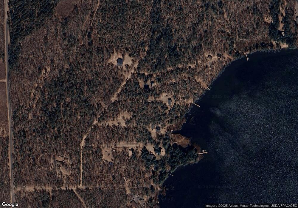
N12662 Bird Dr Minong, WI 54859
Estimated Value: $536,143 - $568,000
3
Beds
2
Baths
--
Sq Ft
3.29
Acres
About This Home
This home is located at N12662 Bird Dr, Minong, WI 54859 and is currently estimated at $552,072. N12662 Bird Dr is a home located in Washburn County.
Ownership History
Date
Name
Owned For
Owner Type
Purchase Details
Closed on
Nov 8, 2021
Sold by
Nelson Jeffery W
Bought by
Canterbury Jason L and Canterbury Janice L
Current Estimated Value
Purchase Details
Closed on
Apr 19, 2012
Sold by
Federal Home Loan Mortgage Corporation
Bought by
Nelson Jeffrey W and Martin Tina A
Purchase Details
Closed on
Jun 29, 2011
Sold by
Washburn County Sheriff
Bought by
Federal Home Loan Mortgage Corp
Create a Home Valuation Report for This Property
The Home Valuation Report is an in-depth analysis detailing your home's value as well as a comparison with similar homes in the area
Home Values in the Area
Average Home Value in this Area
Purchase History
| Date | Buyer | Sale Price | Title Company |
|---|---|---|---|
| Canterbury Jason L | $401,000 | -- | |
| Nelson Jeffrey W | $194,500 | T.M. Title Services, Inc | |
| Federal Home Loan Mortgage Corp | $238,666 | -- |
Source: Public Records
Mortgage History
| Date | Status | Borrower | Loan Amount |
|---|---|---|---|
| Closed | Nelson Jeffrey W | $0 |
Source: Public Records
Tax History Compared to Growth
Tax History
| Year | Tax Paid | Tax Assessment Tax Assessment Total Assessment is a certain percentage of the fair market value that is determined by local assessors to be the total taxable value of land and additions on the property. | Land | Improvement |
|---|---|---|---|---|
| 2023 | $2,733 | $383,200 | $169,900 | $213,300 |
| 2022 | $2,761 | $260,400 | $116,900 | $143,500 |
| 2021 | $2,739 | $260,400 | $116,900 | $143,500 |
| 2020 | $2,639 | $260,400 | $116,900 | $143,500 |
| 2019 | $2,746 | $260,400 | $116,900 | $143,500 |
| 2018 | $2,772 | $260,400 | $116,900 | $143,500 |
| 2017 | $2,771 | $260,400 | $116,900 | $143,500 |
| 2016 | $2,911 | $260,400 | $116,900 | $143,500 |
| 2015 | $3,055 | $260,400 | $116,900 | $143,500 |
| 2014 | $3,107 | $251,200 | $116,900 | $134,300 |
| 2012 | $3,147 | $272,800 | $133,600 | $139,200 |
Source: Public Records
Map
Nearby Homes
- N12428 Eagle View Dr
- 0 Eagle View Dr
- W8524 Karling Ct
- Lot 3 Dragon Dr
- Lot 2 Dragon Dr
- W90XX Nancy Lake Rd
- 8654 Webb Creek Dr
- XXX Bluebird Trail
- N11790 Bluebird Trail Dr
- XXX Bluebird Tr
- N11790 Bluebird Trail
- W8432 Webb Creek Dr
- W8193 Bald Eagle Dr
- xxx Us Hwy 77
- 11490 N Fremont Ave
- W7521 Horseshoe Bend Ln
- W7486 Burval Dr
- W8865 Eagle Roost Ln
- 14366 1 Mile Rd
- W7602 Wallin Dr
- 12662 Bird Dr
- N12646 Bird Dr
- 3.39 acres Bird Dr
- 3.39 acres Bird Ave
- N12681 Bird Dr
- 9051 Mosquito Dr
- W9013 Mosquito Dr
- w 9013 Mosquito Dr
- 9013 9013 W Mosquito Dr
- Lot 12 Mosquito Dr
- 9013 W Mosquito Dr
- W9062 Mosquito Dr
- W9045 W9045 Mosquito Dr
- W9045 Mosquito Dr
- Lot 9 Eagle View
- N12652 Misty Bog Rd
- W9039 W9039 Mosquito Dr
- W9039 Mosquito Dr
- n 12791 Three Mile Rd
- N12791 Three Mile Rd
