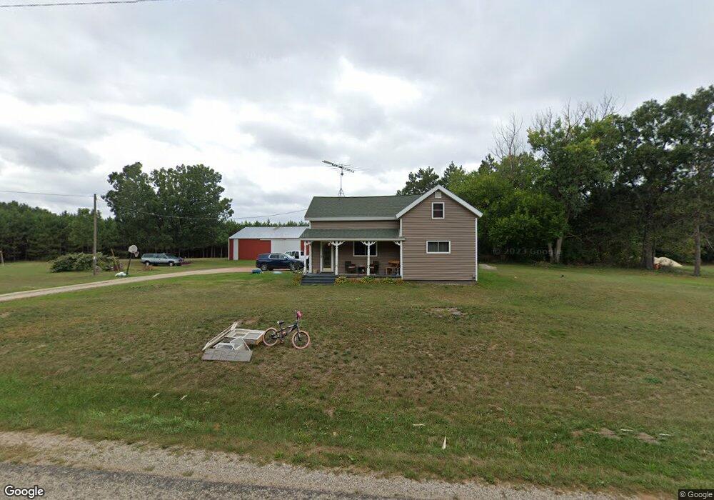
N1353 West Rd Waupaca, WI 54981
Estimated Value: $273,600 - $546,000
3
Beds
1
Bath
1,100
Sq Ft
$358/Sq Ft
Est. Value
About This Home
This home is located at N1353 West Rd, Waupaca, WI 54981 and is currently estimated at $393,650, approximately $357 per square foot. N1353 West Rd is a home located in Waupaca County with nearby schools including Waupaca Learning Center Elementary School, Waupaca Middle School, and Waupaca High School.
Ownership History
Date
Name
Owned For
Owner Type
Purchase Details
Closed on
Sep 12, 2012
Sold by
Abrahamson Larry A and Abrahamson Nathan S
Bought by
Abrahamson Nathan S and Abrahamson Talia
Current Estimated Value
Purchase Details
Closed on
Jul 24, 2008
Sold by
Deutsche Bank National Trust Co
Bought by
Abrahamson Larry A and Abrahamson Nathan S
Purchase Details
Closed on
Feb 18, 2008
Sold by
Johnson Wayne A
Bought by
Deutsche Bank National Trust Company As
Create a Home Valuation Report for This Property
The Home Valuation Report is an in-depth analysis detailing your home's value as well as a comparison with similar homes in the area
Home Values in the Area
Average Home Value in this Area
Purchase History
| Date | Buyer | Sale Price | Title Company |
|---|---|---|---|
| Abrahamson Nathan S | -- | None Available | |
| Abrahamson Larry A | $46,000 | None Available | |
| Deutsche Bank National Trust Company As | $45,000 | -- |
Source: Public Records
Tax History Compared to Growth
Tax History
| Year | Tax Paid | Tax Assessment Tax Assessment Total Assessment is a certain percentage of the fair market value that is determined by local assessors to be the total taxable value of land and additions on the property. | Land | Improvement |
|---|---|---|---|---|
| 2024 | $1,638 | $154,000 | $27,200 | $126,800 |
| 2023 | $1,638 | $154,000 | $27,200 | $126,800 |
| 2022 | $1,734 | $107,400 | $17,000 | $90,400 |
| 2021 | $1,638 | $107,400 | $17,000 | $90,400 |
| 2020 | $1,587 | $107,400 | $17,000 | $90,400 |
| 2019 | $1,600 | $107,400 | $17,000 | $90,400 |
| 2018 | $1,884 | $107,400 | $17,000 | $90,400 |
| 2017 | $2,033 | $107,400 | $17,000 | $90,400 |
| 2016 | $1,894 | $107,400 | $17,000 | $90,400 |
| 2015 | $1,941 | $107,400 | $17,000 | $90,400 |
| 2014 | $2,068 | $111,200 | $17,000 | $94,200 |
| 2013 | $1,481 | $81,400 | $17,000 | $64,400 |
Source: Public Records
Map
Nearby Homes
- 9920 State Road 22
- E1400 Stratton Lake Rd
- N2371 Long Cove Dr
- E1457 Rural Rd
- N2577 Ottman Dr
- 20 Acres County Road D
- N2645 Pleasant Park Ln
- E1280 County Road Q Unit 3
- E1396 Grandview Rd
- E1402 Grandview Rd
- W7429 Akron Dr
- E1592 Murray Ln
- 9640 County Road D
- 0 Echo Lake Rd Unit 50293066
- E1655 Grandview Rd
- E2041 Meadowlark Ln
- N2980 Highland Ln
- E1761 Amy St
- 0 State Road 22 Unit 50271805
- 0 State Road 22 Unit 50271804
- N1382 West Rd
- e 252 Johnson Rd
- E252 Johnson Rd
- E456 Mynard Rd
- N1196 West Rd
- E553 Mynard Rd
- E421 Stratton Lake Rd
- 11109 2nd Ave
- 11197 2nd Ave
- E424 Stratton Lake Rd
- E442 Stratton Lake Rd
- 0 Stratton Lake Rd Unit 50058417
- 0 Stratton Lake Rd Unit 50234791
- 0 Stratton Lake Rd Unit 20904331
- 0 Stratton Lake Rd Unit 50040070
- 0 Stratton Lake Rd Unit 50050018
- 0 Stratton Lake Rd Unit 50182061
- 0 Stratton Lake Rd Unit 50196957
- E472 Stratton Lake Rd
- E620 Mynard Rd