Estimated Value: $475,536 - $724,000
--
Bed
--
Bath
--
Sq Ft
3.07
Acres
About This Home
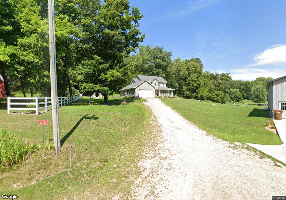
This home is located at N1387 Lake Port Rd, Pepin, WI 54759 and is currently estimated at $599,768. N1387 Lake Port Rd is a home located in Pepin County with nearby schools including Pepin Elementary School and Pepin Area Schools.
Ownership History
Date
Name
Owned For
Owner Type
Purchase Details
Closed on
Jan 30, 2008
Sold by
Mcintosh James C and Mcintosh Linda L
Bought by
Mcintosh Matthew J
Current Estimated Value
Purchase Details
Closed on
Sep 28, 2006
Sold by
Risch David M= and Risch Misty L
Bought by
Mcintosh Matthew J and Mcintosh James C
Home Financials for this Owner
Home Financials are based on the most recent Mortgage that was taken out on this home.
Original Mortgage
$218,500
Interest Rate
6.49%
Create a Home Valuation Report for This Property
The Home Valuation Report is an in-depth analysis detailing your home's value as well as a comparison with similar homes in the area
Home Values in the Area
Average Home Value in this Area
Purchase History
| Date | Buyer | Sale Price | Title Company |
|---|---|---|---|
| Mcintosh Matthew J | -- | -- | |
| Mcintosh Matthew J | -- | -- |
Source: Public Records
Mortgage History
| Date | Status | Borrower | Loan Amount |
|---|---|---|---|
| Previous Owner | Mcintosh Matthew J | $218,500 |
Source: Public Records
Tax History Compared to Growth
Tax History
| Year | Tax Paid | Tax Assessment Tax Assessment Total Assessment is a certain percentage of the fair market value that is determined by local assessors to be the total taxable value of land and additions on the property. | Land | Improvement |
|---|---|---|---|---|
| 2024 | $6,946 | $363,600 | $39,400 | $324,200 |
| 2023 | $6,648 | $363,600 | $39,400 | $324,200 |
| 2022 | $5,849 | $242,300 | $15,000 | $227,300 |
| 2021 | $5,364 | $242,300 | $15,000 | $227,300 |
| 2020 | $5,223 | $242,300 | $15,000 | $227,300 |
| 2019 | $5,513 | $242,300 | $15,000 | $227,300 |
| 2018 | $5,149 | $242,300 | $15,000 | $227,300 |
| 2017 | $6,177 | $242,300 | $15,000 | $227,300 |
| 2016 | $5,378 | $242,300 | $15,000 | $227,300 |
| 2015 | $5,104 | $242,300 | $15,000 | $227,300 |
| 2014 | $5,104 | $242,300 | $15,000 | $227,300 |
| 2013 | $5,104 | $223,200 | $15,000 | $208,200 |
Source: Public Records
Map
Nearby Homes
- 401 Elm St
- 202 Cedar St
- 308 Main St
- 207 2nd St
- 0 Cottonwood Ln
- 7 3rd St
- W9336 State Highway 35
- XXX Xxx
- W11598 S Bluff Rd
- 26884 709th St
- XXX 709th St
- XXX 10 Acres Just Off Twin Bluff Ln S
- 2041 S Oak St
- TBD 3 708th St
- Tbd 230th Ave
- TBD State Highway 35
- 1300 S Lakeshore Dr Unit A3
- 1329 S Oak St
- 900 S Lakeshore Dr Unit 108
- 900 S Lakeshore Dr Unit 405
- N1357 Lake Port Rd
- N1156 Lake Port Rd
- n 1357 Lake Port Rd
- W10388 Milliren Ln
- W10317 Ruby Cir
- N1313 Lake Port Rd
- W10343 Milliren Ln
- 0 Milliren Ln
- 10317 Ruby
- W10320 Ruby Cir
- W10382 Milliren Ln
- N1336 County Road Cc
- 1357 Lake Port Rd
- N1311 County Road Cc
- N1311 County Road Cc
- N1311 County Road Cc
- N1311 Hwy Cc
- N1311 County Road Cc
- N1311 N Co Rd Cc
- 1311 1311 County Road Cc