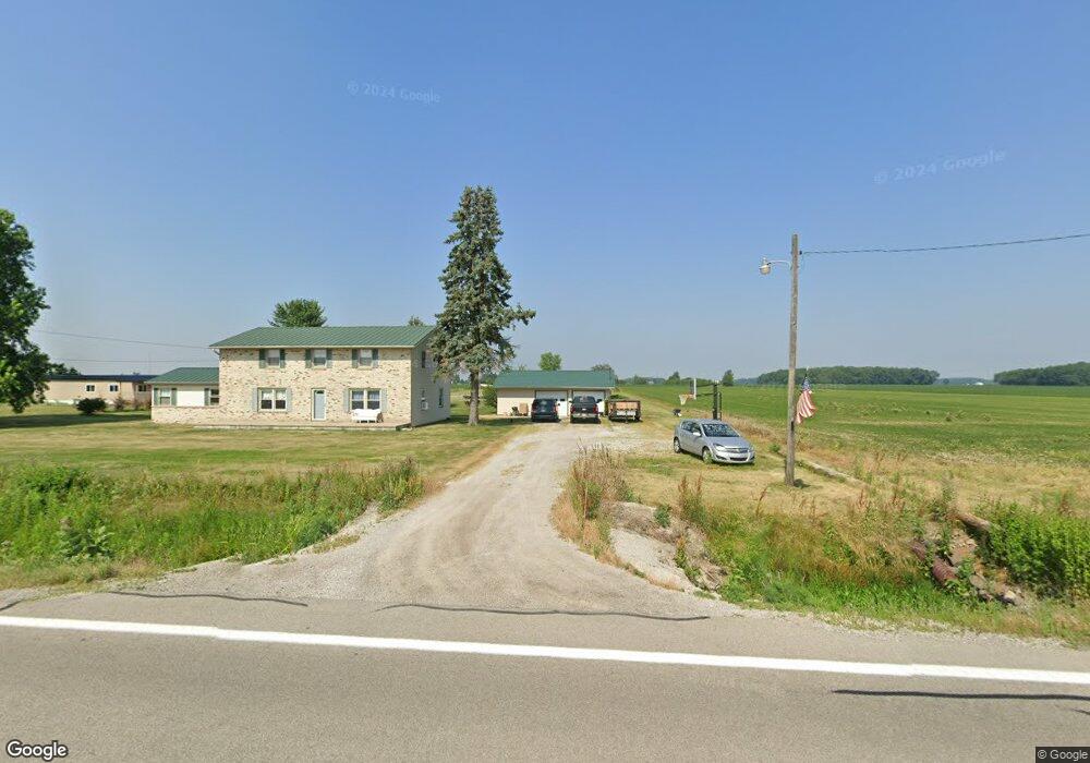
N145 State Route 65 Mc Clure, OH 43534
Estimated Value: $171,000 - $251,000
4
Beds
1
Bath
2,400
Sq Ft
$94/Sq Ft
Est. Value
About This Home
This home is located at N145 State Route 65, Mc Clure, OH 43534 and is currently estimated at $226,254, approximately $94 per square foot. N145 State Route 65 is a home located in Henry County with nearby schools including Napoleon Elementary School and Napoleon Junior/Senior High School.
Ownership History
Date
Name
Owned For
Owner Type
Purchase Details
Closed on
Feb 11, 2022
Sold by
Clark Jacklyn A
Bought by
Robinette Dylan R
Current Estimated Value
Home Financials for this Owner
Home Financials are based on the most recent Mortgage that was taken out on this home.
Original Mortgage
$160,000
Outstanding Balance
$146,101
Interest Rate
2.27%
Mortgage Type
New Conventional
Estimated Equity
$80,153
Purchase Details
Closed on
Oct 27, 2010
Sold by
Clark Michael D
Bought by
Clark Jacklyn A
Create a Home Valuation Report for This Property
The Home Valuation Report is an in-depth analysis detailing your home's value as well as a comparison with similar homes in the area
Home Values in the Area
Average Home Value in this Area
Purchase History
| Date | Buyer | Sale Price | Title Company |
|---|---|---|---|
| Robinette Dylan R | -- | None Listed On Document | |
| Clark Jacklyn A | -- | Attorney |
Source: Public Records
Mortgage History
| Date | Status | Borrower | Loan Amount |
|---|---|---|---|
| Open | Robinette Dylan R | $160,000 |
Source: Public Records
Tax History Compared to Growth
Tax History
| Year | Tax Paid | Tax Assessment Tax Assessment Total Assessment is a certain percentage of the fair market value that is determined by local assessors to be the total taxable value of land and additions on the property. | Land | Improvement |
|---|---|---|---|---|
| 2024 | $2,595 | $59,600 | $10,140 | $49,460 |
| 2023 | $2,595 | $59,600 | $10,140 | $49,460 |
| 2022 | $1,994 | $98,080 | $18,240 | $79,840 |
| 2021 | $2,006 | $48,890 | $9,120 | $39,770 |
| 2020 | $2,131 | $48,890 | $9,120 | $39,770 |
| 2019 | $1,752 | $43,130 | $8,690 | $34,440 |
| 2018 | $1,771 | $43,130 | $8,690 | $34,440 |
| 2017 | $1,663 | $43,130 | $8,690 | $34,440 |
| 2016 | $1,357 | $36,270 | $8,580 | $27,690 |
| 2015 | $1,757 | $36,270 | $8,580 | $27,690 |
| 2014 | $2,074 | $36,270 | $8,580 | $27,690 |
| 2013 | $2,074 | $40,050 | $8,580 | $31,470 |
Source: Public Records
Map
Nearby Homes
- 440 Vine St
- 335 E North St
- 325 E North St
- 7242 Township Road 117
- 3374 County Road J
- 24525 Village Ln Unit 24525
- 24432 W 3rd St
- S261 County Road 4
- 208 N Henry St
- 23912 E 2nd St
- 104 S Turkey Foot Ave
- 9173 County Road P3
- 23763 Front St
- 17645 Sycamore Rd
- 22327 U S 6
- 22888 Wintergreen Rd
- 14060 Harrison Rd
- H737 County Road 8
- 0 Manore Lot A Rd Unit 6130402
- 0 Manore Lot B Rd Unit 6130403
- N117 State Route 65
- N097 State Route 65
- N097 State Route 65
- 117 State Route 65
- 97 State Route 65
- N228 State Route 65
- N040 State Route 65
- 12 State Route 65
- N012 State Route 65
- M-969 Sr 65-A
- M-969 Sr 65
- N282 State Route 65
- 4055 County Road N
- M969 State Route 65
- N351 State Route 65
- M950 State Route 65
- 476 State Route 65
- 884 State Route 65
- N422 State Route 65
- 2419 State Route 6