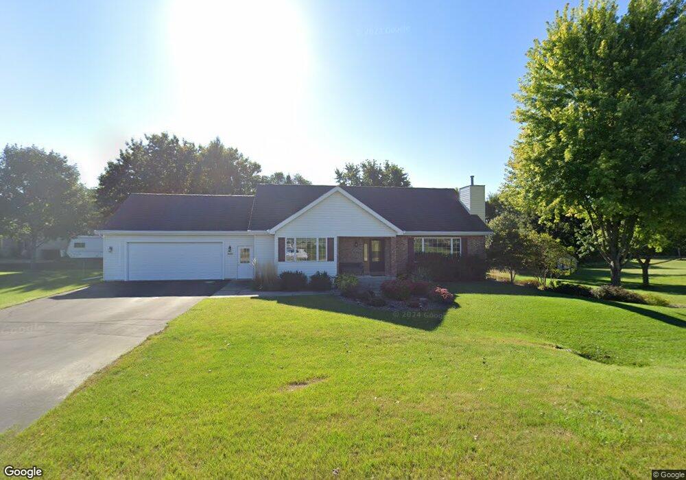
N1634 S Main St Fort Atkinson, WI 53538
Estimated Value: $392,000 - $592,000
2
Beds
3
Baths
1,956
Sq Ft
$235/Sq Ft
Est. Value
About This Home
This home is located at N1634 S Main St, Fort Atkinson, WI 53538 and is currently estimated at $460,039, approximately $235 per square foot. N1634 S Main St is a home located in Jefferson County with nearby schools including Purdy Elementary School, Fort Atkinson Middle School, and Fort Atkinson High School.
Ownership History
Date
Name
Owned For
Owner Type
Purchase Details
Closed on
Jul 13, 2009
Sold by
Colonial Savings Bank Fa
Bought by
Staude Lee W
Current Estimated Value
Home Financials for this Owner
Home Financials are based on the most recent Mortgage that was taken out on this home.
Original Mortgage
$247,500
Outstanding Balance
$154,416
Interest Rate
4.46%
Mortgage Type
New Conventional
Estimated Equity
$305,623
Purchase Details
Closed on
Apr 20, 2009
Sold by
Scherer Tracey C and Scherer Michelle J
Bought by
Colonial Savings Fa
Create a Home Valuation Report for This Property
The Home Valuation Report is an in-depth analysis detailing your home's value as well as a comparison with similar homes in the area
Home Values in the Area
Average Home Value in this Area
Purchase History
| Date | Buyer | Sale Price | Title Company |
|---|---|---|---|
| Staude Lee W | $199,000 | None Available | |
| Colonial Savings Fa | $164,411 | None Available |
Source: Public Records
Mortgage History
| Date | Status | Borrower | Loan Amount |
|---|---|---|---|
| Open | Staude Lee W | $247,500 |
Source: Public Records
Tax History Compared to Growth
Tax History
| Year | Tax Paid | Tax Assessment Tax Assessment Total Assessment is a certain percentage of the fair market value that is determined by local assessors to be the total taxable value of land and additions on the property. | Land | Improvement |
|---|---|---|---|---|
| 2024 | $4,499 | $246,100 | $41,100 | $205,000 |
| 2023 | $4,554 | $246,100 | $41,100 | $205,000 |
| 2022 | $4,397 | $246,100 | $41,100 | $205,000 |
| 2021 | $4,092 | $246,100 | $41,100 | $205,000 |
| 2020 | $3,626 | $246,100 | $41,100 | $205,000 |
| 2019 | $3,760 | $204,100 | $39,600 | $164,500 |
| 2018 | $3,491 | $204,100 | $39,600 | $164,500 |
| 2017 | $3,440 | $204,100 | $39,600 | $164,500 |
| 2016 | $3,564 | $204,100 | $39,600 | $164,500 |
| 2015 | $3,609 | $204,100 | $39,600 | $164,500 |
| 2014 | $3,511 | $204,100 | $39,600 | $164,500 |
| 2013 | $3,628 | $204,100 | $39,600 | $164,500 |
Source: Public Records
Map
Nearby Homes
- W6272 Apple Ln
- 205 Wollet Dr
- N1609 Pleasant Rd
- 263 Heritage Dr Unit 20
- 265 Heritage Dr Unit 19
- W6368 Briar Ln
- N1657 Carlin Rd
- 1268 Jamesway
- 1402 Adrian Blvd
- 633 Hilltop Trail W
- 206 Hilltop Trail
- 611 Talcott Ave
- 1000 Whitetail Dr
- Lot #6 Commerce Pkwy
- Lot #9 Commerce Pkwy
- Lot #10 Commerce Pkwy
- Lot #7 Commerce Pkwy
- Lot #1 Commerce Pkwy
- 336 Jones Ave
- 234 S Main St
- W6024 Thornapple Ln
- N1626 S Main St
- W5998 Apple Ln
- W6030 Thornapple Ln
- N1649 S Main St
- W6001 Apple Ln
- N1618 S Main St
- W6038 Thornapple Ln
- W6035 Thornapple Ln
- N1655 S Main St
- N1621 S Main St
- W5991 Apple Ln
- N1604 S Main St
- W6131 N Thornapple Ct
- W6050 Thornapple Ln
- N1671 S Main St
- W6143 N Thornapple Ct
- W6049 Thornapple Ln
- W5983 Apple Ln
- N1628 Brooke Ln