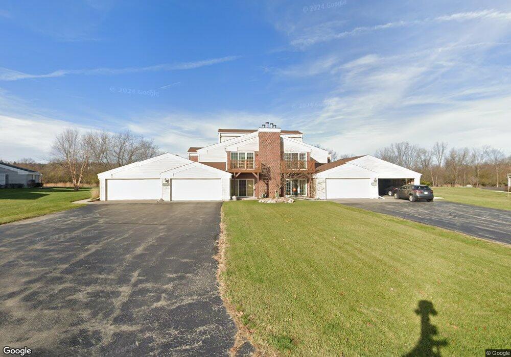
N16W26553 Wild Oats Dr Unit A Pewaukee, WI 53072
Estimated Value: $314,737 - $364,000
--
Bed
--
Bath
--
Sq Ft
0.59
Acres
About This Home
This home is located at N16W26553 Wild Oats Dr Unit A, Pewaukee, WI 53072 and is currently estimated at $334,684. N16W26553 Wild Oats Dr Unit A is a home located in Waukesha County with nearby schools including Meadowbrook Elementary School, Butler Middle School, and North High School.
Ownership History
Date
Name
Owned For
Owner Type
Purchase Details
Closed on
Jul 1, 2005
Sold by
Conrath Carl F and Conrath Amy
Bought by
Woodburn Mary T
Current Estimated Value
Home Financials for this Owner
Home Financials are based on the most recent Mortgage that was taken out on this home.
Original Mortgage
$170,900
Outstanding Balance
$89,385
Interest Rate
5.69%
Mortgage Type
Fannie Mae Freddie Mac
Estimated Equity
$245,299
Purchase Details
Closed on
Oct 31, 2002
Sold by
Schaefer Mary Q
Bought by
Conrath Carl F
Home Financials for this Owner
Home Financials are based on the most recent Mortgage that was taken out on this home.
Original Mortgage
$128,800
Interest Rate
6.08%
Purchase Details
Closed on
Aug 14, 1998
Sold by
Spice Creek Llc
Bought by
Schaefer Mary Q
Create a Home Valuation Report for This Property
The Home Valuation Report is an in-depth analysis detailing your home's value as well as a comparison with similar homes in the area
Home Values in the Area
Average Home Value in this Area
Purchase History
| Date | Buyer | Sale Price | Title Company |
|---|---|---|---|
| Woodburn Mary T | $180,000 | -- | |
| Conrath Carl F | $161,000 | Priority Title Corp | |
| Schaefer Mary Q | $121,800 | -- |
Source: Public Records
Mortgage History
| Date | Status | Borrower | Loan Amount |
|---|---|---|---|
| Open | Woodburn Mary T | $170,900 | |
| Previous Owner | Conrath Carl F | $128,800 |
Source: Public Records
Tax History Compared to Growth
Tax History
| Year | Tax Paid | Tax Assessment Tax Assessment Total Assessment is a certain percentage of the fair market value that is determined by local assessors to be the total taxable value of land and additions on the property. | Land | Improvement |
|---|---|---|---|---|
| 2024 | $2,001 | $211,800 | $28,000 | $183,800 |
| 2023 | $1,999 | $211,800 | $28,000 | $183,800 |
| 2022 | $1,944 | $211,800 | $28,000 | $183,800 |
| 2021 | $2,091 | $211,800 | $28,000 | $183,800 |
| 2020 | $2,095 | $167,000 | $21,500 | $145,500 |
| 2019 | $2,083 | $167,000 | $21,500 | $145,500 |
| 2018 | $1,926 | $167,000 | $21,500 | $145,500 |
| 2017 | $1,927 | $167,000 | $21,500 | $145,500 |
| 2016 | $2,031 | $167,000 | $21,500 | $145,500 |
| 2015 | $2,070 | $167,000 | $21,500 | $145,500 |
| 2014 | $2,133 | $167,000 | $21,500 | $145,500 |
| 2013 | $2,133 | $167,000 | $21,500 | $145,500 |
Source: Public Records
Map
Nearby Homes
- N16W26573 Tall Reeds Ln Unit A
- N16W26583 Wild Oats Dr Unit C
- N16W26571 Tall Reeds Ln Unit B
- N16W26549 Wild Oats Dr Unit 25-C
- N16W26549 Tall Reeds Ln Unit A
- N16W26539 Tall Reeds Ln Unit D
- N19W26672 Milkweed Ln Unit A
- N15W26518 Tall Reeds Ln Unit C
- W263N2345 Deer Haven Dr
- 2912 N University Dr Unit 305
- 2735 Coventry Ln
- W265N2666 Meadowbrook Rd
- N16W27601 Pheasant Ln
- W271N2631 Orchard Ln
- N26W26388 Quail Hollow Rd Unit A
- W269N2762 Lelah Ave
- W270N765 Joanne Dr
- N27W27152 Woodland Dr
- N28W26972 Woodland Dr
- 2605 Emslie Dr
- N16W26553 Wild Oats Dr Unit E
- N16W26553 Wild Oats Dr Unit H
- N16W26553 Wild Oats Dr Unit D
- N16W26553 Consrvancy Dr Unit C
- N16W26553 Consrvancy Dr Unit B
- N16W26553 Consrvancy Dr Unit F
- N16W26553 Consrvancy Dr Unit G
- N16W26561 Wild Oats Dr Unit D
- N16W26561 Wild Oats Dr Unit H
- N16W26561 Wild Oats Dr Unit E
- N16W26561 Wild Oats Dr Unit A
- N16W26561 Conservancy Dr Unit F
- N16W26561 Conservancy Dr Unit B
- N16W26561 Conservancy Dr Unit G
- N16W26561 Conservancy Dr Unit C
- N16W26561 Conservancy Dr Unit B
- N16W26545 Conservancy Dr Unit 213
- N16W26545 Conservancy Dr Unit 216
- N16W26545 Conservancy Dr Unit 217
- N16W26545 Conservancy Dr Unit 212