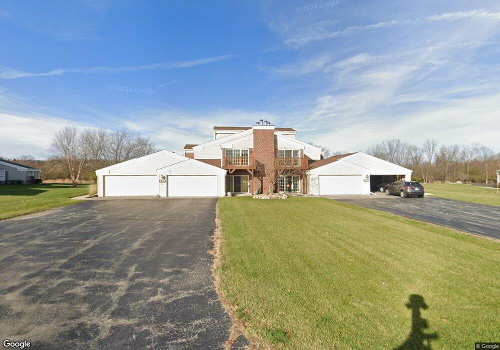
N16W26553 Wild Oats Dr Unit H Pewaukee, WI 53072
Estimated Value: $341,000 - $357,000
--
Bed
--
Bath
--
Sq Ft
0.59
Acres
About This Home
This home is located at N16W26553 Wild Oats Dr Unit H, Pewaukee, WI 53072 and is currently estimated at $350,293. N16W26553 Wild Oats Dr Unit H is a home located in Waukesha County.
Ownership History
Date
Name
Owned For
Owner Type
Purchase Details
Closed on
May 25, 2010
Sold by
Payne Roger K
Bought by
Dentice Joann
Current Estimated Value
Home Financials for this Owner
Home Financials are based on the most recent Mortgage that was taken out on this home.
Original Mortgage
$82,000
Outstanding Balance
$55,176
Interest Rate
5.13%
Mortgage Type
New Conventional
Estimated Equity
$295,117
Create a Home Valuation Report for This Property
The Home Valuation Report is an in-depth analysis detailing your home's value as well as a comparison with similar homes in the area
Home Values in the Area
Average Home Value in this Area
Purchase History
| Date | Buyer | Sale Price | Title Company |
|---|---|---|---|
| Dentice Joann | $159,000 | None Available |
Source: Public Records
Mortgage History
| Date | Status | Borrower | Loan Amount |
|---|---|---|---|
| Open | Dentice Joann | $82,000 |
Source: Public Records
Tax History Compared to Growth
Tax History
| Year | Tax Paid | Tax Assessment Tax Assessment Total Assessment is a certain percentage of the fair market value that is determined by local assessors to be the total taxable value of land and additions on the property. | Land | Improvement |
|---|---|---|---|---|
| 2024 | $2,259 | $230,900 | $28,000 | $202,900 |
| 2023 | $2,260 | $230,900 | $28,000 | $202,900 |
| 2022 | $2,198 | $230,900 | $28,000 | $202,900 |
| 2021 | $2,362 | $230,900 | $28,000 | $202,900 |
| 2020 | $2,251 | $174,000 | $21,500 | $152,500 |
| 2019 | $2,176 | $174,000 | $21,500 | $152,500 |
| 2018 | $2,074 | $174,000 | $21,500 | $152,500 |
| 2017 | $2,013 | $174,000 | $21,500 | $152,500 |
| 2016 | $2,123 | $174,000 | $21,500 | $152,500 |
| 2015 | $2,164 | $174,000 | $21,500 | $152,500 |
| 2014 | $2,229 | $174,000 | $21,500 | $152,500 |
| 2013 | $2,229 | $174,000 | $21,500 | $152,500 |
Source: Public Records
Map
Nearby Homes
- N16W26573 Tall Reeds Ln Unit A
- N16W26583 Wild Oats Dr Unit C
- N16W26571 Tall Reeds Ln Unit B
- N16W26549 Wild Oats Dr Unit 25-C
- N16W26549 Tall Reeds Ln Unit A
- N16W26539 Tall Reeds Ln Unit D
- N19W26672 Milkweed Ln Unit A
- N15W26518 Tall Reeds Ln Unit C
- W263N2345 Deer Haven Dr
- 2912 N University Dr Unit 305
- 2735 Coventry Ln
- W265N2666 Meadowbrook Rd
- N16W27601 Pheasant Ln
- W271N2631 Orchard Ln
- N26W26388 Quail Hollow Rd Unit A
- W269N2762 Lelah Ave
- W270N765 Joanne Dr
- N27W27152 Woodland Dr
- N28W26972 Woodland Dr
- 2605 Emslie Dr
- N16W26553 Wild Oats Dr Unit E
- N16W26553 Wild Oats Dr Unit A
- N16W26553 Wild Oats Dr Unit D
- N16W26553 Consrvancy Dr Unit C
- N16W26553 Consrvancy Dr Unit B
- N16W26553 Consrvancy Dr Unit F
- N16W26553 Consrvancy Dr Unit G
- N16W26561 Wild Oats Dr Unit D
- N16W26561 Wild Oats Dr Unit H
- N16W26561 Wild Oats Dr Unit E
- N16W26561 Wild Oats Dr Unit A
- N16W26561 Conservancy Dr Unit F
- N16W26561 Conservancy Dr Unit B
- N16W26561 Conservancy Dr Unit G
- N16W26561 Conservancy Dr Unit C
- N16W26561 Conservancy Dr Unit B
- N16W26545 Conservancy Dr Unit 213
- N16W26545 Conservancy Dr Unit 216
- N16W26545 Conservancy Dr Unit 217
- N16W26545 Conservancy Dr Unit 212