N2028 385th St Maiden Rock, WI 54750
Estimated Value: $266,135 - $328,000
3
Beds
1
Bath
--
Sq Ft
1
Acres
About This Home
This home is located at N2028 385th St, Maiden Rock, WI 54750 and is currently estimated at $295,378. N2028 385th St is a home located in Pierce County with nearby schools including Ellsworth High School.
Ownership History
Date
Name
Owned For
Owner Type
Purchase Details
Closed on
Dec 6, 2017
Sold by
Holland Jeffrey and Holland Diana M
Bought by
Holland Joseph R
Current Estimated Value
Home Financials for this Owner
Home Financials are based on the most recent Mortgage that was taken out on this home.
Original Mortgage
$90,000
Outstanding Balance
$75,772
Interest Rate
3.94%
Mortgage Type
New Conventional
Estimated Equity
$219,606
Create a Home Valuation Report for This Property
The Home Valuation Report is an in-depth analysis detailing your home's value as well as a comparison with similar homes in the area
Home Values in the Area
Average Home Value in this Area
Purchase History
| Date | Buyer | Sale Price | Title Company |
|---|---|---|---|
| Holland Joseph R | $122,000 | -- |
Source: Public Records
Mortgage History
| Date | Status | Borrower | Loan Amount |
|---|---|---|---|
| Open | Holland Joseph R | $90,000 |
Source: Public Records
Tax History Compared to Growth
Tax History
| Year | Tax Paid | Tax Assessment Tax Assessment Total Assessment is a certain percentage of the fair market value that is determined by local assessors to be the total taxable value of land and additions on the property. | Land | Improvement |
|---|---|---|---|---|
| 2024 | $3,383 | $127,000 | $25,800 | $101,200 |
| 2023 | $3,195 | $127,000 | $25,800 | $101,200 |
| 2022 | $2,538 | $127,000 | $25,800 | $101,200 |
| 2021 | $2,471 | $127,000 | $25,800 | $101,200 |
| 2020 | $2,528 | $123,300 | $22,100 | $101,200 |
| 2019 | $2,479 | $123,300 | $22,100 | $101,200 |
| 2018 | $2,444 | $123,300 | $22,100 | $101,200 |
| 2017 | $2,495 | $123,300 | $22,100 | $101,200 |
| 2016 | $2,437 | $123,300 | $22,100 | $101,200 |
| 2015 | $2,297 | $123,300 | $22,100 | $101,200 |
| 2014 | $2,205 | $123,300 | $22,100 | $101,200 |
| 2013 | $2,316 | $123,300 | $22,100 | $101,200 |
Source: Public Records
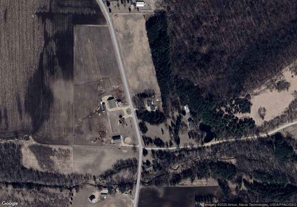
Map
Nearby Homes
- TBD 310th St
- N1024 385th St
- W3527 2nd St
- W3410 State Road 35
- TBD County Trunk Highway Aa
- W5838 County Road Ee
- 0 Xxx 590th St
- XXX 590th
- W1810 County Road Cc
- 28589 Lake Avenue Way
- N33XX W Bluff Rd N
- W7221 155th Ave
- 29178 Westervelt Avenue Way W
- 29430 Lake Avenue Way
- 206 West St
- 208 1st St
- N261 197th St
- 28983 320th Avenue Way
- 29923 Lakeview Ave
- 33400 302nd Street Path
- W3750 200th Ave
- N2025 385th St
- n 2025 385th St
- N1955 385th St
- 2025 385th St
- N2106 385th St
- XXX 10 Acr 385th St
- XXX 10 Acres 385th St
- N1950 385th St
- N1950 385th St
- XXX 40 Acres 385th St
- 000 40 Acres 385th St
- 000 40 Acr 385th St
- 0 385th St
- W3675 200th Ave
- W3671 200th Ave
- XXX 35 Acr 385th St
- XXX 35 Acres 385th St
- N1891 385th St
- 20 Acres Town of Salem