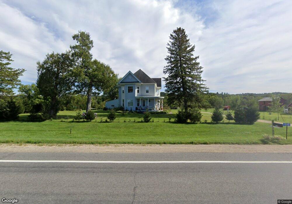
N21622 Us Highway 53 Ettrick, WI 54627
Estimated Value: $396,000 - $433,000
--
Bed
--
Bath
--
Sq Ft
15.5
Acres
About This Home
This home is located at N21622 Us Highway 53, Ettrick, WI 54627 and is currently estimated at $416,108. N21622 Us Highway 53 is a home located in Trempealeau County with nearby schools including Galesville-Ettrick-Trempealeau High School and Berean Christian School.
Ownership History
Date
Name
Owned For
Owner Type
Purchase Details
Closed on
Aug 11, 2014
Sold by
Carlson Michael D and Carlson Misty Moon
Bought by
Woychik Shelly A
Current Estimated Value
Purchase Details
Closed on
Jun 26, 2008
Sold by
Long Monte R and Long Kriati D
Bought by
Carlson Michael D and Carlson Misty Moon
Home Financials for this Owner
Home Financials are based on the most recent Mortgage that was taken out on this home.
Original Mortgage
$184,500
Interest Rate
7.62%
Mortgage Type
Adjustable Rate Mortgage/ARM
Create a Home Valuation Report for This Property
The Home Valuation Report is an in-depth analysis detailing your home's value as well as a comparison with similar homes in the area
Home Values in the Area
Average Home Value in this Area
Purchase History
| Date | Buyer | Sale Price | Title Company |
|---|---|---|---|
| Woychik Shelly A | $200,000 | None Available | |
| Carlson Michael D | $205,000 | None Available |
Source: Public Records
Mortgage History
| Date | Status | Borrower | Loan Amount |
|---|---|---|---|
| Previous Owner | Carlson Michael D | $184,500 |
Source: Public Records
Tax History Compared to Growth
Tax History
| Year | Tax Paid | Tax Assessment Tax Assessment Total Assessment is a certain percentage of the fair market value that is determined by local assessors to be the total taxable value of land and additions on the property. | Land | Improvement |
|---|---|---|---|---|
| 2024 | $3,873 | $218,500 | $27,100 | $191,400 |
| 2023 | $3,695 | $218,500 | $27,100 | $191,400 |
| 2022 | $4,007 | $218,500 | $27,100 | $191,400 |
| 2021 | $3,691 | $218,500 | $27,100 | $191,400 |
| 2020 | $3,634 | $46,240 | $27,100 | $19,140 |
| 2019 | $3,805 | $218,500 | $27,100 | $191,400 |
| 2018 | $3,458 | $173,600 | $29,900 | $143,700 |
| 2017 | $3,662 | $182,300 | $38,600 | $143,700 |
| 2016 | $3,543 | $182,300 | $38,600 | $143,700 |
| 2015 | $3,440 | $193,400 | $49,700 | $143,700 |
| 2014 | $3,353 | $193,400 | $49,700 | $143,700 |
| 2011 | $3,352 | $193,400 | $49,700 | $143,700 |
Source: Public Records
Map
Nearby Homes
- Lot 12 Cherub Ct
- Lot 11 Cherub Ct
- N23764 Wayside Ln
- 22732 U S 53
- 0 County Road D Unit 1943225
- W20479 Brenegan Ln
- 22766 S Main St
- 22653 S Main St
- N23415 Oak Ridge Dr
- N20545 County Road Dd
- N19735 County Road Dd
- N18078 County Road T
- N18155 Sharpe Ln
- XXX N 4th St
- 20278 Bibby St
- 0 N 4th St
- 20153 Hammer Ave
- 20054 W Mill Rd
- 0 Whalen Rd
- 16648 S Main St
- N21622 N21622 Us 53
- N21732 Us Highway 53
- N21497 Us Hwy 53
- W18441 County Road Tt
- N21432 Us Highway 53
- W17981 Dopp Rd
- W18000 Dopp Rd
- N21532 Hwy T
- N21532 County Road T
- N21672 County Road T
- N21833 Us Highway 53
- N21478 County Road T
- N21671 County Road T
- N21767 County Road T
- N21477 County Road T
- N21473 County Road T
- N21799 County Road T
- N21591 County Road T
- W18302 Dopp Rd
- W18372 Dopp Rd