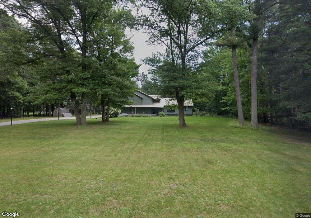
N2398 Rivers Edge Dr Marinette, WI 54143
Estimated Value: $302,000 - $395,000
4
Beds
3
Baths
2,670
Sq Ft
$130/Sq Ft
Est. Value
About This Home
This home is located at N2398 Rivers Edge Dr, Marinette, WI 54143 and is currently estimated at $346,125, approximately $129 per square foot. N2398 Rivers Edge Dr is a home located in Marinette County with nearby schools including Marinette Middle School, Marinette High School, and St. Thomas Aquinas Academy.
Ownership History
Date
Name
Owned For
Owner Type
Purchase Details
Closed on
Jul 22, 2011
Sold by
Harries David M
Bought by
Walters Andrew and Walters Jada
Current Estimated Value
Purchase Details
Closed on
Dec 30, 2008
Sold by
Harries Terri L
Bought by
Harries David M
Purchase Details
Closed on
Jan 31, 2005
Sold by
Leister Edward E and Leister Juliann
Bought by
Harries David M and Harries Terri L
Create a Home Valuation Report for This Property
The Home Valuation Report is an in-depth analysis detailing your home's value as well as a comparison with similar homes in the area
Home Values in the Area
Average Home Value in this Area
Purchase History
| Date | Buyer | Sale Price | Title Company |
|---|---|---|---|
| Walters Andrew | $154,900 | -- | |
| Harries David M | $201,000 | -- | |
| Harries David M | $200,000 | -- |
Source: Public Records
Tax History Compared to Growth
Tax History
| Year | Tax Paid | Tax Assessment Tax Assessment Total Assessment is a certain percentage of the fair market value that is determined by local assessors to be the total taxable value of land and additions on the property. | Land | Improvement |
|---|---|---|---|---|
| 2024 | $2,071 | $154,900 | $20,300 | $134,600 |
| 2023 | $2,245 | $154,900 | $20,300 | $134,600 |
| 2022 | $2,060 | $154,900 | $20,300 | $134,600 |
| 2021 | $1,812 | $154,900 | $20,300 | $134,600 |
| 2020 | $1,877 | $154,900 | $20,300 | $134,600 |
| 2019 | $1,855 | $154,900 | $20,300 | $134,600 |
| 2018 | $2,016 | $154,900 | $20,300 | $134,600 |
| 2017 | $2,011 | $154,900 | $20,300 | $134,600 |
| 2016 | $1,993 | $154,900 | $20,300 | $134,600 |
| 2015 | $1,992 | $154,900 | $20,300 | $134,600 |
| 2014 | $2,141 | $154,900 | $20,300 | $134,600 |
| 2012 | $2,105 | $154,900 | $20,300 | $134,600 |
Source: Public Records
Map
Nearby Homes
- W1380 Little River Rd
- Lt2 Rader Rd
- Lt3 Rader Rd
- Lt9 Radar Rd
- Lt10 Radar Rd
- Lt12 Radar Rd
- 0 Rolling Hills Ln Unit 50305578
- 0 Rolling Hills Ln Unit 50305575
- 0 Rolling Hills Ln Unit 50305580
- 0 Rolling Hills Ln Unit 50305581
- 0 Rolling Hills Ln Unit 50305577
- 0 Rolling Hills Ln Unit 50305583
- 0 Rolling Hills Ln Unit 50305586
- 0 Rolling Hills Ln Unit 50305587
- 0 Rolling Hills Ln Unit 50305576
- 0 Rolling Hills Ln Unit 50305582
- 0 Rolling Hills Ln Unit 50305585
- W739 Heath Ln
- W1882 Rader Rd
- 0 Keller Rd
- N2408 Rivers Edge Dr
- N2376 Rivers Edge Dr
- N2438 Kowalski Rd
- N2387 Rivers Edge Dr
- N2450 Kowalski Rd
- 0 Rivers Edge Dr
- N3836 Rivers Edge Dr
- N2401 Rivers Edge Dr
- N2371 Rivers Edge Dr
- N2398 Kowalski Rd
- N2419 Rivers Edge Dr
- N2366 Rivers Edge Dr
- N2360 Rivers Edge Dr
- N2427 Kowalski Rd
- N2413 Kowalski Rd
- N2429 Rivers Edge Dr
- N2455 Kowalski Rd
- N2401 Kowalski Rd
- W1375 County Road B
- W1353 County Road B