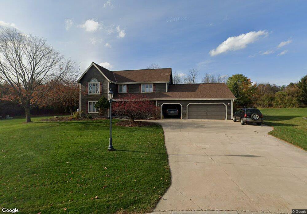
N24W26489 Bucks Island Ct Pewaukee, WI 53072
Estimated Value: $719,872 - $772,000
--
Bed
--
Bath
--
Sq Ft
0.55
Acres
About This Home
This home is located at N24W26489 Bucks Island Ct, Pewaukee, WI 53072 and is currently estimated at $752,468. N24W26489 Bucks Island Ct is a home located in Waukesha County with nearby schools including Pewaukee Lake Elementary School, Asa Clark Middle School, and Pewaukee High School.
Ownership History
Date
Name
Owned For
Owner Type
Purchase Details
Closed on
Apr 28, 2006
Sold by
Rosemurgy John H S and Nitzsche Daniel W
Bought by
Querio Gerald and Querio Marguerite
Current Estimated Value
Home Financials for this Owner
Home Financials are based on the most recent Mortgage that was taken out on this home.
Original Mortgage
$308,000
Outstanding Balance
$179,805
Interest Rate
6.54%
Mortgage Type
Fannie Mae Freddie Mac
Estimated Equity
$572,663
Create a Home Valuation Report for This Property
The Home Valuation Report is an in-depth analysis detailing your home's value as well as a comparison with similar homes in the area
Home Values in the Area
Average Home Value in this Area
Purchase History
| Date | Buyer | Sale Price | Title Company |
|---|---|---|---|
| Querio Gerald | $385,000 | None Available |
Source: Public Records
Mortgage History
| Date | Status | Borrower | Loan Amount |
|---|---|---|---|
| Open | Querio Gerald | $308,000 |
Source: Public Records
Tax History Compared to Growth
Tax History
| Year | Tax Paid | Tax Assessment Tax Assessment Total Assessment is a certain percentage of the fair market value that is determined by local assessors to be the total taxable value of land and additions on the property. | Land | Improvement |
|---|---|---|---|---|
| 2024 | $5,905 | $512,000 | $173,600 | $338,400 |
| 2023 | $5,880 | $512,000 | $173,600 | $338,400 |
| 2022 | $6,411 | $512,000 | $173,600 | $338,400 |
| 2021 | $6,077 | $512,000 | $173,600 | $338,400 |
| 2020 | $6,050 | $409,300 | $136,700 | $272,600 |
| 2019 | $5,895 | $409,300 | $136,700 | $272,600 |
| 2018 | $5,680 | $409,300 | $136,700 | $272,600 |
| 2017 | $6,621 | $409,300 | $136,700 | $272,600 |
| 2016 | $5,871 | $409,300 | $136,700 | $272,600 |
| 2015 | $5,944 | $409,300 | $136,700 | $272,600 |
| 2014 | $6,492 | $409,300 | $136,700 | $272,600 |
| 2013 | $6,492 | $409,300 | $136,700 | $272,600 |
Source: Public Records
Map
Nearby Homes
- W263N2345 Deer Haven Dr
- W265N2666 Meadowbrook Rd
- N26W26388 Quail Hollow Rd Unit A
- N19W26672 Milkweed Ln Unit A
- W269N2762 Lelah Ave
- N28W26972 Woodland Dr
- W271N2631 Orchard Ln
- N27W27152 Woodland Dr
- N16W26549 Wild Oats Dr Unit 25-C
- N16W26549 Tall Reeds Ln Unit A
- N16W26573 Tall Reeds Ln Unit A
- N16W26583 Wild Oats Dr Unit C
- N16W26571 Tall Reeds Ln Unit B
- N16W26539 Tall Reeds Ln Unit D
- N15W26518 Tall Reeds Ln Unit C
- N28W27558 Peninsula Dr
- N28W27564 Peninsula Dr
- N28W25158 Parkway Ridge Cir Unit B
- Ashford Plan at Woodleaf Reserve
- Weston Plan at Woodleaf Reserve
- N25W26490 Bucks Island Ct
- N24W26461 Bucks Island Ct
- N25W26466 Bucks Island Ct
- N25W26456 Fox Den Ct
- N24W26455 Bucks Island Ct
- N25W26461 Fox Den Ct
- N25W26444 Bucks Island Ct
- N24W26427 Bucks Island Ct
- N25W26420 Bucks Island Ct
- N25W26445 Fox Den Ct
- N25W26481 Whitetail Ct
- N25W26473 Whitetail Ct
- N25W26469 Fox Den Ct
- W266N2640 Meadowbrook Rd
- W264N2477 Wilderness Way
- N24W26419 Bucks Island Ct
- W264N2381 Fawn Ct
- W264N2464 Wilderness Way
- N25W26433 Fox Den Ct
- N25W26378 Whitetail Ct