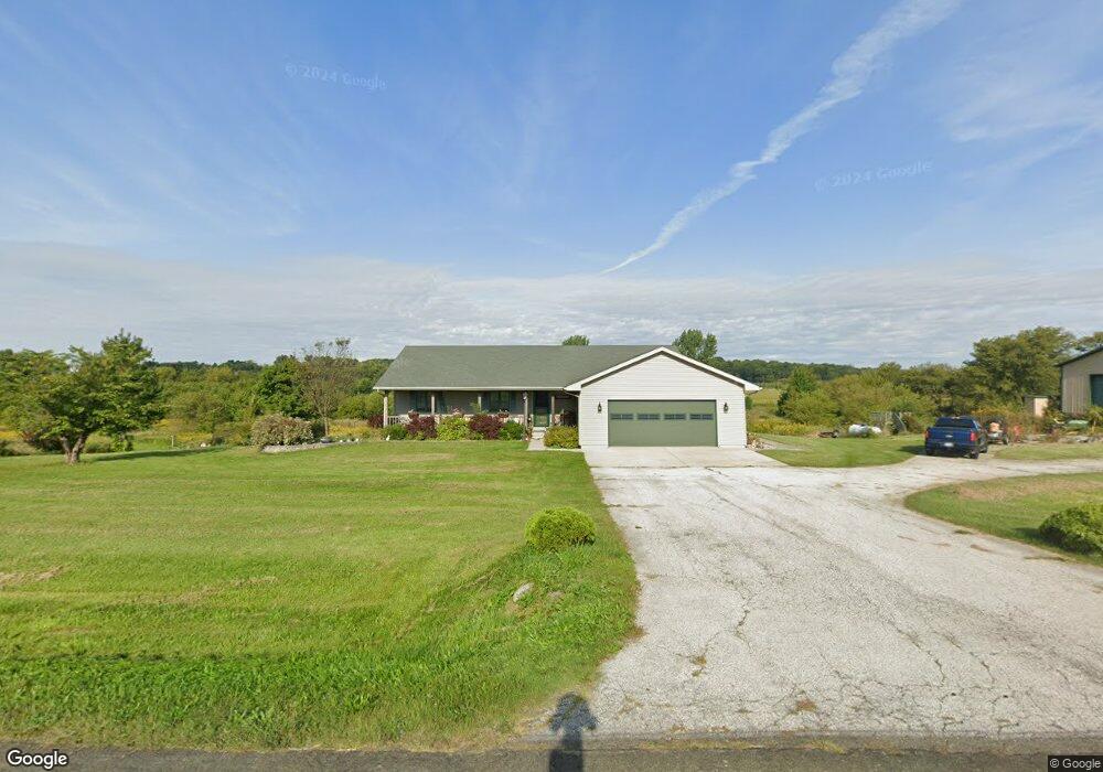
N2531 Level Valley Rd Watertown, WI 53098
Estimated Value: $311,000 - $520,000
--
Bed
--
Bath
--
Sq Ft
9.58
Acres
About This Home
This home is located at N2531 Level Valley Rd, Watertown, WI 53098 and is currently estimated at $448,684. N2531 Level Valley Rd is a home located in Dodge County with nearby schools including John Hustis Elementary School and Hustisford High School.
Ownership History
Date
Name
Owned For
Owner Type
Purchase Details
Closed on
Oct 25, 2024
Sold by
Kohlhoff Jeffrey A
Bought by
Kohlhoff Jeffrey A and Kohlhoff Roni S
Current Estimated Value
Home Financials for this Owner
Home Financials are based on the most recent Mortgage that was taken out on this home.
Original Mortgage
$160,000
Outstanding Balance
$158,717
Interest Rate
7.25%
Mortgage Type
New Conventional
Estimated Equity
$289,967
Purchase Details
Closed on
Mar 28, 2019
Sold by
Locy Robert J and Dinkel Dawn M
Bought by
Locy Robert J and Locy Dawn M
Home Financials for this Owner
Home Financials are based on the most recent Mortgage that was taken out on this home.
Original Mortgage
$60,000
Interest Rate
4.3%
Mortgage Type
Credit Line Revolving
Create a Home Valuation Report for This Property
The Home Valuation Report is an in-depth analysis detailing your home's value as well as a comparison with similar homes in the area
Home Values in the Area
Average Home Value in this Area
Purchase History
| Date | Buyer | Sale Price | Title Company |
|---|---|---|---|
| Kohlhoff Jeffrey A | -- | Knight Barry Title | |
| Locy Robert J | -- | None Available |
Source: Public Records
Mortgage History
| Date | Status | Borrower | Loan Amount |
|---|---|---|---|
| Open | Kohlhoff Jeffrey A | $160,000 | |
| Previous Owner | Locy Robert J | $60,000 |
Source: Public Records
Tax History Compared to Growth
Tax History
| Year | Tax Paid | Tax Assessment Tax Assessment Total Assessment is a certain percentage of the fair market value that is determined by local assessors to be the total taxable value of land and additions on the property. | Land | Improvement |
|---|---|---|---|---|
| 2024 | $4,799 | $284,800 | $68,100 | $216,700 |
| 2023 | $4,727 | $284,800 | $68,100 | $216,700 |
| 2022 | $5,006 | $284,800 | $68,100 | $216,700 |
| 2021 | $4,368 | $284,800 | $68,100 | $216,700 |
| 2020 | $4,686 | $284,800 | $68,100 | $216,700 |
| 2019 | $4,648 | $284,800 | $68,100 | $216,700 |
| 2018 | $4,388 | $264,900 | $67,900 | $197,000 |
| 2017 | $4,455 | $264,900 | $67,900 | $197,000 |
| 2016 | $4,552 | $264,900 | $67,900 | $197,000 |
| 2015 | $4,514 | $264,900 | $67,900 | $197,000 |
| 2014 | $4,752 | $264,900 | $67,900 | $197,000 |
Source: Public Records
Map
Nearby Homes
- 000 Lt0 Sleepy Hollow Rd
- Lot 2 Sleepy Hollow
- 441 Sandy Ln
- 252 S Hustis St
- 244 S Ridge St
- .68 Acre Parcel Anthony Island
- 727 E Lakeview Rd Unit 8
- N1332 County Rd E
- 827 E Lakeview Rd
- W4436 E Lakeview Rd
- N4557 Lakeview Rd
- W2824 Fox Rd
- 506 Center St
- N3220 Hale Rd
- Lt2 Circle View Ct
- N4554 Lakeview Rd
- N4510 & N4504 Anthony Island
- 730 Territorial Rd
- N4510 Anthony Island -
- W5310 County Road R
- N2510 Level Valley Rd
- N2572 Level Valley Rd
- 4747 County Road Me
- W4756 County Road Me
- W4588 County Road Me
- W4757 County Road Me
- W4844 County Road Me
- W4844 County Road Me
- W4810 County Road Me
- W4885 County Road Me
- W4888 County Road Me
- N2475 County Road Em
- N2428 County Road Em
- N2657 County Rd E
- N2491 County Road R
- N2157 Trestle Rd
- W4550 County Road Mm
- N2319 County Road Em
- W4907 Oak Hill Rd