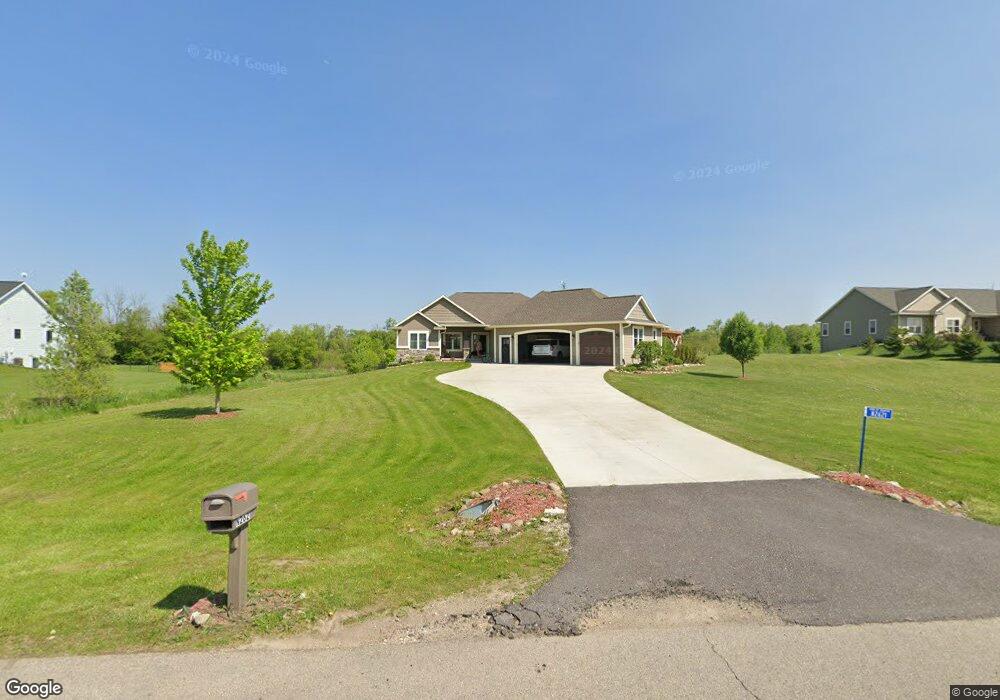
N2621 Prairie Hill Cir Waupun, WI 53963
Estimated Value: $475,351 - $657,000
--
Bed
--
Bath
--
Sq Ft
1.63
Acres
About This Home
This home is located at N2621 Prairie Hill Cir, Waupun, WI 53963 and is currently estimated at $572,588. N2621 Prairie Hill Cir is a home with nearby schools including Meadow View Primary School, Rock River Intermediate School, and Waupun Area Junior High School.
Ownership History
Date
Name
Owned For
Owner Type
Purchase Details
Closed on
Jul 30, 2014
Sold by
Ver Hage Donald P and Ver Hage Mary A
Bought by
Bohn Matthew E and Bohn Kathyn A
Current Estimated Value
Home Financials for this Owner
Home Financials are based on the most recent Mortgage that was taken out on this home.
Original Mortgage
$33,000
Interest Rate
4.19%
Mortgage Type
New Conventional
Purchase Details
Closed on
Aug 16, 2010
Sold by
Koehler Marti A
Bought by
Hage Donald P Ver and Hage Mary A Ver
Purchase Details
Closed on
Jul 15, 2010
Sold by
Larkin David M
Bought by
Koehler Martin A
Create a Home Valuation Report for This Property
The Home Valuation Report is an in-depth analysis detailing your home's value as well as a comparison with similar homes in the area
Home Values in the Area
Average Home Value in this Area
Purchase History
| Date | Buyer | Sale Price | Title Company |
|---|---|---|---|
| Bohn Matthew E | $41,500 | None Available | |
| Hage Donald P Ver | $33,400 | None Available | |
| Koehler Martin A | -- | None Available |
Source: Public Records
Mortgage History
| Date | Status | Borrower | Loan Amount |
|---|---|---|---|
| Closed | Bohn Matthew E | $33,000 |
Source: Public Records
Tax History Compared to Growth
Tax History
| Year | Tax Paid | Tax Assessment Tax Assessment Total Assessment is a certain percentage of the fair market value that is determined by local assessors to be the total taxable value of land and additions on the property. | Land | Improvement |
|---|---|---|---|---|
| 2024 | $5,076 | $461,400 | $51,800 | $409,600 |
| 2023 | $4,970 | $284,500 | $43,800 | $240,700 |
| 2022 | $4,702 | $284,500 | $43,800 | $240,700 |
| 2021 | $4,556 | $284,500 | $43,800 | $240,700 |
| 2020 | $4,577 | $284,500 | $43,800 | $240,700 |
| 2019 | $4,650 | $284,500 | $43,800 | $240,700 |
| 2018 | $4,652 | $284,500 | $43,800 | $240,700 |
| 2017 | $1,671 | $104,000 | $43,800 | $60,200 |
| 2016 | $5 | $300 | $300 | $0 |
| 2015 | $6 | $300 | $300 | $0 |
| 2014 | $6 | $300 | $300 | $0 |
| 2013 | $6 | $300 | $300 | $0 |
Source: Public Records
Map
Nearby Homes
- 18 Pluim Dr Unit 16
- 18 Pluim Dr Unit 13
- 395 Fond du Lac St
- 380 Fond du Lac St
- 134 N Watertown St
- 327 Carrington St
- 516 E Lincoln St
- 516 Doty St
- 315 E Main St
- 231 Woodland Dr
- 614 Carrington St
- 25 W Franklin St
- 517 W Jefferson St
- 295 Harmsen Ave
- 17.92 Ac Pattee Dr
- 736 Fern St
- 806 Rock River Ave
- W12681 County As
- 109 Filbey St
- N5449 County M Rd
- Lot 11 Prairie Hill Cir
- 0 Prairie Hill Cir
- N2609 Prairie Hill Cir
- N2643 Prairie Hill Cir
- W10389 Prairie Hill Rd
- N2639 Prairie Hill Cir
- N2610 Prairie Hill Cir
- W10388 Prairie Hill Rd
- W10428 Church Rd
- 0 Prairie Hill Rd Unit 50051936
- 0 Prairie Hill Rd Unit 50051939
- 0 Prairie Hill Rd Unit 50051937
- N2561 Banner Rd
- N2561 Banner Rd
- N2591 Banner Rd
- Lot 1 Prairie Hills Rd
- W10344 Church Rd
- W10416 Church Rd
- W10446 Church Rd
- W10378 Church Rd