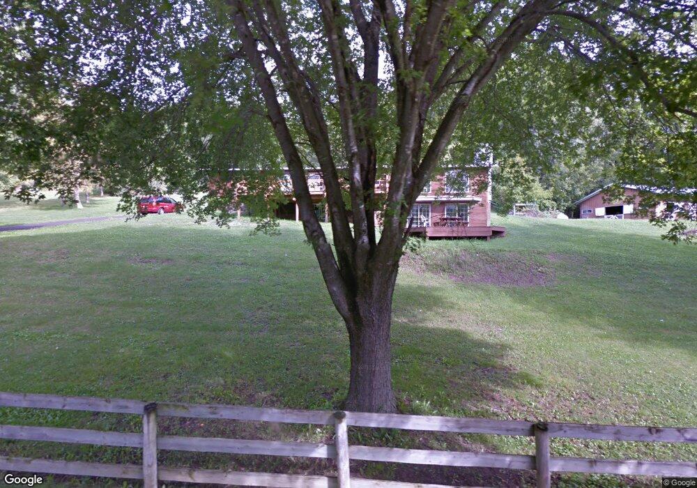
N2849 Demlow Rd La Crosse, WI 54601
Estimated Value: $450,517 - $483,000
--
Bed
--
Bath
--
Sq Ft
1.75
Acres
About This Home
This home is located at N2849 Demlow Rd, La Crosse, WI 54601 and is currently estimated at $467,379. N2849 Demlow Rd is a home located in La Crosse County with nearby schools including West Salem Elementary School, West Salem Middle School, and West Salem High School.
Ownership History
Date
Name
Owned For
Owner Type
Purchase Details
Closed on
Dec 5, 2019
Sold by
Fiers Bradley L and Fiers Tanja J
Bought by
Forer Nicholas J and Lezpona Emily A
Current Estimated Value
Home Financials for this Owner
Home Financials are based on the most recent Mortgage that was taken out on this home.
Original Mortgage
$220,000
Outstanding Balance
$194,529
Interest Rate
3.75%
Mortgage Type
New Conventional
Estimated Equity
$272,850
Purchase Details
Closed on
Dec 18, 2015
Sold by
Callaway Carol A
Bought by
Fiers Bradley L and Fiers Tanja J
Create a Home Valuation Report for This Property
The Home Valuation Report is an in-depth analysis detailing your home's value as well as a comparison with similar homes in the area
Home Values in the Area
Average Home Value in this Area
Purchase History
| Date | Buyer | Sale Price | Title Company |
|---|---|---|---|
| Forer Nicholas J | $240,000 | Knight Barry Title | |
| Fiers Bradley L | $158,000 | New Castle Title |
Source: Public Records
Mortgage History
| Date | Status | Borrower | Loan Amount |
|---|---|---|---|
| Open | Forer Nicholas J | $220,000 |
Source: Public Records
Tax History Compared to Growth
Tax History
| Year | Tax Paid | Tax Assessment Tax Assessment Total Assessment is a certain percentage of the fair market value that is determined by local assessors to be the total taxable value of land and additions on the property. | Land | Improvement |
|---|---|---|---|---|
| 2023 | $3,762 | $322,000 | $41,900 | $280,100 |
| 2022 | $3,602 | $322,000 | $41,900 | $280,100 |
| 2021 | $3,554 | $213,200 | $28,500 | $184,700 |
| 2020 | $3,398 | $213,200 | $28,500 | $184,700 |
| 2019 | $3,507 | $213,200 | $28,500 | $184,700 |
| 2018 | $3,347 | $213,200 | $28,500 | $184,700 |
| 2017 | $2,440 | $155,700 | $28,500 | $127,200 |
| 2016 | $2,481 | $155,700 | $28,500 | $127,200 |
| 2015 | $2,519 | $155,700 | $28,500 | $127,200 |
| 2014 | $2,043 | $128,200 | $28,500 | $99,700 |
| 2013 | $2,250 | $123,900 | $24,800 | $99,100 |
Source: Public Records
Map
Nearby Homes
- W4051 Twin Creeks Rd
- 0000 County Road M
- W5285 County Road F
- N2031 County Road F -
- N1947 Forest Ridge Dr
- W4936 Battlestone Station Rd
- W4946 Battlestone Station Rd Unit 23
- W4952 Battlestone Station Rd Unit 25
- 00 Smith Valley Rd
- W5600 Stonehill Rd N
- N2015 Stonecrest Rd
- 0 County Road Fa Unit 1932828
- 0 Stone Hill Rd N Unit 1937709
- 26 Stone Hill Rd N
- W5419 Pine Bluff Rd
- W5522 Eagle Point Dr
- W5453 Pine Bluff Rd
- N1583 Meadow Ridge Rd
- N2194 Valley Rd
- 5051 County Road B Unit 24
- N2841 Demlow Rd
- N2871 Demlow Rd
- W4448 Drectrah Rd
- N2835 Demlow Rd
- W4416 Drectrah Rd
- N2829 Demlow Rd
- W4445 Drectrah Rd
- W4425 Drectrah Rd
- W4380 Drectrah Rd
- W4433 Drectrah Rd
- W4411 Drectrah Rd
- W4398 Drectrah Rd
- N2784 Patrie Dr
- W4391 Drectrah Rd
- W4391 Drectrah Rd Unit W4393
- W4391 Drectrah Rd Unit W4391-4393
- W4509 Drectrah Rd
- W4363 Drectrah Rd
- W4475 Drectrah Rd
- N2750 Patrie Dr