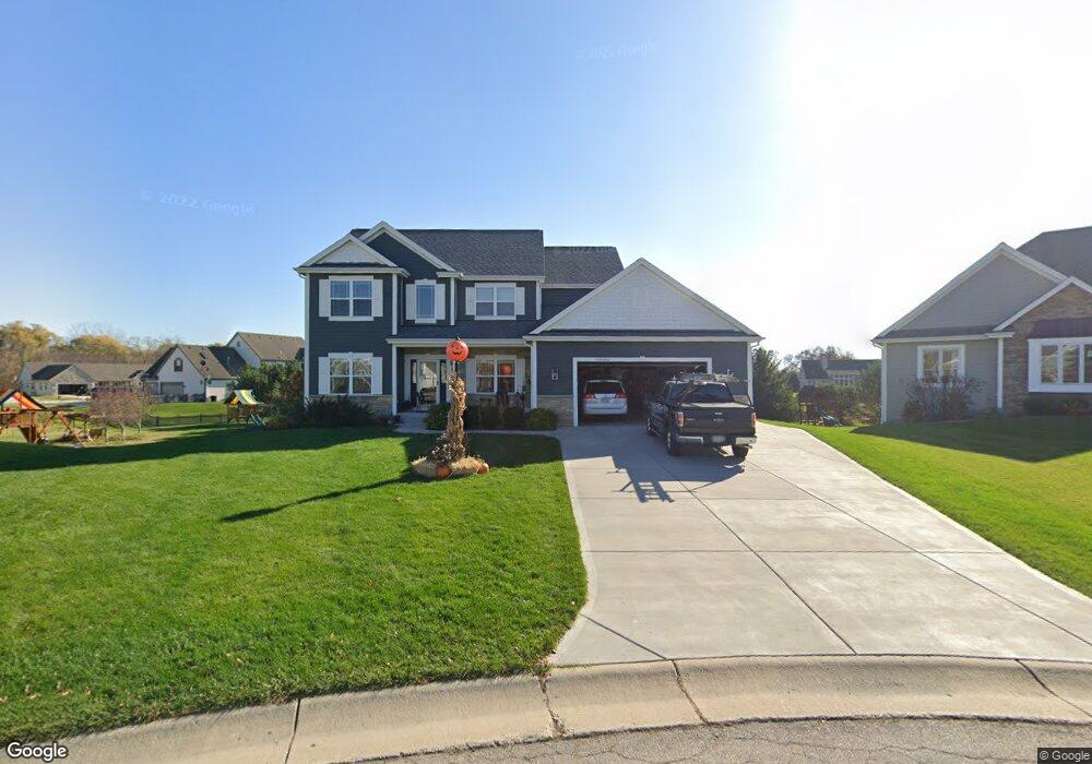
N28W24319 Single Tree Ct Pewaukee, WI 53072
Estimated Value: $687,000 - $906,000
Studio
--
Bath
--
Sq Ft
20,909
Sq Ft Lot
About This Home
This home is located at N28W24319 Single Tree Ct, Pewaukee, WI 53072 and is currently estimated at $760,924. N28W24319 Single Tree Ct is a home with nearby schools including Pewaukee Lake Elementary School, Asa Clark Middle School, and Pewaukee High School.
Ownership History
Date
Name
Owned For
Owner Type
Purchase Details
Closed on
Mar 3, 2025
Sold by
Forman Kraig M and Forman Lori A
Bought by
Forman Revocable Living Trust and Forman
Current Estimated Value
Purchase Details
Closed on
Dec 31, 2013
Sold by
Tim O Brien Homes Inc
Bought by
Forman Kraig M and Forman Lori A
Home Financials for this Owner
Home Financials are based on the most recent Mortgage that was taken out on this home.
Original Mortgage
$350,600
Interest Rate
4.23%
Mortgage Type
New Conventional
Purchase Details
Closed on
Jul 26, 2013
Sold by
Mn Holdings Inc
Bought by
Tim Obrien Homes Inc
Home Financials for this Owner
Home Financials are based on the most recent Mortgage that was taken out on this home.
Original Mortgage
$249,000
Interest Rate
3.28%
Mortgage Type
Credit Line Revolving
Create a Home Valuation Report for This Property
The Home Valuation Report is an in-depth analysis detailing your home's value as well as a comparison with similar homes in the area
Home Values in the Area
Average Home Value in this Area
Purchase History
| Date | Buyer | Sale Price | Title Company |
|---|---|---|---|
| Forman Revocable Living Trust | -- | None Listed On Document | |
| Forman Kraig M | $412,800 | None Available | |
| Tim Obrien Homes Inc | $149,900 | None Available |
Source: Public Records
Mortgage History
| Date | Status | Borrower | Loan Amount |
|---|---|---|---|
| Previous Owner | Forman Kraig M | $350,600 | |
| Previous Owner | Tim Obrien Homes Inc | $249,000 |
Source: Public Records
Tax History
| Year | Tax Paid | Tax Assessment Tax Assessment Total Assessment is a certain percentage of the fair market value that is determined by local assessors to be the total taxable value of land and additions on the property. | Land | Improvement |
|---|---|---|---|---|
| 2024 | $6,085 | $501,700 | $178,100 | $323,600 |
| 2023 | $6,056 | $501,700 | $178,100 | $323,600 |
| 2022 | $6,241 | $501,700 | $178,100 | $323,600 |
| 2021 | $6,205 | $501,700 | $178,100 | $323,600 |
| 2020 | $6,619 | $430,000 | $132,300 | $297,700 |
| 2019 | $6,446 | $430,000 | $132,300 | $297,700 |
Source: Public Records
Map
Nearby Homes
- N28W24239 Watertown Rd
- W241N2507 E Parkway Meadow Cir Unit 6
- N24W24050 Brandon Oaks Dr Unit A
- W240N2532 E Parkway Meadow Cir Unit 5
- W240N2524 E Parkway Meadow Cir Unit 5
- N22 W24122 Cloister Cir Unit 5 E
- 1343 Meadowcreek Dr Unit D
- 1013 Waterstone Ct
- 1044 Waterstone Ct
- 1106 Oxbow Ct
- W240N2192 Dorchester Dr Unit 10A
- N21W24202 Cumberland Dr Unit 23 I
- N21W24045 Garden Cir Unit F
- 359 Lexington Ct Unit B
- N28W25285 Parkway Ridge Cir Unit C
- 1356 Greenhedge Rd Unit C4
- N28W25285 Madeline Blvd Unit A Bldg 14 Unit 52
- W248N2151 Kettle Cove Ct
- 809 Ridgeway Dr
- N19W24667 River Edge Ct
- N28W24329 Single Tree Ct
- N28W24310 Single Tree Ct
- N28W24349 Single Tree Ct
- N28W24330 Single Tree Ct
- W243N2777 Creekside Dr
- W243N2781 Creekside Dr
- N28W24359 Single Tree Ct
- N28W24360 Single Tree Ct
- W243N2755 Creekside Dr
- N28W24369 Single Tree Ct
- W243N2727 Creekside Dr
- W243N2797 Creekside Dr
- N28W24370 Single Tree Ct
- W243N2735 Creekside Dr
- W243N2743 Creekside Dr
- W243N2784 Creekside Dr
- W243N2725 Creekside Dr
- N28W24389 Single Tree Ct
- W244N2766 Single Tree Dr
- W244N2758 Single Tree Dr
Your Personal Tour Guide
Ask me questions while you tour the home.