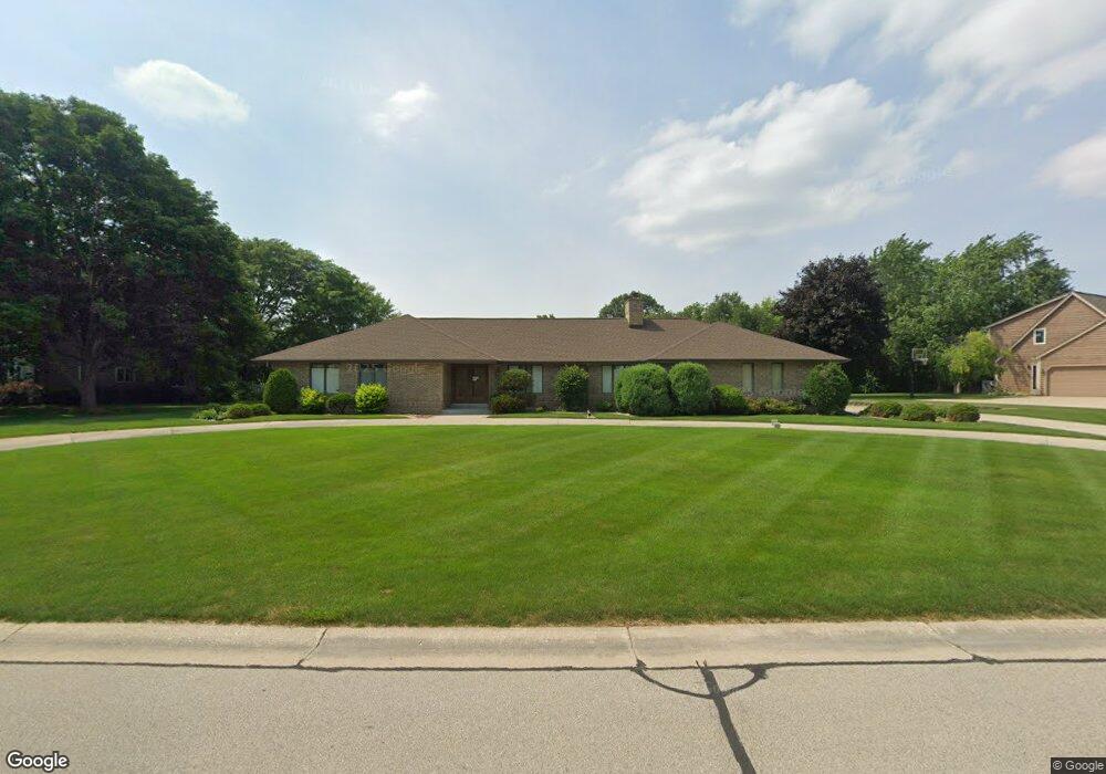
N31W23580 Rough Hill Rd Pewaukee, WI 53072
Estimated Value: $663,742 - $712,000
--
Bed
--
Bath
--
Sq Ft
0.59
Acres
About This Home
This home is located at N31W23580 Rough Hill Rd, Pewaukee, WI 53072 and is currently estimated at $690,936. N31W23580 Rough Hill Rd is a home located in Waukesha County with nearby schools including Pewaukee Lake Elementary School, Asa Clark Middle School, and Pewaukee High School.
Ownership History
Date
Name
Owned For
Owner Type
Purchase Details
Closed on
Dec 14, 2016
Sold by
The Lois Zarth Marital Trust
Bought by
Braun Michael T
Current Estimated Value
Home Financials for this Owner
Home Financials are based on the most recent Mortgage that was taken out on this home.
Original Mortgage
$266,000
Outstanding Balance
$215,121
Interest Rate
3.57%
Mortgage Type
New Conventional
Estimated Equity
$475,815
Purchase Details
Closed on
Jan 11, 2016
Sold by
Zarth Lois A
Bought by
Zarth Lois A and The Lois A Zarth Marital Trust
Purchase Details
Closed on
Jun 6, 1997
Sold by
Zarth Ronald H and Zarth Lois A
Bought by
Zarth Ronald H and Zarth Lois A
Create a Home Valuation Report for This Property
The Home Valuation Report is an in-depth analysis detailing your home's value as well as a comparison with similar homes in the area
Home Values in the Area
Average Home Value in this Area
Purchase History
| Date | Buyer | Sale Price | Title Company |
|---|---|---|---|
| Braun Michael T | $386,000 | None Available | |
| Zarth Lois A | -- | None Available | |
| Zarth Ronald H | -- | -- |
Source: Public Records
Mortgage History
| Date | Status | Borrower | Loan Amount |
|---|---|---|---|
| Open | Braun Michael T | $266,000 |
Source: Public Records
Tax History Compared to Growth
Tax History
| Year | Tax Paid | Tax Assessment Tax Assessment Total Assessment is a certain percentage of the fair market value that is determined by local assessors to be the total taxable value of land and additions on the property. | Land | Improvement |
|---|---|---|---|---|
| 2024 | $5,032 | $439,400 | $154,600 | $284,800 |
| 2023 | $5,005 | $439,400 | $154,600 | $284,800 |
| 2022 | $5,195 | $439,400 | $154,600 | $284,800 |
| 2021 | $5,172 | $439,400 | $154,600 | $284,800 |
| 2020 | $5,493 | $373,000 | $128,700 | $244,300 |
| 2019 | $5,349 | $373,000 | $128,700 | $244,300 |
| 2018 | $5,156 | $373,000 | $128,700 | $244,300 |
| 2017 | $5,275 | $373,000 | $128,700 | $244,300 |
| 2016 | $5,333 | $373,000 | $128,700 | $244,300 |
| 2015 | $5,401 | $373,000 | $128,700 | $244,300 |
| 2014 | $5,898 | $373,000 | $128,700 | $244,300 |
| 2013 | $5,898 | $373,000 | $128,700 | $244,300 |
Source: Public Records
Map
Nearby Homes
- W233N3088 Oakmont Ct E Unit B
- N35W23701 Auburn Ct Unit 1
- N25W24117 River Park Dr Unit 2
- W241N2573 E Parkway Meadow Cir Unit 3
- W229N3655 Sterling Ct
- W240N2500 E Parkway Meadow Cir Unit 8
- W241N2507 E Parkway Meadow Cir Unit 6
- 1339 Hillwood Blvd Unit D
- N26W22577 Oakwood Ln
- 509 Westfield Way Unit F
- N28W22352 Foxwood Ln
- 1023 Waterstone Ct
- W243N2280 Deer Park Dr Unit A
- 1136 Oxbow Ct
- N42W22833 Beacon Ct
- N24W22420 Meadowood Ln
- 1019 Waterstone Ct
- 1039 Waterstone Ct
- N21W24202 Cumberland Dr Unit 23 I
- N21W24305 Cumberland Dr Unit 38 N
- N31W23640 Rough Hill Rd
- N31W23588 Rough Hill Rd
- N31W23611 Rough Hill Rd
- N31W23591 Rough Hill Rd
- W237N3160 Littlefield Ct
- W237N3150 Littlefield Ct
- N31W23569 Woodstream Ct
- N31W23577 Rough Hill Rd
- N31W23696 Rough Hill Rd
- N31W23623 Rough Hill Rd
- N31W23671 Rough Hill Rd
- W235N3144 Greenfield Ln
- N34W23714 Five Fields Rd
- W235N3125 Greenfield Ln
- N31W23545 Woodstream Ct
- N31W23552 Woodstream Ct
- W235N3122 Greenfield Ln
- W237N3179 Littlefield Ct
- W237N3143 Littlefield Ct
- W237N3139 Littlefield Ct