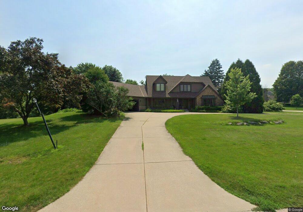
N32W23631 Fieldside Rd Pewaukee, WI 53072
Estimated Value: $508,000 - $814,000
--
Bed
--
Bath
--
Sq Ft
0.49
Acres
About This Home
This home is located at N32W23631 Fieldside Rd, Pewaukee, WI 53072 and is currently estimated at $706,022. N32W23631 Fieldside Rd is a home located in Waukesha County with nearby schools including Pewaukee Lake Elementary School, Asa Clark Middle School, and Pewaukee High School.
Ownership History
Date
Name
Owned For
Owner Type
Purchase Details
Closed on
Apr 20, 1998
Sold by
Clarke Donald P and Clarke Kathleen L
Bought by
Conrad Christopher J and Gunderson Wendy
Current Estimated Value
Home Financials for this Owner
Home Financials are based on the most recent Mortgage that was taken out on this home.
Original Mortgage
$220,000
Interest Rate
7.02%
Mortgage Type
Purchase Money Mortgage
Create a Home Valuation Report for This Property
The Home Valuation Report is an in-depth analysis detailing your home's value as well as a comparison with similar homes in the area
Home Values in the Area
Average Home Value in this Area
Purchase History
| Date | Buyer | Sale Price | Title Company |
|---|---|---|---|
| Conrad Christopher J | $275,000 | -- |
Source: Public Records
Mortgage History
| Date | Status | Borrower | Loan Amount |
|---|---|---|---|
| Previous Owner | Conrad Christopher J | $220,000 | |
| Closed | Conrad Christopher J | $15,000 |
Source: Public Records
Tax History Compared to Growth
Tax History
| Year | Tax Paid | Tax Assessment Tax Assessment Total Assessment is a certain percentage of the fair market value that is determined by local assessors to be the total taxable value of land and additions on the property. | Land | Improvement |
|---|---|---|---|---|
| 2024 | $6,091 | $504,800 | $149,800 | $355,000 |
| 2023 | $6,074 | $504,800 | $149,800 | $355,000 |
| 2022 | $6,302 | $504,800 | $149,800 | $355,000 |
| 2021 | $6,585 | $504,800 | $149,800 | $355,000 |
| 2020 | $6,741 | $415,100 | $121,900 | $293,200 |
| 2019 | $6,582 | $415,100 | $121,900 | $293,200 |
| 2018 | $5,999 | $415,100 | $121,900 | $293,200 |
| 2017 | $5,372 | $370,500 | $121,900 | $248,600 |
| 2016 | $5,572 | $370,500 | $121,900 | $248,600 |
| 2015 | $5,364 | $370,500 | $121,900 | $248,600 |
| 2014 | $5,857 | $370,500 | $121,900 | $248,600 |
| 2013 | $5,857 | $370,500 | $121,900 | $248,600 |
Source: Public Records
Map
Nearby Homes
- N35W23701 Auburn Ct Unit 1
- W233N3088 Oakmont Ct E Unit B
- W229N3655 Sterling Ct
- N25W24117 River Park Dr Unit 2
- W241N2573 E Parkway Meadow Cir Unit 3
- W240N2500 E Parkway Meadow Cir Unit 8
- W241N2507 E Parkway Meadow Cir Unit 6
- 1339 Hillwood Blvd Unit D
- 509 Westfield Way Unit F
- 1023 Waterstone Ct
- N26W22577 Oakwood Ln
- N42W22833 Beacon Ct
- N28W22352 Foxwood Ln
- W243N2280 Deer Park Dr Unit A
- 1136 Oxbow Ct
- 1019 Waterstone Ct
- 1039 Waterstone Ct
- 152A Westfield Way Unit D
- 353 Westfield Way
- 1002 Lilac Ln
- W236N3276 Waterside Ct
- N32W23582 Fieldside Rd
- W236N3262 Waterside Ct
- N33W23655 Fieldside Rd
- W236N3283 Waterside Ct
- N33W23666 Fieldside Rd
- W236N3250 Waterside Ct
- W236N3271 Waterside Ct
- N32W23544 Fieldside Rd
- N33W23697 Fieldside Rd
- N34W23714 Five Fields Rd
- N32W23549 Fieldside Rd
- W236N3244 Waterside Ct
- N33W23676 Fieldside Rd
- N32W23522 Fieldside Rd
- W236N3265 Waterside Ct
- W236N3360 Fieldside Ct
- N32W23527 Fieldside Rd
- N33W23727 Fieldside Rd
- N31W23588 Rough Hill Rd