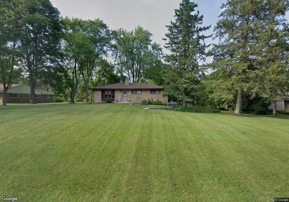
N33W22056 Memory Ln Pewaukee, WI 53072
Estimated Value: $357,125 - $527,000
Studio
--
Bath
--
Sq Ft
20,909
Sq Ft Lot
About This Home
This home is located at N33W22056 Memory Ln, Pewaukee, WI 53072 and is currently estimated at $441,531. N33W22056 Memory Ln is a home located in Waukesha County with nearby schools including Pewaukee Lake Elementary School, Asa Clark Middle School, and Pewaukee High School.
Ownership History
Date
Name
Owned For
Owner Type
Purchase Details
Closed on
Aug 30, 2000
Sold by
Peterson Karen A and Peterson Linda T
Bought by
Wandrey Daniel R and Wandrey Amy B
Current Estimated Value
Home Financials for this Owner
Home Financials are based on the most recent Mortgage that was taken out on this home.
Original Mortgage
$153,528
Outstanding Balance
$52,695
Interest Rate
8.05%
Mortgage Type
FHA
Estimated Equity
$388,836
Purchase Details
Closed on
May 31, 1996
Sold by
Peterson Robert M and Peterson Susan M
Bought by
Peterson Karen A and Peterson Linda T
Home Financials for this Owner
Home Financials are based on the most recent Mortgage that was taken out on this home.
Original Mortgage
$110,600
Interest Rate
7.37%
Create a Home Valuation Report for This Property
The Home Valuation Report is an in-depth analysis detailing your home's value as well as a comparison with similar homes in the area
Home Values in the Area
Average Home Value in this Area
Purchase History
| Date | Buyer | Sale Price | Title Company |
|---|---|---|---|
| Wandrey Daniel R | $154,600 | -- | |
| Peterson Karen A | $122,900 | -- |
Source: Public Records
Mortgage History
| Date | Status | Borrower | Loan Amount |
|---|---|---|---|
| Open | Wandrey Daniel R | $153,528 | |
| Previous Owner | Peterson Karen A | $110,600 |
Source: Public Records
Tax History
| Year | Tax Paid | Tax Assessment Tax Assessment Total Assessment is a certain percentage of the fair market value that is determined by local assessors to be the total taxable value of land and additions on the property. | Land | Improvement |
|---|---|---|---|---|
| 2024 | $3,713 | $246,200 | $92,400 | $153,800 |
| 2023 | $3,880 | $246,200 | $92,400 | $153,800 |
| 2022 | $4,086 | $246,200 | $92,400 | $153,800 |
| 2021 | $3,792 | $246,200 | $92,400 | $153,800 |
| 2020 | $2,708 | $191,500 | $74,500 | $117,000 |
| 2019 | $2,598 | $190,000 | $74,500 | $115,500 |
| 2018 | $3,635 | $190,000 | $74,500 | $115,500 |
| 2017 | $3,636 | $190,000 | $74,500 | $115,500 |
| 2016 | $3,748 | $190,000 | $74,500 | $115,500 |
| 2015 | $3,796 | $190,000 | $74,500 | $115,500 |
| 2014 | $2,904 | $190,000 | $74,500 | $115,500 |
| 2013 | $2,904 | $190,000 | $74,500 | $115,500 |
Source: Public Records
Map
Nearby Homes
- N32W22121 Hill n Dale Cir
- W221N3075 Greenwood Ct
- N29W22090 Kathryn Ct
- N28W22131 Indianwood Ct
- W226N3551 Wethersfield Rd
- 2570 Gaywood Ct
- Lt1 Duplainville Rd
- 2550 Harmony Cir
- N37W22910 Wyndemere Dr
- W224N2507 Ridgewood Ln
- 2465 Lionel Ct
- Lt118 Berwick Ct
- Lt120 Berwick Ct
- Lt116 Berwick Ct
- Lt114 Berwick Ct
- N42W22770 Beacon Ct
- 21965 W North Ave
- W221N4564 Timber Dr
- N35W23668 Auburn Ct
- 1930 Cotton Tail Ln
- N33W22084 Memory Ln
- N33W22024 Memory Ln
- N33W22055 Memory Ln
- W220N3339 Springdale Rd
- N33W22034 Memory Ln
- N33W22081 Memory Ln
- N33W22033 Hill n Dale Cir
- N33W22106 Memory Ln
- N33W22021 Memory Ln
- N33W22101 Memory Ln
- N33W22075 Hill n Dale Cir
- N33W22111 Memory Ln
- N32W22077 Hill n Dale Cir
- W220N3375 Springdale Rd
- N33W22134 Memory Ln
- N32W22043 Hill n Dale Cir
- N32W22020 Hill n Dale Cir
- N32W22095 Hill n Dale Cir
- N33W22050 Hill n Dale Cir
- N33W22135 Memory Ln
Your Personal Tour Guide
Ask me questions while you tour the home.