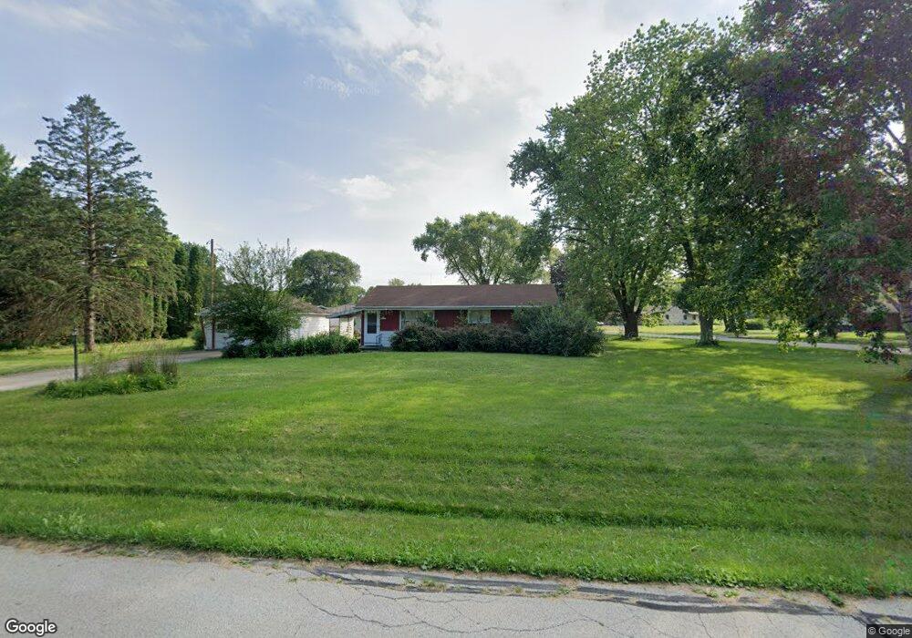
N33W22179 Memory Ln Pewaukee, WI 53072
Estimated Value: $294,428 - $451,000
--
Bed
--
Bath
--
Sq Ft
0.57
Acres
About This Home
This home is located at N33W22179 Memory Ln, Pewaukee, WI 53072 and is currently estimated at $376,857. N33W22179 Memory Ln is a home located in Waukesha County with nearby schools including Pewaukee Lake Elementary School, Asa Clark Middle School, and Pewaukee High School.
Ownership History
Date
Name
Owned For
Owner Type
Purchase Details
Closed on
Sep 24, 1999
Sold by
Lentz Michael J and Estate Of Theodore J Lentz
Bought by
Mccarthy William A
Current Estimated Value
Home Financials for this Owner
Home Financials are based on the most recent Mortgage that was taken out on this home.
Original Mortgage
$87,000
Outstanding Balance
$24,902
Interest Rate
7.37%
Estimated Equity
$351,955
Create a Home Valuation Report for This Property
The Home Valuation Report is an in-depth analysis detailing your home's value as well as a comparison with similar homes in the area
Home Values in the Area
Average Home Value in this Area
Purchase History
| Date | Buyer | Sale Price | Title Company |
|---|---|---|---|
| Mccarthy William A | $132,000 | -- |
Source: Public Records
Mortgage History
| Date | Status | Borrower | Loan Amount |
|---|---|---|---|
| Open | Mccarthy William A | $87,000 |
Source: Public Records
Tax History Compared to Growth
Tax History
| Year | Tax Paid | Tax Assessment Tax Assessment Total Assessment is a certain percentage of the fair market value that is determined by local assessors to be the total taxable value of land and additions on the property. | Land | Improvement |
|---|---|---|---|---|
| 2024 | $2,569 | $205,900 | $97,300 | $108,600 |
| 2023 | $2,532 | $205,900 | $97,300 | $108,600 |
| 2022 | $2,588 | $205,900 | $97,300 | $108,600 |
| 2021 | $2,560 | $205,900 | $97,300 | $108,600 |
| 2020 | $2,566 | $163,200 | $80,400 | $82,800 |
| 2019 | $2,477 | $163,200 | $80,400 | $82,800 |
| 2018 | $2,399 | $163,200 | $80,400 | $82,800 |
| 2017 | $2,411 | $163,200 | $80,400 | $82,800 |
| 2016 | $2,498 | $163,200 | $80,400 | $82,800 |
| 2015 | $2,546 | $163,200 | $80,400 | $82,800 |
| 2014 | $2,466 | $163,200 | $80,400 | $82,800 |
| 2013 | $2,466 | $163,200 | $80,400 | $82,800 |
Source: Public Records
Map
Nearby Homes
- 21445 Gumina Rd
- N28W22352 Foxwood Ln
- W229N3655 Sterling Ct
- N26W22577 Oakwood Ln
- 2550 Harmony Cir
- N42W22833 Beacon Ct
- W233N3088 Oakmont Ct E Unit B
- 21710 Astolat Dr
- 2685 Spencer Ln
- W221N4524 Timber Dr
- Lt115 Berwick Ct
- Lt118 Berwick Ct
- Lt117 Berwick Ct
- Lt120 Berwick Ct
- Lt119 Berwick Ct
- Lt116 Berwick Ct
- Lt114 Berwick Ct
- W220N4551 Timber Dr
- W220N4599 Timber Dr
- W220N4600 Timber Dr
- N33W22159 Memory Ln
- N33W22251 Hill n Dale Cir
- N33W22163 Memory Ln
- N33W22158 Memory Ln
- N33W22214 Hill n Dale Cir
- N33W22271 Hill n Dale Cir
- N33W22135 Memory Ln
- N33W22240 Hill n Dale Cir
- N34W22156 Hill n Dale Cir
- N33W22268 Hill n Dale Cir
- N33W22134 Memory Ln
- N33W22141 Hill n Dale Cir
- N34W22209 Memory Ln
- N34W22202 Memory Ln
- N34W22134 Hill n Dale Cir
- N33W22288 Hill n Dale Cir
- N34W22217 Memory Ln
- N33W22111 Memory Ln
- N33W22106 Memory Ln
- N34W22222 Memory Ln