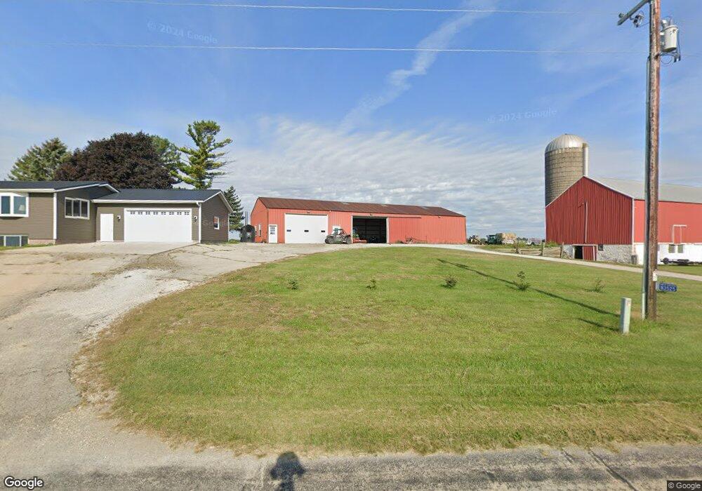
N3525 Level Valley Rd Hustisford, WI 53034
Estimated Value: $367,000 - $450,753
--
Bed
--
Bath
--
Sq Ft
20.05
Acres
About This Home
This home is located at N3525 Level Valley Rd, Hustisford, WI 53034 and is currently estimated at $408,877. N3525 Level Valley Rd is a home with nearby schools including John Hustis Elementary School, Hustisford High School, and Bethany Lutheran School.
Ownership History
Date
Name
Owned For
Owner Type
Purchase Details
Closed on
May 25, 2012
Sold by
Bruce Barry R and Bruce Kari A
Bought by
Meyer Debra L
Current Estimated Value
Home Financials for this Owner
Home Financials are based on the most recent Mortgage that was taken out on this home.
Original Mortgage
$24,682
Outstanding Balance
$17,138
Interest Rate
3.87%
Mortgage Type
Purchase Money Mortgage
Estimated Equity
$391,739
Create a Home Valuation Report for This Property
The Home Valuation Report is an in-depth analysis detailing your home's value as well as a comparison with similar homes in the area
Home Values in the Area
Average Home Value in this Area
Purchase History
| Date | Buyer | Sale Price | Title Company |
|---|---|---|---|
| Meyer Debra L | $95,000 | None Available |
Source: Public Records
Mortgage History
| Date | Status | Borrower | Loan Amount |
|---|---|---|---|
| Open | Meyer Debra L | $24,682 |
Source: Public Records
Tax History Compared to Growth
Tax History
| Year | Tax Paid | Tax Assessment Tax Assessment Total Assessment is a certain percentage of the fair market value that is determined by local assessors to be the total taxable value of land and additions on the property. | Land | Improvement |
|---|---|---|---|---|
| 2024 | $3,441 | $207,500 | $50,400 | $157,100 |
| 2023 | $3,371 | $207,300 | $50,200 | $157,100 |
| 2022 | $3,585 | $207,600 | $50,500 | $157,100 |
| 2021 | $3,109 | $207,500 | $50,400 | $157,100 |
| 2020 | $3,352 | $207,600 | $50,500 | $157,100 |
| 2019 | $3,324 | $207,600 | $50,500 | $157,100 |
| 2018 | $3,149 | $193,600 | $50,400 | $143,200 |
| 2017 | $3,206 | $193,500 | $50,300 | $143,200 |
| 2016 | $3,272 | $193,500 | $50,300 | $143,200 |
| 2015 | $3,251 | $193,500 | $50,300 | $143,200 |
| 2014 | $3,471 | $193,500 | $50,300 | $143,200 |
Source: Public Records
Map
Nearby Homes
- 441 Sandy Ln
- 252 S Hustis St
- 244 S Ridge St
- .68 Acre Parcel Anthony Island
- 727 E Lakeview Rd Unit 8
- 827 E Lakeview Rd
- W4436 E Lakeview Rd
- N4557 Lakeview Rd
- N4510 & N4504 Anthony Island
- N4510 Anthony Island -
- N4554 Lakeview Rd
- W4747 County Road Me
- N4569 Hazelwood Rd
- N4550 County Road Dj
- N4973 Lake Dr
- N5025 Arrowhead Ct
- Lt38 Sinissippi Point Rd
- 000 Lt0 Sleepy Hollow Rd
- N3220 Hale Rd
- Lot 2 Sleepy Hollow
- N3392 Level Valley Rd
- W4259 Nehls Rd
- N3488 County Road Ee
- N3695 County Rd E
- N3574 County Rd E
- N3701 County Rd E
- N3711 County Rd E
- N3367 County Road R
- N3655 County Rd E
- N3719 County Rd E
- N3378 County Road R
- N3613 County Rd E
- N3621 County Rd E
- N3727 County Rd E
- N3648 County Road R
- N3735 County Rd E
- N3785 Level Valley Rd
- N3753 County Rd E
- N3767 County Rd E
- N3771 County Rd E