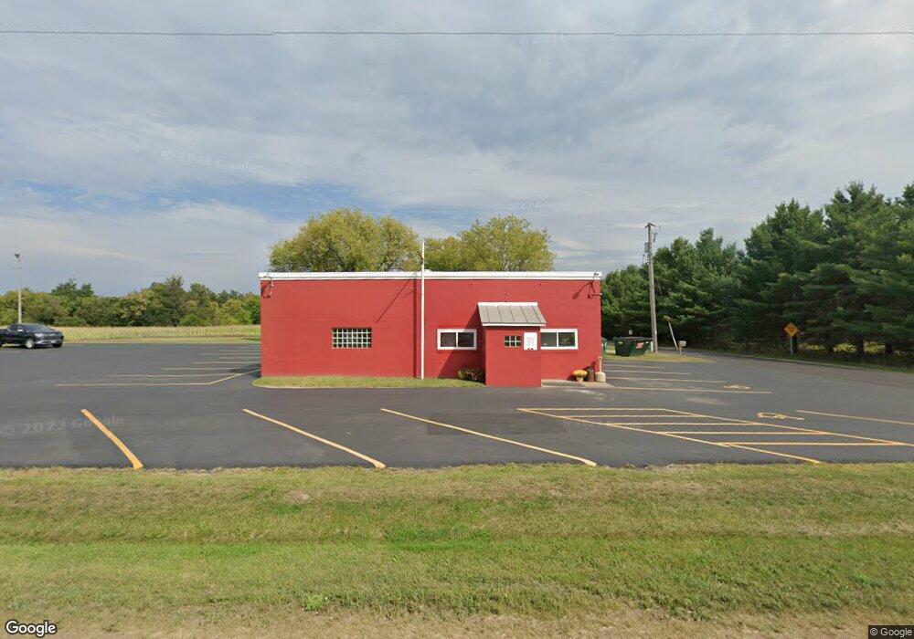
N4004 State Road 49 Waupaca, WI 54981
Estimated Value: $328,637
--
Bed
--
Bath
1,672
Sq Ft
$197/Sq Ft
Est. Value
About This Home
This home is located at N4004 State Road 49, Waupaca, WI 54981 and is currently estimated at $328,637, approximately $196 per square foot. N4004 State Road 49 is a home located in Waupaca County with nearby schools including Waupaca Learning Center Elementary School, Waupaca Middle School, and Waupaca High School.
Ownership History
Date
Name
Owned For
Owner Type
Purchase Details
Closed on
Jan 29, 2024
Sold by
Taber Peter James and Chelberg Carrie Ann
Bought by
Tabers Country Inn Llc
Current Estimated Value
Purchase Details
Closed on
Jul 1, 2019
Sold by
Brodnan Richard J
Bought by
Taber Peter J
Home Financials for this Owner
Home Financials are based on the most recent Mortgage that was taken out on this home.
Original Mortgage
$151,312
Interest Rate
4%
Mortgage Type
Future Advance Clause Open End Mortgage
Purchase Details
Closed on
Sep 23, 2013
Sold by
The Farmers State Bank Of Waupaca
Bought by
Brodnan Richard J
Purchase Details
Closed on
May 9, 2013
Sold by
Dunbar Beverly M
Bought by
Farmers State Bank
Create a Home Valuation Report for This Property
The Home Valuation Report is an in-depth analysis detailing your home's value as well as a comparison with similar homes in the area
Home Values in the Area
Average Home Value in this Area
Purchase History
| Date | Buyer | Sale Price | Title Company |
|---|---|---|---|
| Tabers Country Inn Llc | -- | None Listed On Document | |
| Taber Peter J | $187,500 | None Available | |
| Brodnan Richard J | $100,000 | None Available | |
| Farmers State Bank | $120,000 | None Available |
Source: Public Records
Mortgage History
| Date | Status | Borrower | Loan Amount |
|---|---|---|---|
| Previous Owner | Taber Peter J | $151,312 |
Source: Public Records
Tax History Compared to Growth
Tax History
| Year | Tax Paid | Tax Assessment Tax Assessment Total Assessment is a certain percentage of the fair market value that is determined by local assessors to be the total taxable value of land and additions on the property. | Land | Improvement |
|---|---|---|---|---|
| 2024 | $2,071 | $196,700 | $21,200 | $175,500 |
| 2023 | $2,071 | $121,300 | $20,300 | $101,000 |
| 2022 | $1,902 | $121,300 | $20,300 | $101,000 |
| 2021 | $2,051 | $121,300 | $20,300 | $101,000 |
| 2020 | $2,006 | $121,300 | $20,300 | $101,000 |
| 2019 | $2,073 | $121,300 | $20,300 | $101,000 |
| 2018 | $2,295 | $121,300 | $20,300 | $101,000 |
| 2017 | $2,232 | $121,300 | $20,300 | $101,000 |
| 2016 | $2,232 | $121,300 | $20,300 | $101,000 |
| 2015 | $2,271 | $121,300 | $20,300 | $101,000 |
| 2014 | $2,281 | $121,300 | $20,300 | $101,000 |
| 2013 | $2,283 | $121,300 | $20,300 | $101,000 |
Source: Public Records
Map
Nearby Homes
- 920 Thomas Trail
- 908 Honey Bear Ln
- 901 Thomas Trail
- 401 Bailey St
- 340 North St
- E2264 Meadow Valley Ct
- 409 Scott St
- 113 N State St
- 611 W Fulton St
- 203 Vista Ct
- 200 Vista Ct
- 200 Prairie View Ct
- 0 Nichols Creek Rd Unit 20803047
- 213 S Franklin St
- 726 E Fulton St
- N3480 Feathers Ct
- 0 Covered Bridge Rd Unit 50292957
- 0 Feathers Ct Unit 20803048
- 0 N Hill Rd Unit 20803057
- 0 N Hill Rd Unit 20803055
- N4004 Wisconsin 49
- E2741 Goldsmith Rd
- E2761 Goldsmith Rd
- E2782 Goldsmith Rd
- N4092 State Road 49
- N4089 Wisconsin 49
- N4089 State Road 49
- N3922 State Road 49
- N3915 State Road 49
- 0 Olson Rd Unit 50011557
- 0 Olson Rd Unit 50246103
- 0 Olson Rd Unit 20806400
- 0 Olson Rd Unit 50036922
- N3897 State Road 49
- 0 Goldsmith Rd Unit 20903979
- E2834 Goldsmith Rd
- E2803 Goldsmith Rd
- N3889 Wisconsin 49
- N3889 State Road 49
- E2855 Goldsmith Rd