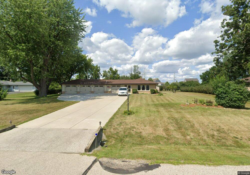
N40W22930 Hattie Ct Pewaukee, WI 53072
Estimated Value: $429,000 - $639,000
--
Bed
--
Bath
--
Sq Ft
0.68
Acres
About This Home
This home is located at N40W22930 Hattie Ct, Pewaukee, WI 53072 and is currently estimated at $517,576. N40W22930 Hattie Ct is a home located in Waukesha County with nearby schools including Pewaukee Lake Elementary School, Asa Clark Middle School, and Pewaukee High School.
Ownership History
Date
Name
Owned For
Owner Type
Purchase Details
Closed on
Jun 3, 2025
Sold by
Jones Keith E and Jones Nancy L
Bought by
Keith E Jones And Nancy L Jones Joint Living
Current Estimated Value
Purchase Details
Closed on
Sep 26, 2007
Sold by
Thomas Audrey F and Nowacki Audrey F
Bought by
Jones Keith E and Jones Nancy L
Home Financials for this Owner
Home Financials are based on the most recent Mortgage that was taken out on this home.
Original Mortgage
$210,000
Interest Rate
6.55%
Mortgage Type
Purchase Money Mortgage
Create a Home Valuation Report for This Property
The Home Valuation Report is an in-depth analysis detailing your home's value as well as a comparison with similar homes in the area
Home Values in the Area
Average Home Value in this Area
Purchase History
| Date | Buyer | Sale Price | Title Company |
|---|---|---|---|
| Keith E Jones And Nancy L Jones Joint Living | -- | None Listed On Document | |
| Jones Keith E | $210,000 | Burnet Title Llc |
Source: Public Records
Mortgage History
| Date | Status | Borrower | Loan Amount |
|---|---|---|---|
| Previous Owner | Jones Keith E | $210,000 |
Source: Public Records
Tax History Compared to Growth
Tax History
| Year | Tax Paid | Tax Assessment Tax Assessment Total Assessment is a certain percentage of the fair market value that is determined by local assessors to be the total taxable value of land and additions on the property. | Land | Improvement |
|---|---|---|---|---|
| 2024 | $3,791 | $307,500 | $108,600 | $198,900 |
| 2023 | $3,757 | $307,500 | $108,600 | $198,900 |
| 2022 | $3,857 | $307,500 | $108,600 | $198,900 |
| 2021 | $3,827 | $307,500 | $108,600 | $198,900 |
| 2020 | $3,877 | $248,600 | $87,700 | $160,900 |
| 2019 | $3,328 | $219,800 | $87,700 | $132,100 |
| 2018 | $3,108 | $212,300 | $87,700 | $124,600 |
| 2017 | $3,112 | $212,300 | $87,700 | $124,600 |
| 2016 | $3,226 | $212,300 | $87,700 | $124,600 |
| 2015 | $3,281 | $212,300 | $87,700 | $124,600 |
| 2014 | $3,269 | $212,300 | $87,700 | $124,600 |
| 2013 | $3,269 | $212,300 | $87,700 | $124,600 |
Source: Public Records
Map
Nearby Homes
- W229N3655 Sterling Ct
- N45W22742 Charlotte Way
- N46W22811 Lindsay Rd
- N35W23690 Auburn Ct Unit 13-1
- W222N4700 Seven Oaks Dr
- W220N4551 Timber Dr
- N35W23701 Auburn Ct Unit 1
- N32W23360 Fieldside Rd
- W220N4599 Timber Dr
- W220N4600 Timber Dr
- W220N4606 Timber Dr
- W238N4620 Woods Edge Dr
- N34W23849 Grace Ave Unit C
- W232N3043 Emerald Ln Unit A
- 21445 Gumina Rd
- N31W22134 Green Rd
- N48W21601 Martha Ln
- N48W21629 Martha Ln
- N48W21577 Martha Ln
- W215N4855 Kathleen Dr
- N40W22890 Sunset Dr
- N40W22950 Hattie Ct
- N40W22917 Hattie Ct
- N40W22870 Sunset Dr
- N41W22831 Sunder Creek Dr
- N41W22829 Sunder Creek Dr
- W229N4019 Sunset Dr
- N40W22957 Hattie Ct
- N40W22869 Sunset Dr
- W228N4048 Sunset Dr
- N40W22850 Sunset Dr
- N41W22835 Sunder Creek Dr
- N41W22817 Sunder Creek Dr
- W229N4032 Sunset Dr
- W228N4063 Crescent Dr
- N41W22839 Sunder Creek Dr
- N40W22828 Sunset Dr
- N41W22795 Sunder Creek Dr
- W229N4011 Sunset Dr
- N41W22812 Sunder Creek Dr