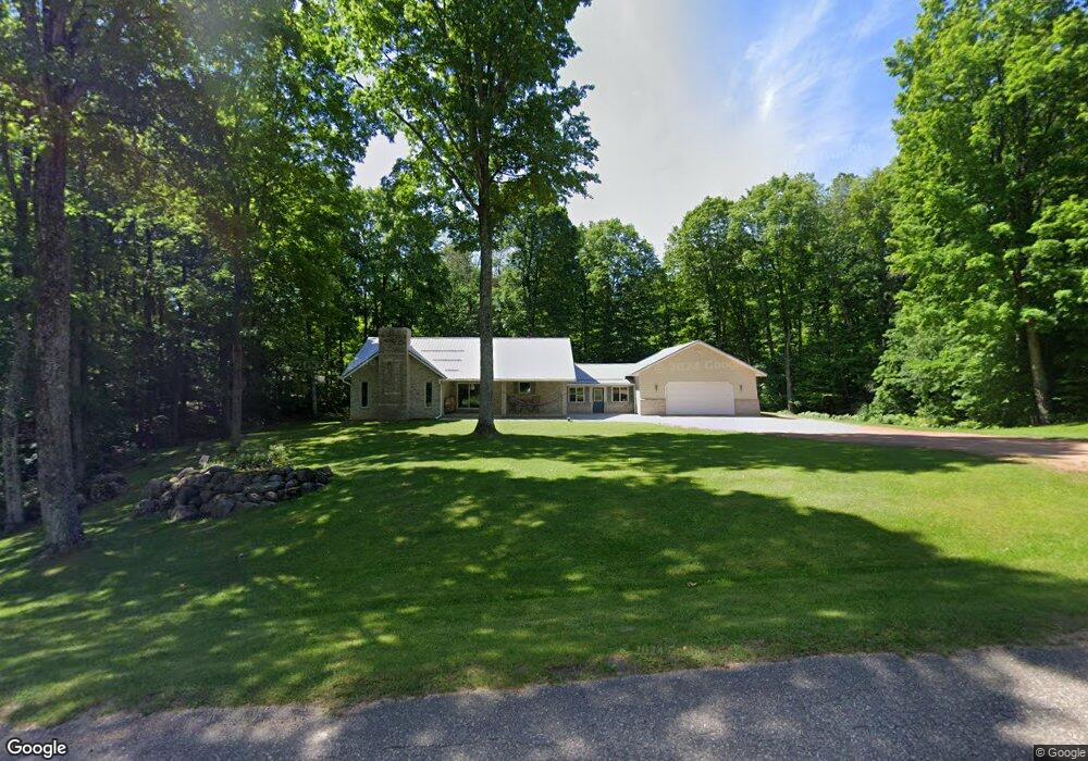
N4219 Maple Dr Antigo, WI 54409
Estimated Value: $307,981 - $443,000
Studio
--
Bath
--
Sq Ft
87,556
Sq Ft Lot
About This Home
This home is located at N4219 Maple Dr, Antigo, WI 54409 and is currently estimated at $375,495. N4219 Maple Dr is a home located in Langlade County with nearby schools including Antigo High School.
Ownership History
Date
Name
Owned For
Owner Type
Purchase Details
Closed on
Jul 18, 2012
Sold by
Walrath Nathan
Bought by
Walrath Heidi
Current Estimated Value
Purchase Details
Closed on
May 31, 2006
Sold by
Eldridge David L and Eldridge Marti L
Bought by
Walrath Nathan and Walrath Heidi
Create a Home Valuation Report for This Property
The Home Valuation Report is an in-depth analysis detailing your home's value as well as a comparison with similar homes in the area
Purchase History
| Date | Buyer | Sale Price | Title Company |
|---|---|---|---|
| Walrath Heidi | -- | Langlade Abstract & Title, C | |
| Walrath Nathan | -- | Community Title Of Northern |
Source: Public Records
Tax History
| Year | Tax Paid | Tax Assessment Tax Assessment Total Assessment is a certain percentage of the fair market value that is determined by local assessors to be the total taxable value of land and additions on the property. | Land | Improvement |
|---|---|---|---|---|
| 2025 | $3,568 | $182,000 | $14,800 | $167,200 |
| 2024 | $32 | $182,000 | $14,800 | $167,200 |
| 2023 | $2,962 | $182,000 | $14,800 | $167,200 |
| 2022 | $2,658 | $182,000 | $14,800 | $167,200 |
| 2021 | $2,783 | $182,000 | $14,800 | $167,200 |
| 2020 | $2,918 | $182,000 | $14,800 | $167,200 |
| 2019 | $2,632 | $182,000 | $14,800 | $167,200 |
| 2018 | $2,564 | $182,000 | $14,800 | $167,200 |
| 2017 | $2,595 | $182,000 | $14,800 | $167,200 |
| 2016 | $2,594 | $191,100 | $14,000 | $177,100 |
| 2015 | $2,626 | $191,100 | $14,000 | $177,100 |
| 2014 | $2,763 | $191,100 | $14,000 | $177,100 |
| 2013 | $2,961 | $191,100 | $14,000 | $177,100 |
Source: Public Records
Map
Nearby Homes
- W7834 State Highway 47
- ON Cth I
- N5352 County Highway I
- N5134 Star Neva Rd
- 826 Eastview Dr
- 520 Alpha Ct
- 905 Langlade Rd
- 324 Center St
- 423 Cth F
- 1813 Neva Rd
- W9496 Cth C
- 2007 Progress Blvd
- 000 Center St
- Lot 9 Ackley St
- 116 5th Ave
- 1727 N Superior St
- 1320 Arctic St
- 1630 N Superior St Unit 1632
- 229 5th Ave
- 1104 Arctic St
- N4254 Polar Rd
- N4204 Maple Dr
- N4191 Maple Dr
- N4302 Hill Rd
- N4236 Hill Rd
- N4265 State Highway 52
- N4196 Maple Dr
- N4220 Hill Rd
- N4249 State Highway 52
- N4206 Hill Rd
- N4150 Maple Dr
- N4167 Maple Dr
- W7520 Hutchwood Rd
- W7852 Acorn Ln
- W7832 Acorn Ln
- W7816 Acorn Ln
- N4142 Maple Dr
- W7838 Acorn Ln
- N4119 Maple Dr
- N4128 Maple Dr
Your Personal Tour Guide
Ask me questions while you tour the home.