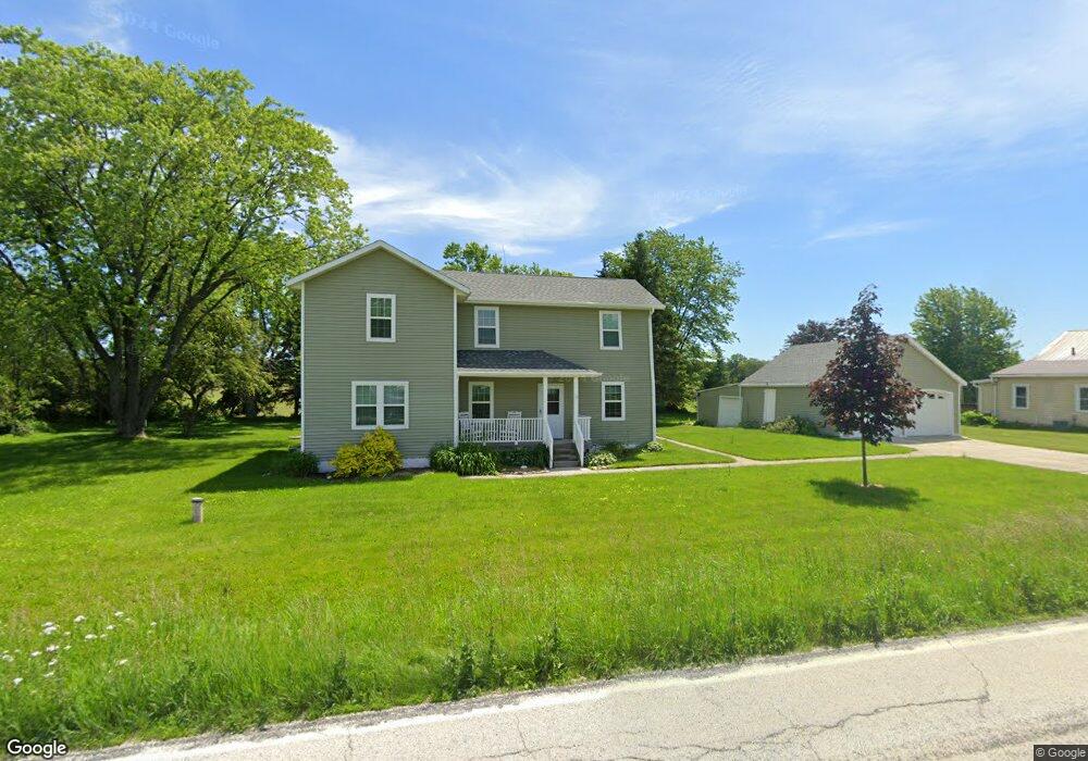
N4243 County Rd S Plymouth, WI 53073
Estimated Value: $413,238 - $480,000
--
Bed
--
Bath
--
Sq Ft
0.72
Acres
About This Home
This home is located at N4243 County Rd S, Plymouth, WI 53073 and is currently estimated at $436,310. N4243 County Rd S is a home located in Sheboygan County with nearby schools including Plymouth High School.
Ownership History
Date
Name
Owned For
Owner Type
Purchase Details
Closed on
Jul 31, 2020
Sold by
Fenske Cole A and Fenske Katie
Bought by
Lessnau Rob J and Lessnau Deborah A
Current Estimated Value
Home Financials for this Owner
Home Financials are based on the most recent Mortgage that was taken out on this home.
Original Mortgage
$204,000
Outstanding Balance
$181,296
Interest Rate
3.1%
Mortgage Type
New Conventional
Estimated Equity
$255,014
Purchase Details
Closed on
Apr 15, 2016
Sold by
Fenske Cole A. Cole A. and Fenske Cole A
Bought by
Dix Robert W and Dix Kimberly A
Purchase Details
Closed on
Nov 19, 2013
Sold by
Dix Robert W. & Kimberly A. Robert W. & Kimberly A.
Bought by
Gerken Shanon L and Gerken Krista L
Create a Home Valuation Report for This Property
The Home Valuation Report is an in-depth analysis detailing your home's value as well as a comparison with similar homes in the area
Home Values in the Area
Average Home Value in this Area
Purchase History
| Date | Buyer | Sale Price | Title Company |
|---|---|---|---|
| Lessnau Rob J | $255,000 | New Title Company Name | |
| Dix Robert W | $189,000 | -- | |
| Gerken Shanon L | $25,000 | -- |
Source: Public Records
Mortgage History
| Date | Status | Borrower | Loan Amount |
|---|---|---|---|
| Open | Lessnau Rob J | $204,000 |
Source: Public Records
Tax History Compared to Growth
Tax History
| Year | Tax Paid | Tax Assessment Tax Assessment Total Assessment is a certain percentage of the fair market value that is determined by local assessors to be the total taxable value of land and additions on the property. | Land | Improvement |
|---|---|---|---|---|
| 2024 | $4,171 | $340,700 | $32,600 | $308,100 |
| 2023 | $3,687 | $340,700 | $32,600 | $308,100 |
| 2022 | $3,535 | $207,400 | $23,200 | $184,200 |
| 2021 | $3,628 | $207,400 | $23,200 | $184,200 |
| 2020 | $2,736 | $160,900 | $23,200 | $137,700 |
| 2019 | $2,761 | $160,900 | $23,200 | $137,700 |
| 2018 | $2,639 | $160,900 | $23,200 | $137,700 |
| 2017 | $2,449 | $160,900 | $23,200 | $137,700 |
| 2016 | $2,421 | $160,900 | $23,200 | $137,700 |
| 2015 | $697 | $46,000 | $23,200 | $22,800 |
| 2014 | $260 | $25,000 | $23,200 | $1,800 |
Source: Public Records
Map
Nearby Homes
- W7571 County Rd N
- W7435 County Road V
- 617 Lake St
- 543 Clark St
- 612 Lake St
- Lt9 Bobolink Ln
- 627 Bobolink Ln
- Lt0 Clark St
- Lt54 Upper Greystone Dr
- Lt55 Upper Greystone Dr
- Lt53 Upper Greystone Dr
- Lt61 Upper Greystone Dr
- Elizabeth Plan at Greystone Settlement
- Springfield Plan at Greystone Settlement
- Simen Plan at Greystone Settlement
- Montrose Manor II Plan at Greystone Settlement
- Vintage Plan at Greystone Settlement
- Barbara Plan at Greystone Settlement
- Sarah Plan at Greystone Settlement
- Elizabeth II Plan at Greystone Settlement
- N4237 County Rd S
- N4259 County Rd S
- N4306 County Rd S
- W7274 County Road U
- N4313 County Rd S
- W7252 Kettle View Rd
- N4322 County Rd S
- N4330 County Rd S
- W7310 County Rd N
- W7228 Kettle View Rd
- N4376 County Rd S
- W7283 County Rd N
- W7196 County Rd N
- W7325 County Rd N
- W7309 County Rd N
- W7229 County Rd N
- N4386 County Rd S
- W7347 County Rd N
- N4404 County Rd S
- W7462 Kettle View Rd