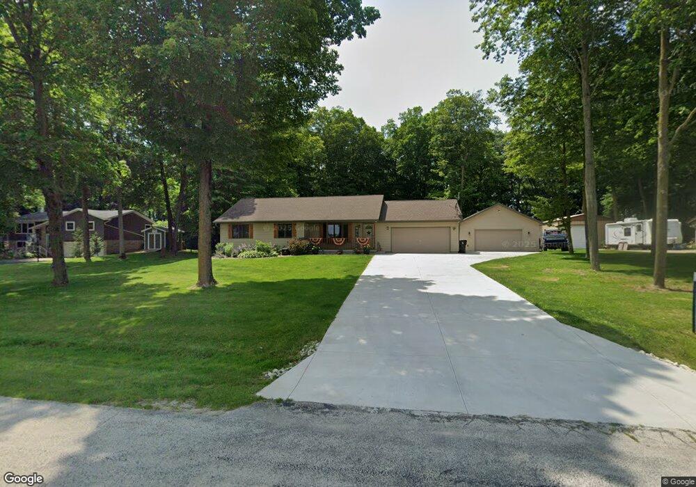
N4277 Maple Dr Iron Ridge, WI 53035
Estimated Value: $310,597 - $396,000
--
Bed
--
Bath
--
Sq Ft
0.57
Acres
About This Home
This home is located at N4277 Maple Dr, Iron Ridge, WI 53035 and is currently estimated at $359,149. N4277 Maple Dr is a home located in Dodge County with nearby schools including John Hustis Elementary School, Hustisford High School, and Bethany Lutheran School.
Ownership History
Date
Name
Owned For
Owner Type
Purchase Details
Closed on
Aug 19, 2016
Sold by
Luebke Michael
Bought by
Luebke Michael and Budnik Jennifer M
Current Estimated Value
Purchase Details
Closed on
Feb 28, 2007
Sold by
Miller Scott A
Bought by
Luenke Michael
Home Financials for this Owner
Home Financials are based on the most recent Mortgage that was taken out on this home.
Original Mortgage
$164,825
Outstanding Balance
$99,821
Interest Rate
6.27%
Mortgage Type
Purchase Money Mortgage
Estimated Equity
$259,328
Create a Home Valuation Report for This Property
The Home Valuation Report is an in-depth analysis detailing your home's value as well as a comparison with similar homes in the area
Home Values in the Area
Average Home Value in this Area
Purchase History
| Date | Buyer | Sale Price | Title Company |
|---|---|---|---|
| Luebke Michael | -- | None Available | |
| Luenke Michael | $173,500 | None Available |
Source: Public Records
Mortgage History
| Date | Status | Borrower | Loan Amount |
|---|---|---|---|
| Open | Luenke Michael | $164,825 |
Source: Public Records
Tax History Compared to Growth
Tax History
| Year | Tax Paid | Tax Assessment Tax Assessment Total Assessment is a certain percentage of the fair market value that is determined by local assessors to be the total taxable value of land and additions on the property. | Land | Improvement |
|---|---|---|---|---|
| 2024 | $2,919 | $177,800 | $36,800 | $141,000 |
| 2023 | $2,855 | $177,800 | $36,800 | $141,000 |
| 2022 | $3,036 | $177,800 | $36,800 | $141,000 |
| 2021 | $2,625 | $177,800 | $36,800 | $141,000 |
| 2020 | $2,837 | $177,800 | $36,800 | $141,000 |
| 2019 | $2,813 | $177,800 | $36,800 | $141,000 |
| 2018 | $2,644 | $164,500 | $36,800 | $127,700 |
| 2017 | $2,699 | $164,500 | $36,800 | $127,700 |
| 2016 | $2,751 | $164,500 | $36,800 | $127,700 |
| 2015 | $2,738 | $164,500 | $36,800 | $127,700 |
| 2014 | $2,951 | $164,500 | $36,800 | $127,700 |
Source: Public Records
Map
Nearby Homes
- 109 S Lake St
- .68 Acre Parcel Anthony Island
- N4510 & N4504 Anthony Island
- N4510 Anthony Island -
- 244 S Ridge St
- N4690 Lake Dr
- 727 E Lakeview Rd Unit 8
- N4973 Lake Dr
- N4554 Lakeview Rd
- N5413 County Rd S
- N4550 County Road Dj
- 0 Burkwald Ave
- W2824 Fox Rd
- 202 East Ave
- 234 Watertower Cir
- Lt1 Lilly Rd
- Lt0 Lilly Rd
- Lt2 Lilly Rd
- Lt0 E Neda Rd
- N6436 County Road Tw
- N4287 Maple Dr
- N4269 Maple Dr
- N4295 Maple Dr
- N4270 Maple Dr
- N4255 Maple Dr
- N4298 Maple Dr
- W3684 E Maple Dr
- N4235 Maple Dr
- N4216 Maple Dr
- W3687 E Maple Dr
- N4211 Maple Dr
- N4202 Maple Dr
- N4189 Maple Dr
- W3703 Oak Lawn Rd
- W3696 Oak Lawn Rd
- N4170 Maple Dr
- N4152 Maple Dr
- N4311 Rich Glo Ln
- N4316 Rich Glo Ln
- N4322 Rich Glo Ln