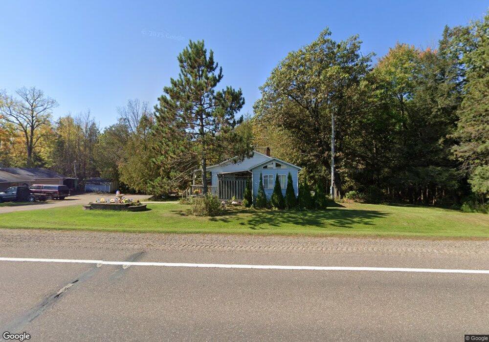
N4305 State Highway 13 Medford, WI 54451
Estimated Value: $201,000 - $243,000
--
Bed
--
Bath
--
Sq Ft
0.9
Acres
About This Home
This home is located at N4305 State Highway 13, Medford, WI 54451 and is currently estimated at $215,520. N4305 State Highway 13 is a home located in Taylor County with nearby schools including Medford High School, Rural Virtual Academy, and Immanuel Lutheran School.
Ownership History
Date
Name
Owned For
Owner Type
Purchase Details
Closed on
Jan 4, 2018
Sold by
Sislo Daniel A and Sislo Margaret A
Bought by
Krawczyk Terrance D and Krawczyk Kimberly A
Current Estimated Value
Home Financials for this Owner
Home Financials are based on the most recent Mortgage that was taken out on this home.
Original Mortgage
$132,554
Outstanding Balance
$112,212
Interest Rate
4.5%
Mortgage Type
FHA
Estimated Equity
$103,308
Create a Home Valuation Report for This Property
The Home Valuation Report is an in-depth analysis detailing your home's value as well as a comparison with similar homes in the area
Home Values in the Area
Average Home Value in this Area
Purchase History
| Date | Buyer | Sale Price | Title Company |
|---|---|---|---|
| Krawczyk Terrance D | $135,000 | Midwest Title Services, Llc |
Source: Public Records
Mortgage History
| Date | Status | Borrower | Loan Amount |
|---|---|---|---|
| Open | Krawczyk Terrance D | $132,554 |
Source: Public Records
Tax History Compared to Growth
Tax History
| Year | Tax Paid | Tax Assessment Tax Assessment Total Assessment is a certain percentage of the fair market value that is determined by local assessors to be the total taxable value of land and additions on the property. | Land | Improvement |
|---|---|---|---|---|
| 2024 | $2,355 | $185,100 | $9,000 | $176,100 |
| 2023 | $2,358 | $185,100 | $9,000 | $176,100 |
| 2022 | $1,902 | $137,400 | $17,300 | $120,100 |
| 2021 | $1,842 | $122,500 | $16,200 | $106,300 |
| 2020 | $2,154 | $122,500 | $16,200 | $106,300 |
| 2019 | $2,083 | $122,500 | $16,200 | $106,300 |
| 2018 | $1,410 | $88,400 | $12,000 | $76,400 |
| 2017 | $1,552 | $88,400 | $12,000 | $76,400 |
| 2016 | $1,567 | $88,400 | $12,000 | $76,400 |
| 2015 | $1,562 | $88,400 | $12,000 | $76,400 |
| 2014 | $1,521 | $88,400 | $12,000 | $76,400 |
| 2013 | $1,582 | $88,400 | $12,000 | $76,400 |
Source: Public Records
Map
Nearby Homes
- W5729 Jolly Ave
- N3855 Shattuck St
- W5451 Correction Ln
- N3652 Shattuck St
- 0 Perkinstown Ave Unit 50305963
- N3334 Oak Ridge Rd Unit Lot B
- N3334 Oak Ridge Rd
- 620 Williams Ct
- N3282 Woodland Rd
- 652 N 2nd St
- 549 Zirngible Cir
- W6306 Hillcrest Rd
- 529 N 2nd St
- 405 W Pine St
- 344 Urquhart St
- 210 N Main St
- 0 State Highway 13 Unit 11500582
- 526 Broadway Place
- 227 S Park Ave
- 125.87 Acres Johns Ln
- N4305 State Highway 13
- N4258 State Highway 13
- N4258 State Highway 13
- n 4258 State Highway 13
- 4258 State Highway 13
- N4270 State Highway 13
- N4308 State Highway 13
- n 4308 State Highway 13
- n 4308 State Highway 13
- N4341 State Highway 13
- n 4341 State Highway 13
- N4362 State Highway 13
- N4365 State Highway 13
- N4391 State Highway 13
- 1.40 Acres Mol Highway 13
- 1.40 Acres MOL Highway 13
- W5655 Pleasant Ave
- W5595 Pleasant Ave
- +/-14.11 Acres Pleasant Ave
- W5523 Pleasant Ave