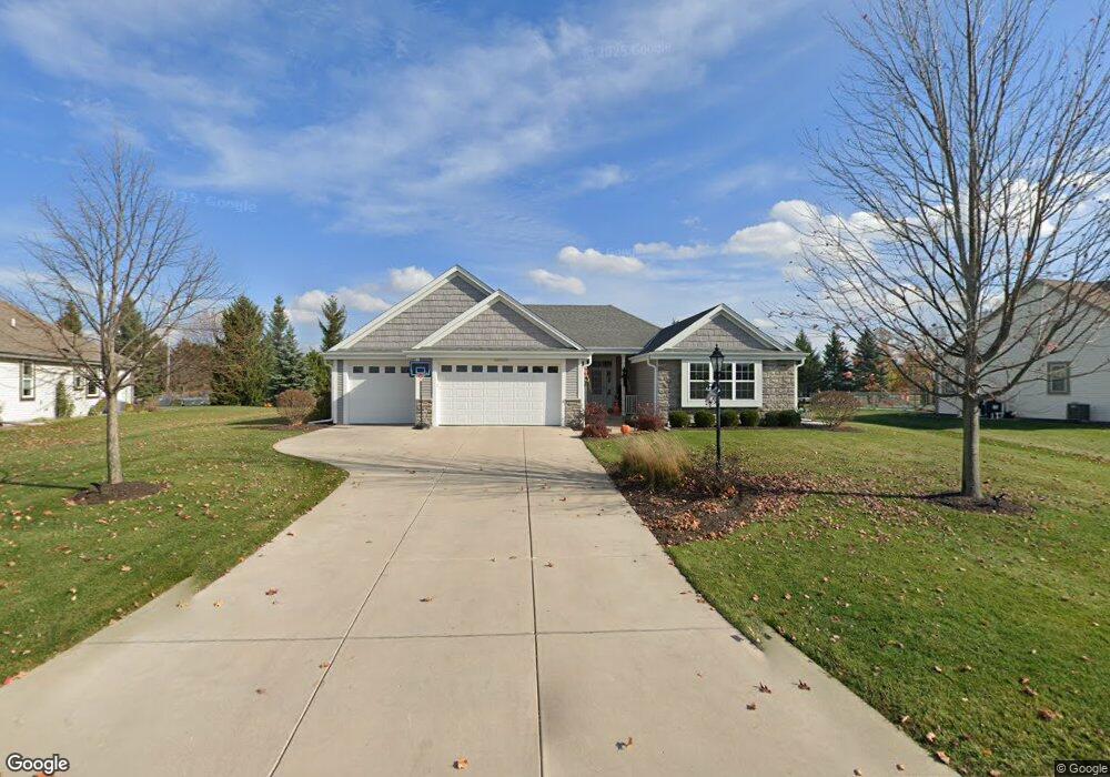
N43W22674 Bridge St Pewaukee, WI 53072
Estimated Value: $684,000 - $769,000
Studio
--
Bath
--
Sq Ft
24,829
Sq Ft Lot
About This Home
This home is located at N43W22674 Bridge St, Pewaukee, WI 53072 and is currently estimated at $714,992. N43W22674 Bridge St is a home with nearby schools including Pewaukee Lake Elementary School, Asa Clark Middle School, and Pewaukee High School.
Ownership History
Date
Name
Owned For
Owner Type
Purchase Details
Closed on
Nov 30, 2011
Sold by
Mk/S Ep Llc
Bought by
Johnson Michael A and Johnson Angela M
Current Estimated Value
Home Financials for this Owner
Home Financials are based on the most recent Mortgage that was taken out on this home.
Original Mortgage
$306,375
Outstanding Balance
$209,581
Interest Rate
4.01%
Mortgage Type
New Conventional
Estimated Equity
$505,411
Create a Home Valuation Report for This Property
The Home Valuation Report is an in-depth analysis detailing your home's value as well as a comparison with similar homes in the area
Home Values in the Area
Average Home Value in this Area
Purchase History
| Date | Buyer | Sale Price | Title Company |
|---|---|---|---|
| Johnson Michael A | $322,500 | None Available |
Source: Public Records
Mortgage History
| Date | Status | Borrower | Loan Amount |
|---|---|---|---|
| Open | Johnson Michael A | $306,375 |
Source: Public Records
Tax History
| Year | Tax Paid | Tax Assessment Tax Assessment Total Assessment is a certain percentage of the fair market value that is determined by local assessors to be the total taxable value of land and additions on the property. | Land | Improvement |
|---|---|---|---|---|
| 2024 | $6,242 | $511,200 | $127,500 | $383,700 |
| 2023 | $6,212 | $511,200 | $127,500 | $383,700 |
| 2022 | $6,401 | $511,200 | $127,500 | $383,700 |
| 2021 | $6,365 | $511,200 | $127,500 | $383,700 |
| 2020 | $6,107 | $393,900 | $104,200 | $289,700 |
| 2019 | $5,945 | $393,900 | $104,200 | $289,700 |
| 2018 | $5,729 | $393,900 | $104,200 | $289,700 |
| 2017 | $5,019 | $345,800 | $56,100 | $289,700 |
| 2016 | $4,796 | $318,200 | $56,100 | $262,100 |
| 2015 | $4,581 | $318,200 | $56,100 | $262,100 |
| 2014 | $5,002 | $318,200 | $56,100 | $262,100 |
| 2013 | $5,002 | $318,200 | $56,100 | $262,100 |
Source: Public Records
Map
Nearby Homes
- N42W22770 Beacon Ct
- N47W22683 Weyer Rd
- Lt1 Duplainville Rd
- W221N4564 Timber Dr
- N37W22910 Wyndemere Dr
- W226N3551 Wethersfield Rd
- N48W21601 Martha Ln
- N48 W21629 Martha Ln
- W215N4855 Kathleen Dr
- W215N4905 Kathleen Dr
- N39W23612 Grey Fox Ct
- N49W21592 Kathleen Dr
- W214N4894 Casey Ct
- W214N4932 Casey Ct
- N35W23668 Auburn Ct
- N35W23701 Auburn Ct Unit 1
- N51W18554 Loveland Way
- N32W22121 Hill n Dale Cir
- Lt1 Lisbon Rd
- W242N4251 Swan Rd
- N44W22696 Bridge St
- N43W22652 Victoria St
- N44W22718 Bridge St
- N44W22711 Bridge St
- N43W22748 Victoria St
- N43W22651 Victoria St
- N43W22663 Victoria St
- W227N4346 Bridge St
- N44W22729 Bridge St
- N43W22727 Victoria St
- N43W22772 Victoria St
- N43W22755 Victoria St
- N43W22755 Victoria St Unit N43W22755
- N44W22743 Bridge St
- N43W22788 Victoria St
- n44w Bridge Ct
- N42W22668 Brighton Ct
- N43W22769 Victoria St
- N42W22690 Brighton Ct
- N42W22712 Brighton Ct
Your Personal Tour Guide
Ask me questions while you tour the home.