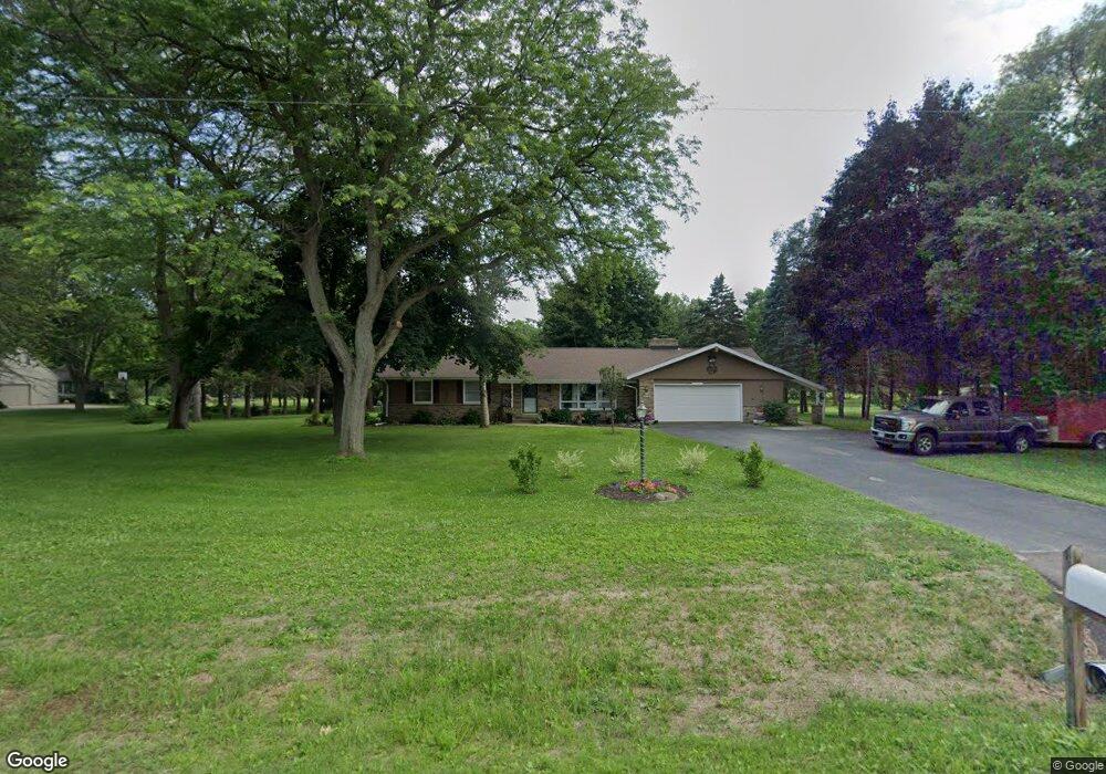
N44W23767 Lindsay Rd Pewaukee, WI 53072
Estimated Value: $458,272 - $600,000
--
Bed
--
Bath
--
Sq Ft
2.83
Acres
About This Home
This home is located at N44W23767 Lindsay Rd, Pewaukee, WI 53072 and is currently estimated at $533,818. N44W23767 Lindsay Rd is a home located in Waukesha County with nearby schools including Maple Avenue Elementary School, Templeton Middle School, and Hamilton High School.
Ownership History
Date
Name
Owned For
Owner Type
Purchase Details
Closed on
Nov 14, 2017
Sold by
Lunowa Cathleen A
Bought by
Sherman Samuel
Current Estimated Value
Home Financials for this Owner
Home Financials are based on the most recent Mortgage that was taken out on this home.
Original Mortgage
$288,100
Outstanding Balance
$241,414
Interest Rate
3.85%
Mortgage Type
New Conventional
Estimated Equity
$292,404
Purchase Details
Closed on
Mar 16, 2009
Sold by
Sette Nicholas A
Bought by
Sette Nicholas A and Nicholas A Sette Revocable Trust
Create a Home Valuation Report for This Property
The Home Valuation Report is an in-depth analysis detailing your home's value as well as a comparison with similar homes in the area
Home Values in the Area
Average Home Value in this Area
Purchase History
| Date | Buyer | Sale Price | Title Company |
|---|---|---|---|
| Sherman Samuel | $315,000 | None Available | |
| Sette Nicholas A | -- | None Available |
Source: Public Records
Mortgage History
| Date | Status | Borrower | Loan Amount |
|---|---|---|---|
| Open | Sherman Samuel | $288,100 |
Source: Public Records
Tax History Compared to Growth
Tax History
| Year | Tax Paid | Tax Assessment Tax Assessment Total Assessment is a certain percentage of the fair market value that is determined by local assessors to be the total taxable value of land and additions on the property. | Land | Improvement |
|---|---|---|---|---|
| 2024 | $4,375 | $339,600 | $150,300 | $189,300 |
| 2023 | $4,057 | $328,600 | $150,300 | $178,300 |
| 2022 | $4,015 | $328,600 | $150,300 | $178,300 |
| 2021 | $3,819 | $328,600 | $150,300 | $178,300 |
| 2020 | $4,009 | $275,500 | $121,400 | $154,100 |
| 2019 | $4,040 | $275,500 | $121,400 | $154,100 |
| 2018 | $3,492 | $275,500 | $121,400 | $154,100 |
| 2017 | $3,643 | $275,500 | $121,400 | $154,100 |
| 2016 | $3,529 | $275,500 | $121,400 | $154,100 |
| 2015 | $3,964 | $275,500 | $121,400 | $154,100 |
| 2014 | $3,892 | $275,500 | $121,400 | $154,100 |
| 2013 | $3,892 | $275,500 | $121,400 | $154,100 |
Source: Public Records
Map
Nearby Homes
- W238N4620 Woods Edge Dr
- N46W22811 Lindsay Rd
- N45W22742 Charlotte Way
- N35W23690 Auburn Ct Unit 13-1
- N35W23701 Auburn Ct Unit 1
- 533 Westfield Way Unit C
- W237N5468 Limestone Ct
- N34W23849 Grace Ave Unit C
- W237N5478 Fieldstone Pass Cir
- 1339 Hillwood Blvd Unit D
- W238N5544 Fieldstone Pass Cir
- N55W23912 Fieldstone Pass Cir
- W229N3655 Sterling Ct
- W242N5613 Peppertree Dr S
- 353 Westfield Way
- 339 Jonathan Dr
- N55W23842 Fieldstone Pass Cir
- 1356 Greenhedge Rd Unit C1
- 1356 Greenhedge Rd Unit C7
- W242N5607 Simona Ct
- N44W23797 Lindsay Rd
- N44W23733 Lindsay Rd
- N45W23792 Lindsay Rd
- N44W23845 Lindsay Rd
- W238N4518 Woods Edge Dr
- N44W23675 Lindsay Rd
- N45W23714 Lindsay Rd
- N46W23787 Woods Edge Ct
- W238N4523 Woods Edge Dr
- N46W23765 Woods Edge Ct
- W238N4551 Woods Edge Dr
- 23787 Woods Edge Ct
- N46W23743 Woods Edge Ct
- W223N4477 Planetree Trail
- W238N4573 Woods Edge Dr
- N46W23777 Woods Edge Ct
- W238N4375 Farm Field Cir
- N45W23587 Lindsay Rd
- W238N4625 Woods Edge Dr
- N45W23541 Lindsay Rd