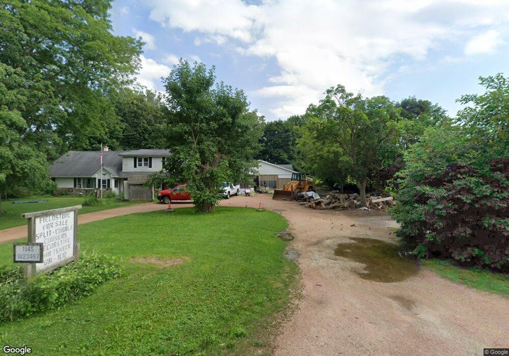
N45W23467 Lindsay Rd Pewaukee, WI 53072
Estimated Value: $428,986 - $677,000
--
Bed
--
Bath
--
Sq Ft
1.98
Acres
About This Home
This home is located at N45W23467 Lindsay Rd, Pewaukee, WI 53072 and is currently estimated at $533,497. N45W23467 Lindsay Rd is a home located in Waukesha County with nearby schools including Maple Avenue Elementary School, Templeton Middle School, and Hamilton High School.
Ownership History
Date
Name
Owned For
Owner Type
Purchase Details
Closed on
Jun 29, 2022
Sold by
Kaerek Homes Inc
Bought by
Johnson Evan T and Johnson Alexandria C
Current Estimated Value
Purchase Details
Closed on
Apr 6, 2022
Sold by
Woodleaf Investments Llc
Bought by
Johnson Bryan Alan and Henry Tricia Torsella
Purchase Details
Closed on
Mar 14, 2022
Sold by
Woodleaf Investments Llc
Bought by
Medicherla Nageswara Rao and Medicherla Usha Lakshmi
Purchase Details
Closed on
Jun 26, 2017
Sold by
Nettesheim William J
Bought by
Nettesheim Alice E
Create a Home Valuation Report for This Property
The Home Valuation Report is an in-depth analysis detailing your home's value as well as a comparison with similar homes in the area
Home Values in the Area
Average Home Value in this Area
Purchase History
| Date | Buyer | Sale Price | Title Company |
|---|---|---|---|
| Johnson Evan T | $604,200 | Jacobi Ryan M | |
| Johnson Bryan Alan | $159,000 | Frontier Title | |
| Medicherla Nageswara Rao | $165,000 | Frontier Title | |
| Nettesheim Alice E | $311,000 | -- |
Source: Public Records
Tax History Compared to Growth
Tax History
| Year | Tax Paid | Tax Assessment Tax Assessment Total Assessment is a certain percentage of the fair market value that is determined by local assessors to be the total taxable value of land and additions on the property. | Land | Improvement |
|---|---|---|---|---|
| 2024 | $3,637 | $310,300 | $131,600 | $178,700 |
| 2023 | $3,469 | $310,300 | $131,600 | $178,700 |
| 2022 | $3,794 | $310,300 | $131,600 | $178,700 |
| 2021 | $3,287 | $310,300 | $131,600 | $178,700 |
| 2020 | $3,955 | $294,100 | $108,700 | $185,400 |
| 2019 | $4,003 | $294,100 | $108,700 | $185,400 |
| 2018 | $3,427 | $294,100 | $108,700 | $185,400 |
| 2017 | $4,306 | $294,100 | $108,700 | $185,400 |
| 2016 | $3,778 | $294,100 | $108,700 | $185,400 |
| 2015 | $3,843 | $289,100 | $108,700 | $180,400 |
| 2014 | $4,093 | $289,100 | $108,700 | $180,400 |
| 2013 | $4,093 | $289,100 | $108,700 | $180,400 |
Source: Public Records
Map
Nearby Homes
- W238N4620 Woods Edge Dr
- N46W22811 Lindsay Rd
- N45W22742 Charlotte Way
- W222N4700 Seven Oaks Dr
- W237N5468 Limestone Ct
- N35W23690 Auburn Ct Unit 13-1
- W229N3655 Sterling Ct
- W237N5478 Fieldstone Pass Cir
- N35W23701 Auburn Ct Unit 1
- W238N5544 Fieldstone Pass Cir
- N55W23912 Fieldstone Pass Cir
- W220N4551 Timber Dr
- W220N4599 Timber Dr
- W220N4600 Timber Dr
- W220N4606 Timber Dr
- N34W23849 Grace Ave Unit C
- N55W23842 Fieldstone Pass Cir
- 533 Westfield Way Unit C
- W242N5613 Peppertree Dr S
- W242N5607 Simona Ct
- W234N4575 Lori Ln
- Lt0 Lori Ln
- N46W23423 Lindsay Rd
- W234N4592 Lori Ln
- W234N4586 Lori Ln
- N46W23355 Lindsay Rd
- N45W23587 Lindsay Rd
- N46W23347 Lindsay Rd
- W223N4477 Planetree Trail
- N45W23541 Lindsay Rd
- N43W23257 Beaver Ct
- N43W23295 Beaver Ct
- N44W23675 Lindsay Rd
- N43W23238 Beaver Ct
- N43W23266 Beaver Ct
- N45W23714 Lindsay Rd
- N43W23289 Beaver Ct
- N46W23743 Woods Edge Ct
- N44W23733 Lindsay Rd
- N46W23765 Woods Edge Ct