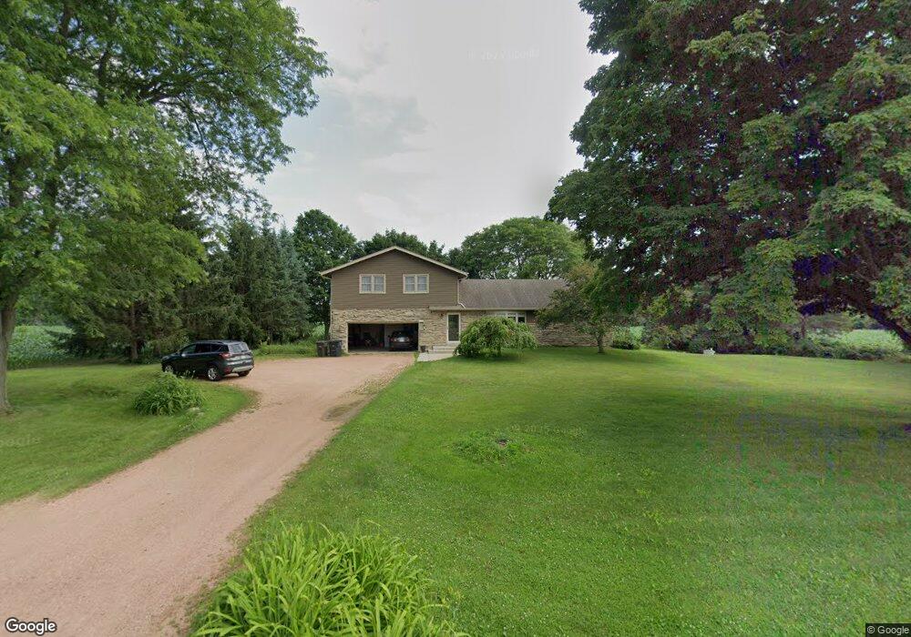
N45W23587 Lindsay Rd Pewaukee, WI 53072
Estimated Value: $428,555 - $561,000
Studio
--
Bath
--
Sq Ft
41,818
Sq Ft Lot
About This Home
This home is located at N45W23587 Lindsay Rd, Pewaukee, WI 53072 and is currently estimated at $496,639. N45W23587 Lindsay Rd is a home located in Waukesha County with nearby schools including Maple Avenue Elementary School, Templeton Middle School, and Hamilton High School.
Ownership History
Date
Name
Owned For
Owner Type
Purchase Details
Closed on
May 14, 2021
Sold by
Johns Judith A
Bought by
Eisner Zachary and Eisner Kelsey
Current Estimated Value
Home Financials for this Owner
Home Financials are based on the most recent Mortgage that was taken out on this home.
Original Mortgage
$332,500
Outstanding Balance
$300,857
Interest Rate
3%
Mortgage Type
New Conventional
Estimated Equity
$195,782
Purchase Details
Closed on
Oct 19, 2016
Sold by
Johns Chris D
Bought by
Johns Judith A
Purchase Details
Closed on
Nov 10, 2015
Sold by
Johns Elizabeth A
Bought by
Elizabeth A Johns Revocable Living Trust
Create a Home Valuation Report for This Property
The Home Valuation Report is an in-depth analysis detailing your home's value as well as a comparison with similar homes in the area
Home Values in the Area
Average Home Value in this Area
Purchase History
| Date | Buyer | Sale Price | Title Company |
|---|---|---|---|
| Eisner Zachary | $350,000 | Prism Title | |
| Johns Judith A | -- | None Available | |
| Elizabeth A Johns Revocable Living Trust | -- | None Available |
Source: Public Records
Mortgage History
| Date | Status | Borrower | Loan Amount |
|---|---|---|---|
| Open | Eisner Zachary | $332,500 |
Source: Public Records
Tax History
| Year | Tax Paid | Tax Assessment Tax Assessment Total Assessment is a certain percentage of the fair market value that is determined by local assessors to be the total taxable value of land and additions on the property. | Land | Improvement |
|---|---|---|---|---|
| 2024 | $3,813 | $296,800 | $109,800 | $187,000 |
| 2023 | $3,648 | $296,800 | $109,800 | $187,000 |
| 2022 | $3,608 | $296,800 | $109,800 | $187,000 |
| 2021 | $3,431 | $296,800 | $109,800 | $187,000 |
| 2020 | $3,283 | $246,600 | $92,400 | $154,200 |
| 2019 | $3,317 | $246,600 | $92,400 | $154,200 |
| 2018 | $2,839 | $246,600 | $92,400 | $154,200 |
| 2017 | $3,610 | $246,600 | $92,400 | $154,200 |
| 2016 | $3,140 | $246,600 | $92,400 | $154,200 |
| 2015 | $3,254 | $246,600 | $92,400 | $154,200 |
| 2014 | $3,465 | $246,600 | $92,400 | $154,200 |
| 2013 | $3,465 | $246,600 | $92,400 | $154,200 |
Source: Public Records
Map
Nearby Homes
- W242N4251 Swan Rd
- N42W22770 Beacon Ct
- N47W22683 Weyer Rd
- W245N4749 Swan Rd
- N53 W23713 Ervin Place
- N53 W23713 Ervin Place
- N53W23818 Ervin Place
- N35W23668 Auburn Ct
- 1125 Carlee Ann Ln
- N35W23701 Auburn Ct Unit 1
- N37W22910 Wyndemere Dr
- W237N5468 Limestone Ct
- W238N5544 Fieldstone Pass Cir
- N34W23838 Grace Ave Unit A
- N34W23844 Grace Ave Unit B
- 858 Laureate Dr
- W239N5533 Fieldstone Pass Cir
- W221N4524 Timber Dr
- N55W23842 Fieldstone Pass Cir
- 243 Royal Oak Ct
- W223N4477 Planetree Trail
- N45W23541 Lindsay Rd
- N44W23675 Lindsay Rd
- W234N4575 Lori Ln
- N45W23467 Lindsay Rd
- W234N4586 Lori Ln
- N45W23714 Lindsay Rd
- Lt0 Lori Ln
- N44W23733 Lindsay Rd
- N46W23765 Woods Edge Ct
- N46W23743 Woods Edge Ct
- N44W23767 Lindsay Rd
- W234N4592 Lori Ln
- N45W23792 Lindsay Rd
- N46W23787 Woods Edge Ct
- N46W23423 Lindsay Rd
- 23787 Woods Edge Ct
- N46W23777 Woods Edge Ct
- N44W23797 Lindsay Rd
- W238N4518 Woods Edge Dr
Your Personal Tour Guide
Ask me questions while you tour the home.