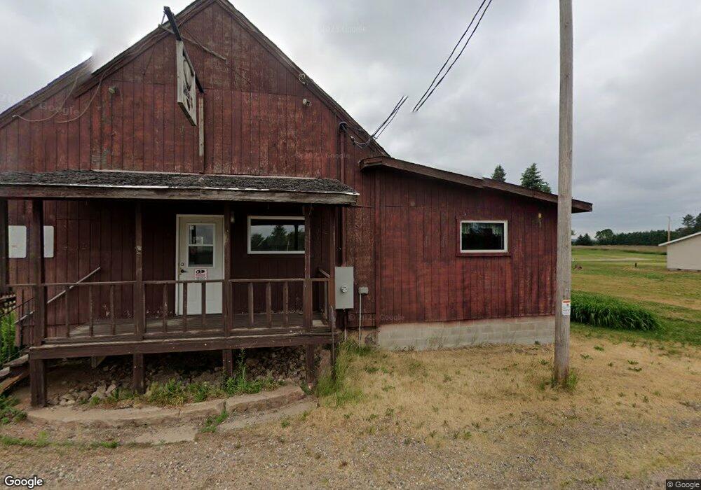
N4982 State Highway 52 Bryant, WI 54418
Estimated Value: $238,925
Studio
--
Bath
2,500
Sq Ft
$96/Sq Ft
Est. Value
About This Home
This home is located at N4982 State Highway 52, Bryant, WI 54418 and is currently estimated at $238,925, approximately $95 per square foot. N4982 State Highway 52 is a home located in Langlade County with nearby schools including Antigo High School.
Ownership History
Date
Name
Owned For
Owner Type
Purchase Details
Closed on
Dec 14, 2022
Sold by
Buckshot Investments Llc
Bought by
Pempek Brian
Current Estimated Value
Purchase Details
Closed on
Mar 9, 2012
Sold by
Citizens Bank
Bought by
Buckshot Investments Llc
Purchase Details
Closed on
Mar 7, 2012
Sold by
Pat And Jean Llc
Bought by
Citizens Bank
Create a Home Valuation Report for This Property
The Home Valuation Report is an in-depth analysis detailing your home's value as well as a comparison with similar homes in the area
Purchase History
| Date | Buyer | Sale Price | Title Company |
|---|---|---|---|
| Pempek Brian | $75,000 | Atty. Richard M. Olk | |
| Buckshot Investments Llc | -- | Dominion Title, 3000 Riversi | |
| Citizens Bank | -- | -- |
Source: Public Records
Tax History
| Year | Tax Paid | Tax Assessment Tax Assessment Total Assessment is a certain percentage of the fair market value that is determined by local assessors to be the total taxable value of land and additions on the property. | Land | Improvement |
|---|---|---|---|---|
| 2025 | $1,548 | $142,200 | $2,900 | $139,300 |
| 2024 | $17 | $142,200 | $2,900 | $139,300 |
| 2023 | $2,083 | $147,200 | $2,900 | $144,300 |
| 2022 | $1,879 | $147,200 | $2,900 | $144,300 |
| 2021 | $1,995 | $147,200 | $2,900 | $144,300 |
| 2020 | $2,401 | $147,200 | $2,900 | $144,300 |
| 2019 | $2,191 | $147,200 | $2,900 | $144,300 |
| 2018 | $2,095 | $147,200 | $2,900 | $144,300 |
| 2016 | $2,182 | $147,200 | $2,900 | $144,300 |
| 2015 | $2,527 | $178,800 | $4,300 | $174,500 |
| 2014 | $2,587 | $178,800 | $4,300 | $174,500 |
| 2013 | -- | $178,800 | $4,300 | $174,500 |
Source: Public Records
Map
Nearby Homes
- Lot #11 Kentwoods Rd
- W7834 State Highway 47
- W4982 Harmon Rd
- ON Cth I
- N5134 Star Neva Rd
- W8488 Forrest Rd
- W9496 Cth C
- 826 Eastview Dr
- 812 Eastview Dr
- 905 Langlade Rd
- 1813 Neva Rd
- 423 Cth F
- 0 Fire Lane Rd
- 2007 Progress Blvd
- Lot 9 Ackley St
- 000 Center St
- 1727 N Superior St
- 116 5th Ave
- 1630 N Superior St Unit 1632
- 1320 Arctic St
- N4982 State Highway 52
- W6981 Price Polar Rd
- W6880 Price Polar Rd
- W7017 Price Polar Rd
- W7035 State Highway 64
- W7035 State Highway 64
- 80 Acres Polar Rd
- 8081 W Gallenberg Ln
- W7086 Hill Rd
- W7075 Price Polar Rd
- 0000 Polar Rd
- 80 Acres Polar Rd
- W7480 Cth O
- N516 S Rollwood Rd
- N5215 Grey Rd
- N4532 Polar Rd
- N5102 Grey Rd
- N4596 Angle Rd
- N4539 Polar Rd
- ON Flak Rd
Your Personal Tour Guide
Ask me questions while you tour the home.