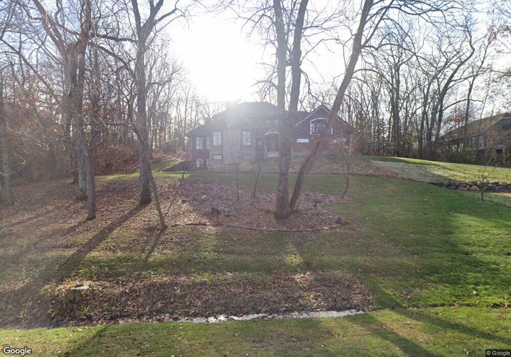
N51W28373 Maes Walke Pewaukee, WI 53072
Estimated Value: $961,000 - $1,224,000
--
Bed
--
Bath
--
Sq Ft
1.06
Acres
About This Home
This home is located at N51W28373 Maes Walke, Pewaukee, WI 53072 and is currently estimated at $1,089,004. N51W28373 Maes Walke is a home located in Waukesha County with nearby schools including Swallow Elementary School, Arrowhead High School, and Zion Lutheran School.
Ownership History
Date
Name
Owned For
Owner Type
Purchase Details
Closed on
May 31, 2023
Sold by
Tschurwald Jeffrey G and Tschurwald Deborah Crooke
Bought by
Ferrell Heather
Current Estimated Value
Purchase Details
Closed on
Mar 31, 2022
Sold by
Tschurwald Jeffrey G and Tschurwald Deborah Crooke
Bought by
Tschurwald Jeffrey G and Tschurwald Deborah Crooke
Purchase Details
Closed on
Sep 29, 1999
Sold by
Johnson Sand & Gravel Inc
Bought by
Tschurwald Jeffrey G and Tschurwald Deborah Crooke
Create a Home Valuation Report for This Property
The Home Valuation Report is an in-depth analysis detailing your home's value as well as a comparison with similar homes in the area
Home Values in the Area
Average Home Value in this Area
Purchase History
| Date | Buyer | Sale Price | Title Company |
|---|---|---|---|
| Ferrell Heather | $997,000 | None Listed On Document | |
| Tschurwald Jeffrey G | -- | None Listed On Document | |
| Tschurwald Jeffrey G | $75,000 | -- |
Source: Public Records
Tax History Compared to Growth
Tax History
| Year | Tax Paid | Tax Assessment Tax Assessment Total Assessment is a certain percentage of the fair market value that is determined by local assessors to be the total taxable value of land and additions on the property. | Land | Improvement |
|---|---|---|---|---|
| 2024 | $7,417 | $652,800 | $121,500 | $531,300 |
| 2023 | $7,180 | $652,800 | $121,500 | $531,300 |
| 2022 | $6,899 | $652,800 | $121,500 | $531,300 |
| 2021 | $6,553 | $652,800 | $121,500 | $531,300 |
| 2020 | $6,991 | $652,800 | $121,500 | $531,300 |
| 2019 | $7,320 | $576,100 | $113,400 | $462,700 |
| 2018 | $7,556 | $576,100 | $113,400 | $462,700 |
| 2017 | $8,742 | $576,100 | $113,400 | $462,700 |
| 2016 | $8,116 | $576,100 | $113,400 | $462,700 |
| 2015 | $7,971 | $576,100 | $113,400 | $462,700 |
| 2014 | $8,312 | $576,100 | $113,400 | $462,700 |
| 2013 | $8,312 | $602,300 | $113,400 | $488,900 |
Source: Public Records
Map
Nearby Homes
- N49W28215 Maryanns Way
- 1702 E Juniper Way
- 1600 E Juniper Way
- 902 N Bluespruce Cir
- 1012 N Bluespruce Cir
- 1527 Sandhill Blvd Unit 12D
- 1554 Lookout Ct Unit 46
- W282N4343 Somerset Ln
- N82W27734 Marshall Dr
- 1117 Sweetbriar Ln Unit 22
- 508 Merton Ave
- 1195 Mary Hill Cir
- 447 Merton Ave
- N59W25898 Amberwood Ct
- 1252 Mary Hill Cir
- N42W27633 Alexander Ct
- N47W27080 Green Hill Ct
- W289N4159 Farm Valley Ct
- N40W27836 Glacier Rd
- 286 Hazel Ln
- W284N5074 Roosevelts Quay
- W284N5038 Roosevelts Quay
- N50W28341 Maes Walke
- W284N5018 Roosevelts Quay
- N50W28321 Maes Walke
- W284N5089 Roosevelts Quay
- W284N5039 Roosevelts Quay
- W284N5061 Roosevelts Quay
- W284N4994 Roosevelts Quay
- N50W28301 Maes Walke
- N49W28306 Maryanns Way
- N51W28485 Maes Walke
- W284N5011 Roosevelts Quay
- N49W28284 Maryanns Way
- N49W28320 Maryanns Way
- N49W28264 Maryanns Way
- W284N4979 Roosevelts Quay
- W284N4964 Roosevelts Quay
- N49W28344 Maryanns Way
- N49W28344 Maryann's Way