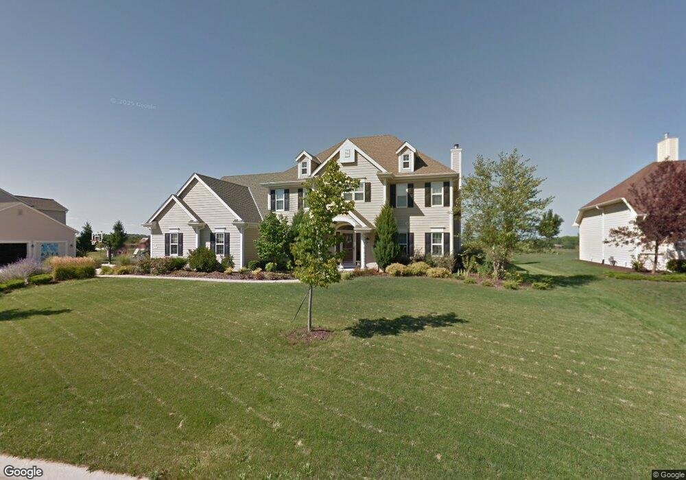
N54W17584 Walnut Way Dr Menomonee Falls, WI 53051
Estimated Value: $701,000 - $862,000
5
Beds
3
Baths
3,622
Sq Ft
$217/Sq Ft
Est. Value
About This Home
This home is located at N54W17584 Walnut Way Dr, Menomonee Falls, WI 53051 and is currently estimated at $787,194, approximately $217 per square foot. N54W17584 Walnut Way Dr is a home located in Waukesha County with nearby schools including Marcy Elementary School, Templeton Middle School, and Hamilton High School.
Ownership History
Date
Name
Owned For
Owner Type
Purchase Details
Closed on
Jan 24, 2025
Sold by
Puri Kamaljit and Singh-Puri Gurinder K
Bought by
Kamaljit Puri And Gurinder Singh-Puri Revocab
Current Estimated Value
Purchase Details
Closed on
Jun 7, 2010
Sold by
Cook Michael L and Cook Donna J
Bought by
Puri Kamaljit and Singh Puri Gurinder K
Home Financials for this Owner
Home Financials are based on the most recent Mortgage that was taken out on this home.
Original Mortgage
$300,000
Interest Rate
4.97%
Mortgage Type
New Conventional
Create a Home Valuation Report for This Property
The Home Valuation Report is an in-depth analysis detailing your home's value as well as a comparison with similar homes in the area
Home Values in the Area
Average Home Value in this Area
Purchase History
| Date | Buyer | Sale Price | Title Company |
|---|---|---|---|
| Kamaljit Puri And Gurinder Singh-Puri Revocab | -- | None Listed On Document | |
| Puri Kamaljit | $515,000 | None Available |
Source: Public Records
Mortgage History
| Date | Status | Borrower | Loan Amount |
|---|---|---|---|
| Previous Owner | Puri Kamaljit | $300,000 |
Source: Public Records
Tax History Compared to Growth
Tax History
| Year | Tax Paid | Tax Assessment Tax Assessment Total Assessment is a certain percentage of the fair market value that is determined by local assessors to be the total taxable value of land and additions on the property. | Land | Improvement |
|---|---|---|---|---|
| 2024 | $7,424 | $655,800 | $149,600 | $506,200 |
| 2023 | $7,159 | $655,800 | $149,600 | $506,200 |
| 2022 | $8,680 | $479,400 | $103,000 | $376,400 |
| 2021 | $7,314 | $479,400 | $103,000 | $376,400 |
| 2020 | $7,290 | $479,400 | $103,000 | $376,400 |
| 2019 | $7,360 | $479,400 | $103,000 | $376,400 |
| 2018 | $6,900 | $466,000 | $103,000 | $363,000 |
| 2017 | $6,682 | $466,000 | $103,000 | $363,000 |
| 2016 | $6,840 | $466,000 | $103,000 | $363,000 |
| 2015 | $7,171 | $466,000 | $103,000 | $363,000 |
| 2014 | $7,948 | $466,000 | $103,000 | $363,000 |
| 2013 | $7,948 | $466,000 | $103,000 | $363,000 |
Source: Public Records
Map
Nearby Homes
- W170N5582 Ridgewood Dr Unit 5582
- N59W17728 Meadow Ct Unit 15
- N51W18938 Quietwood Dr
- N54W16349 Westwind Dr
- Lt40 Edgewater Ct
- N51W18970 Quietwood Dr
- N51W18825 Quietwood Dr
- W183N6023 Lost Pond Ct
- W208N6659 Sweet Clover Dr
- W164N4951 Lilac Ct
- N51W18979 Quietwood Dr
- N51W19033 Quietwood Dr
- Lt2 Quietwood Dr
- Lt43 Emerald Hills Dr
- Lt46 Emerald Hills Dr
- W188N5040 Red Crown Trail
- 4620 N Calhoun Rd
- N54W19469 Broadwing Place
- N54W19340 Kearney Ln
- W194N5457 Broadwing Cir
- N54W17552 Walnut Way Dr
- N54W17616 Walnut Way Dr
- W176N5456 Highridge Dr
- N54W17520 Walnut Way Dr
- N54W17640 Walnut Way Dr
- W174N5447 Walnut Ct
- N54W17678 Walnut Way Dr
- N54W17488 Walnut Way Dr
- N54W17667 Walnut Way Dr
- W174N5429 Walnut Ct
- N54W17712 Walnut Way Dr
- N54W17446 Walnut Way Dr
- W176N5404 Highridge Dr
- W176N5439 Highridge Dr
- W174N5417 Walnut Ct
- N54W17744 Walnut Way Dr
- W176N5411 Highridge Dr
- N54W17414 Walnut Way Dr
- N54W17431 Walnut Way Dr
- W177N5440 Legend Ct